Contact us
Get in touch with our experts to find out the possibilities daily truth data holds for your organization.

ICEYE team members spent much of last week in Washington, DC to attend Esri's annual Federal GIS Conference. FedGIS is Esri's premier public-sector event, attracting upwards of 5,000 attendees from 89 countries. It's also a critical show for ICEYE, connecting our teams with new people, partners, and insights. We're proud to support government agencies across the globe with solutions, missions, and data — all powered by the world's largest constellation of SAR satellites.
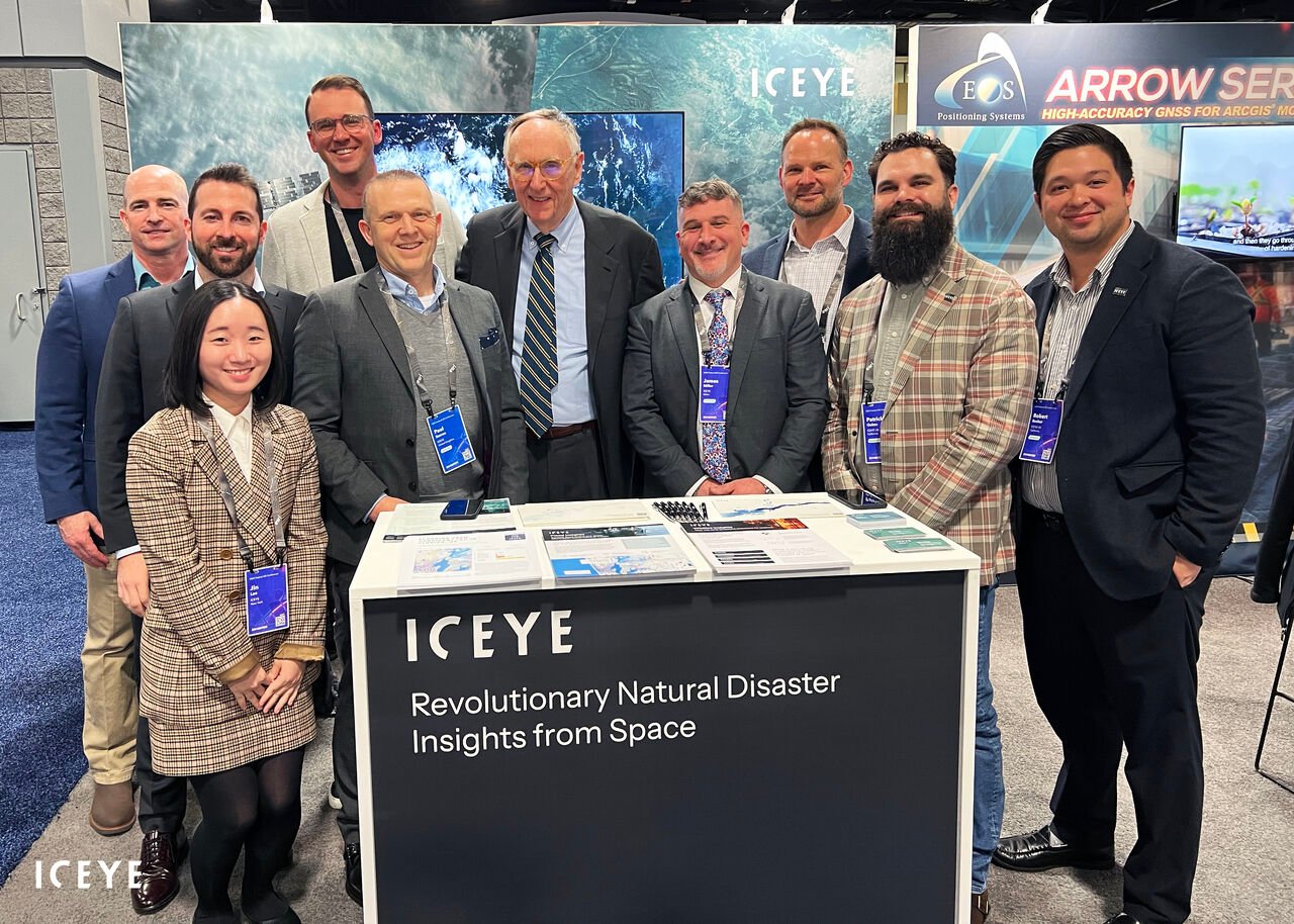
This year's FedGIS delegation included nearly a dozen ICEYE employees, with members of our Government Solutions, Partnerships, and ICEYE US teams all in attendance. ICEYE is a proud Esri silver partner and also has many employees active in the GIS community. This includes Paul Barron, ICEYE's head of global partnerships, who currently serves on Esri's Partner Advisory Council. FedGIS is a great opportunity to strengthen this partnership and connect with GIS experts and innovators from the public sector. Esri and the ArcGIS ecosystem have become foundational to ICEYE's government work, shaping the way we serve federal agencies and deliver actionable insights to users around the world.
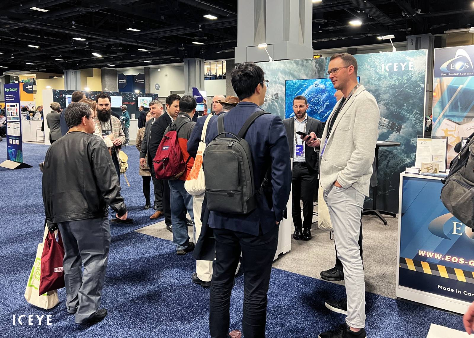
The expo gave attendees an opportunity to visit Esri partner booths and explore new innovations in GIS. The ICEYE team was stationed at booth #418, joined by 100+ other Esri partners throughout the expo hall. Partner teams enjoyed steady foot traffic from the thousands of attendees on site this year. According to our team, the expo led to many meaningful new connections, and also provided a glimpse at the priorities and pain points that are top-of-mind for many leaders.
Community resilience was a recurring theme this year as many agencies wrestle with the growing impacts of natural disasters. This was a popular topic with our Government Solutions team as they demoed ICEYE's satellite-powered disaster response & recovery suite, including our analysis-ready Flood Insights and Wildfire Insights.
The expo was a highlight for our team at FedGIS 2024. But ICEYE people and products made a number of other high-profile appearances throughout the show. This includes a Lightning Talk, expert panel discussion, and some unexpected coverage during the Plenary keynote from Esri's president and co-founder, Jack Dangermond.
Continue below to see a few of our team's favorite moments.
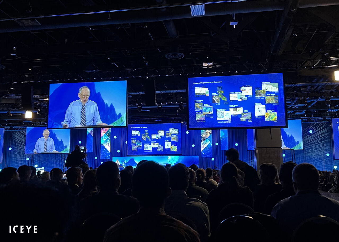 Jack Dangermond's Plenary sessions are an Esri staple, drawing thousands of attendees interested to hear from the company's president and co-founder. Our team was thrilled to watch live as Jack highlighted ICEYE's Wildfire Insights solution, including the value it provided during the 2023 Lahaina Wildfires in Hawaii. Through the power of SAR remote sensing, ICEYE produced analysis-ready wildfire data layers within hours of ignition. This includes observation-driven wildfire perimeters and automated damage assessments at the individual property level. ICEYE gave local officials their first unobstructed view of community impacts during the event.
 Our team was delighted to receive a surprise visit from Esri's president and co-founder, Jack Dangermond. ICEYE is a proud Esri partner and FedsGIS unlocks some valuable opportunities to connect with our colleagues from Esri. ICEYE's Paul Barron also enjoyed meeting with Jack and many other Esri leaders at the partner meeting, including Patty Mims, Richard Cooke, and Thomas Fair - as well as their teams.
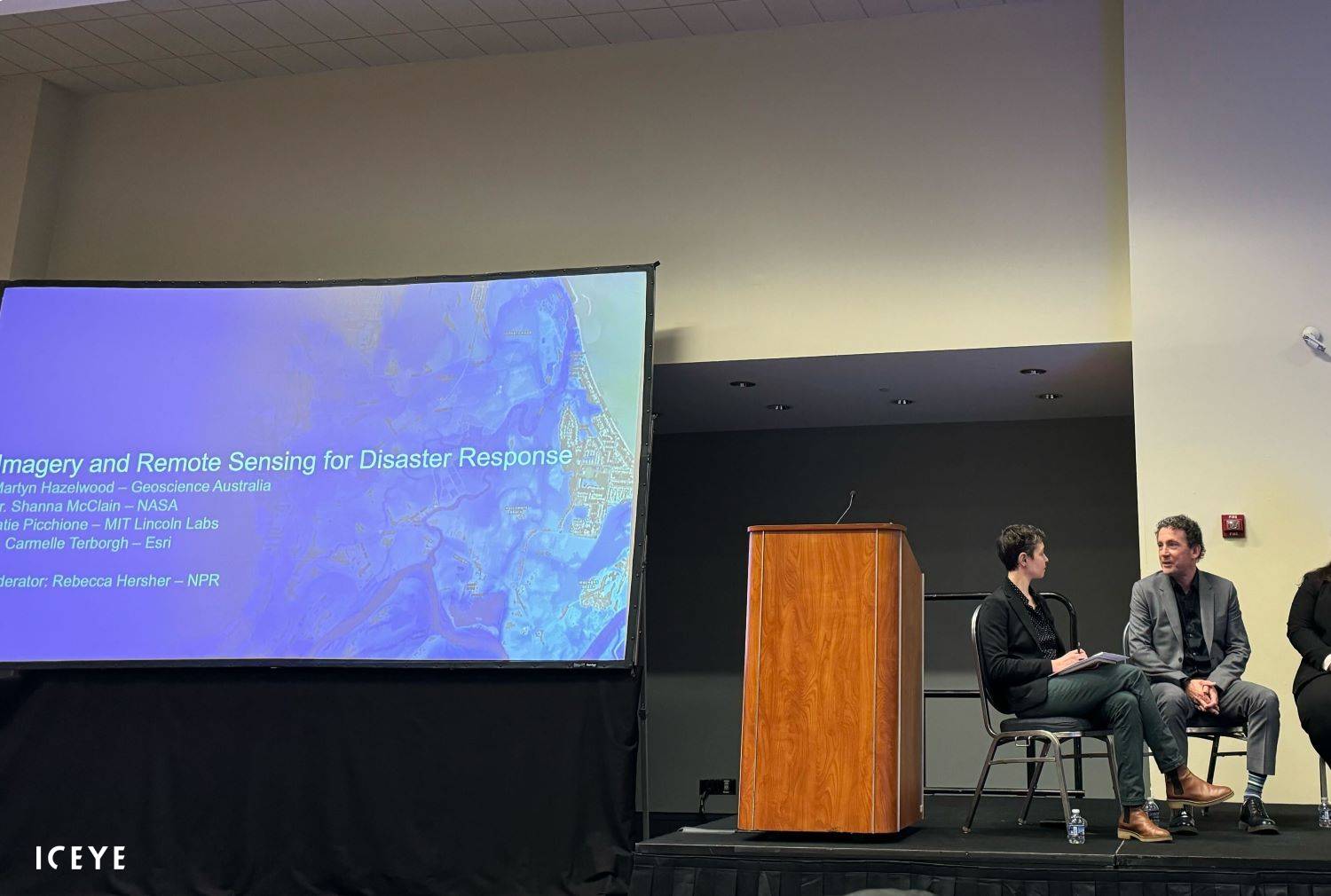
FedGIS offered a rare chance to welcome an ICEYE partner from across the globe. Martyn Hazelwood is an official at Geoscience Australia, the federal agency that oversees geoscience research, resources, and innovation across Australia. At Monday's Imagery Summit, Marty joined a panel of experts for a session called "Imagery & Remote Sensing for Disaster Response." The panel was moderated by NPR's Rebecca Hersher, with Marty joined on stage by other experts from NASA, Esri, and MIT's Lincoln Labs. Marty is helping communities across Australia reshape their approach to disaster response and resilience. ICEYE is proud to be a part of that journey.
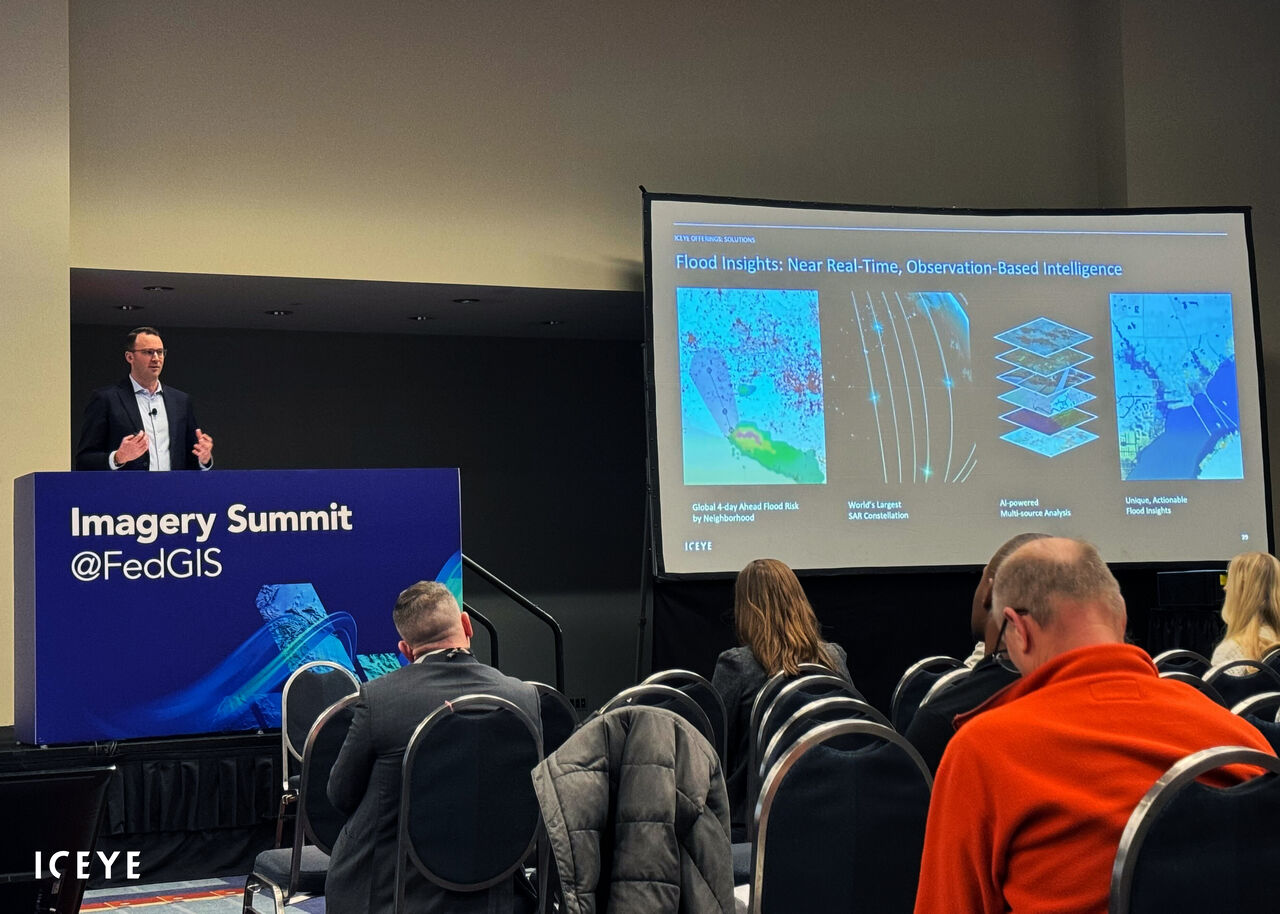 Andy Read, ICEYE's VP of Government Solutions, hosted a Lightning Talk at the FedGIS Imagery Summit on Monday. The session, "Creating a Global Source of Truth for Government Agencies," explored how ICEYE leverages its SAR satellite data to produce near real-time disaster insights for ArcGIS.
The Imagery Summit was another key highlight for our team, providing a chance to learn from GIS experts and also attend ICEYE-related sessions from Andy and Marty. Thanks to the folks at Esri who made this event possible, including Beau Legeer, Kate Fickas, Kailey Mongeon, and all of their teams.
 During the expo, our Government Solutions team provided live demos to highlight the integration of ICEYE's Flood Insights and Wildfire Insights with ArcGIS. It was a pleasure to connect with so many GIS leaders from the public sector and learn more about the problems they solve and challenges they face.
ICEYE's government partners were also instrumental in facilitating many of these new connections. Special thanks to the folks at New Light Technologies, Michael Baker, and Dewbury for contributing to a successful FedGIS. Our team is grateful for the continued support as we grow ICEYE's public-sector footprint.
Thank you again to the entire team at Esri for another great FedGIS, and to all the curious and passionate GIS advocates who stopped by to learn more about ICEYE. We look forward to reconnecting at the Esri User Conference in July.

25 June 2026

14 May 2026

18 March 2026