Flooding_Thailand_building_hero_medium Flooding_Thailand_building_hero_medium_mobile

ICEYE Flood Insights

Strengthen flood resilience with satellite-powered insights & impact monitoring

Leverage the world's largest constellation of SAR satellites to support community flood response, recovery, and mitigation.

Assess the true impact of local flooding within hours

ICEYE’s Flood Insights solution is the world’s first always-on flood monitoring tool developed for the public sector. It combines satellite remote sensing with observational ground truth to deliver GIS-ready flood intel within hours. Visualize flood depth/extent data with building footprints to quickly assess local impacts and coordinate resources. Give your emergency managers the situational awareness they need to lead data-driven flood response efforts.

monitor

Improve situational awareness

Visualize hyperlocal flood impacts in near real-time to confidently deploy resources on the ground. ICEYE synthesizes data from satellites, ground-truth observations, and third-party sources to deliver actionable insights within hours.

act_as_one

Optimize emergency response

Equip various agencies with a single source of truth using ICEYE's GIS-enabled flood insights. Rather than wait days or more for outside help, ICEYE empowers emergency managers to take action by leading data-driven recovery efforts.

multiple_satellite

Strengthen community resilience

Modernize your disaster response and mitigation with always-on satellite monitoring from ICEYE. With access to GIS-enabled flood intelligence, your leaders can better protect their most vulnerable communities and infrastructure.

Free Whitepaper

Optimize government-led emergency response with GIS-ready disaster insights

Replace legacy flood modeling with satellite-based monitoring

Equip your agencies with GIS-compatible insights on flood depth, extent, and building impacts – all within hours of a flood's peak.

ICEYE near real-time flood intelligence - Andy Read

Strengthen community flood resilience with ICEYE

Government solutions

Flood maps powered by observation, not simulation

ICEYE generates near real-time flood intelligence through a combination of remote sensing satellites, observational ground truth, and sophisticated third-party data sets. Unlike traditional flood modeling, ICEYE creates flood maps using real observation data instead of what-if projections. This allows us to deliver GIS-ready depth, extent, and impact data layers your teams can trust.

Flood_layers_video-cover

Observe floods day or night, even through cloud cover

SAR satellite imagery

1. Remote-sensing satellites

Operating the world's largest SAR satellite constellation allows ICEYE to deliver unprecedented local insights on a global scale. With 30+ satellites, rapid tasking, and 4x (or more) daily re-visits, our natural disaster monitoring is always on.

2. Multi-source analysis

While SAR satellites power all our government solutions, the remote sensing data is only one source of the final output. ICEYE's Flood Insights also incorporate intel from several other sources, including local observations, river gauges, and third-party data sets. This near real-time holistic analysis yields actionable flood intel your teams can trust.

3. GIS-ready insights

ICEYE delivers GIS-ready flood intelligence to support rapid disaster response and recovery. Leverage your existing GIS suite to view, analyze, and operationalize a single source of truth across multiple agencies on the ground. Initial insights are ready within hours and then updated 1x daily as a flood evolves.

Flood intelligence briefings

Explore ICEYE's most popular flood briefings, including expert analysis and satellite-powered visualizations from major flood events around the world.

September 2023

PDF

Flooding from Hurricane Idalia in Southeast US

View ICEYE's flood briefing on the flooding from Hurricane Idalia in Southeast US from September 2023.

July 2023

PDF

Flooding in Northeast US

View ICEYE's flood briefing on the flooding in Northeast US from July 2023.

March 2023

PDF

Flood Briefing: California, US

View ICEYE's flood briefing after atmospheric river hit in California, US

Other perils

Product

Wildfire monitoring

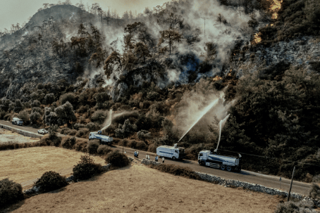
Respond to wildfires in innovative ways by leveraging ICEYE’s unique persistent monitoring capabilities.

Wildfire_public-sector-response_onethird

Beta

Wind monitoring

Gain access to situational and near real-time damage data related to storms that occur across the globe.

Hurricane-satelllite-render_onethird

Beta

Earthquake monitoring

Embrace a proactive approach with ICEYE’s actionable insights before, during and after an earthquake.

Earthquake_Turkey_onethird

How can ICEYE support your flood resilience?