Contact us
Get in touch with our experts to find out the possibilities daily truth data holds for your organization.

Glaciers play an essential role in hydrological and climatological studies. They are a crucial water resource for the world’s population as they store approximately three-quarters of Earth's freshwater and their variations are considered early indicators and visible evidence of climatic changes.
Currently, glaciers cover about 10 percent of the world's total land area. Most of the glaciers are located in Antarctica and the Arctic including Greenland, Arctic Canada and Alaska. Large mountainous glaciers can be found in the Andes in South America and the Himalaya in Asia.
Besides these areas, many glacier research studies have also been performed in the Alps mainly medium-sized and large valley glaciers. For example, the biggest and largest glacier of Europe, the Aletsch Glacier in Switzerland, is subject of many studies.
Many of the recent studies utilize remote sensing technologies as they allow for an effective wide area mapping and monitoring of glaciers located far off over a long period of time.
Glaciers periodically retreat or advance. Many studies were conducted and demonstrate a glacier shrinkage in most areas of the world.
As a direct consequence, areas of unstable, loose sediments are exposed resulting in slope instabilities of large areas with an increase of erosion and landslides. Due to rising temperatures over the last decades, the number of ice avalanches has increased and many glacial lakes have been developed which lead to an increased risk of inundation. These geohazards threaten lives, damage land, properties, and infrastructure.
Tidewater glaciers behave, in general, much more dynamically than land terminating glaciers. Sudden dynamic changes include rapid retreat, flow acceleration, and surface thinning are usual. At the coast, losses at the glaciers’ fronts through iceberg break-offs, called ‘calving’, have increased over the last years. Some of the icebergs can reach enormous dimensions.
For example, the largest iceberg calved from the Ross Ice Shelf in Antarctica had a length of 295 km and a width of 37 km in March 2000. Pieces of it were spotted near New Zealand even eleven years later. Drifting icebergs are a serious threat to maritime shipping and also endanger rigs.
Melting glaciers and ice sheets are a main factor of global sea level rise. Since 1880, the global mean sea level has risen about 24 centimeters, a third of it occurred in the last 2 and a half decades. This rapid development jeopardises many coastal areas and low-lying islands, their infrastructure and live conditions.
The necessity to understand the complex glacial processes and to forecast how they will respond as the climate changes becomes essential.
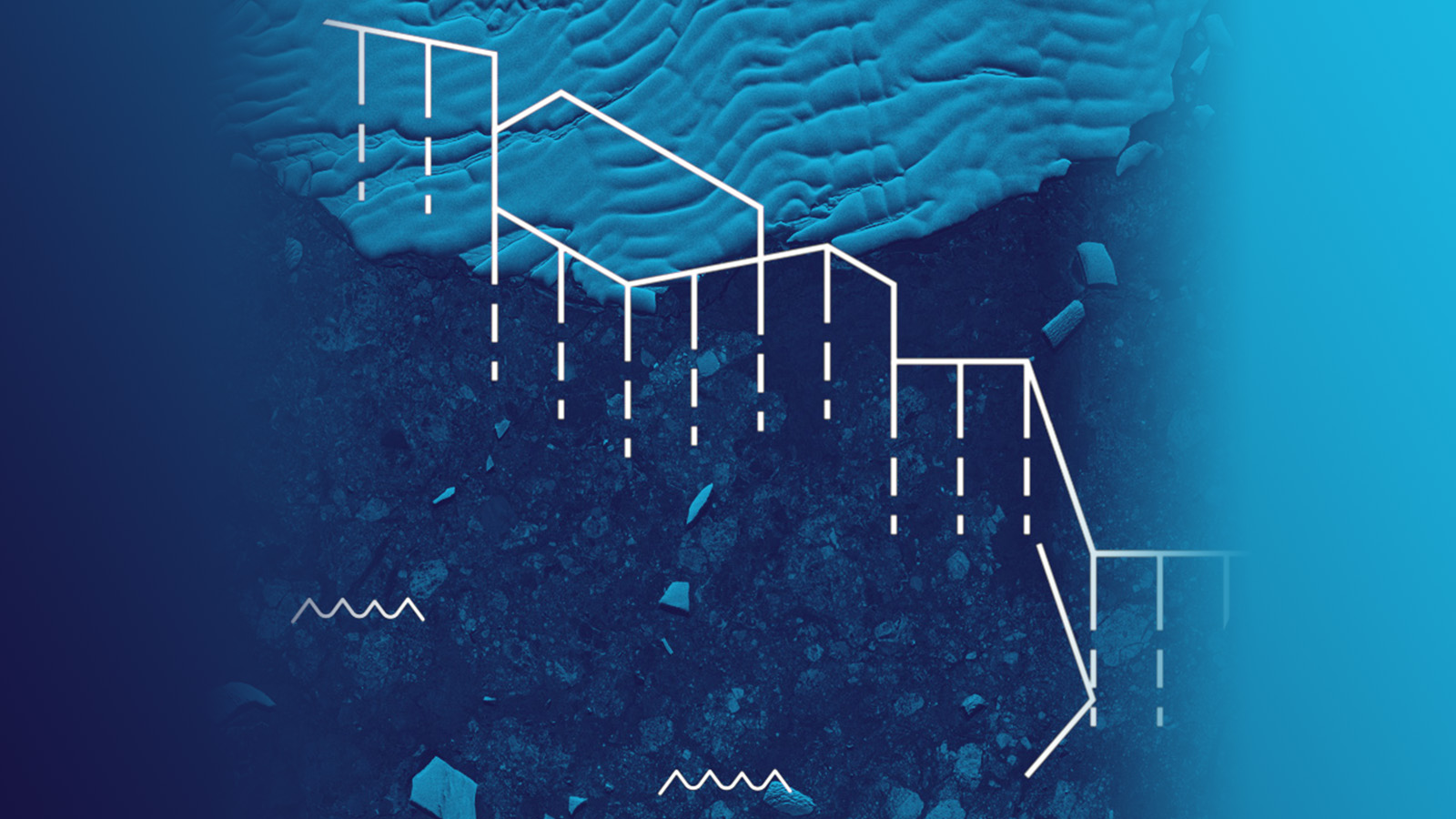
Mapping the extent of glaciers, systematic monitoring of the glacier velocity and measuring its mass change over time, are important elements for glacial studies.
Satellite images have been utilized in glaciology for a while. Remote sensing techniques are very efficient and cost effective, especially in remote and difficult to access areas.
Glaciers are very often located in clouded areas, like the Arctic or in mountainous regions. This makes remote sensing based on optical imagery often difficult whereas radar imagery can be acquired during cloudy conditions and independent of daylight, e.g. during the polar night. These radar capabilities allow continuous glacier monitoring and can reliably deliver images at any requested date.
Improved SAR imagery resolution allows a very high level of insights and high reliability of analysis results and is of great importance especially for small-scale glacier monitoring.
Additionally, new techniques and methods for glacier monitoring using synthetic-aperture radar (SAR) data have been developed to determine the extent of a glacier and analyse the changes over the last years. The movement of glacier surfaces can be estimated and tracked on the basis of two images or a time series over a longer period of time. Different radar technologies can be applied using radar backscatter and interferometric phase using InSAR methods, to receive very detailed information about glacier velocity and velocity gradient with an accuracy of several centimeters.
Figure 1 shows the Gangotri Glacier, located in Uttarkashi District, Uttarakhand, India, bordering Tibet, in an ICEYE SAR satellite image. This glacier is a primary source of the Ganges and is one of the largest in the Himalayas.
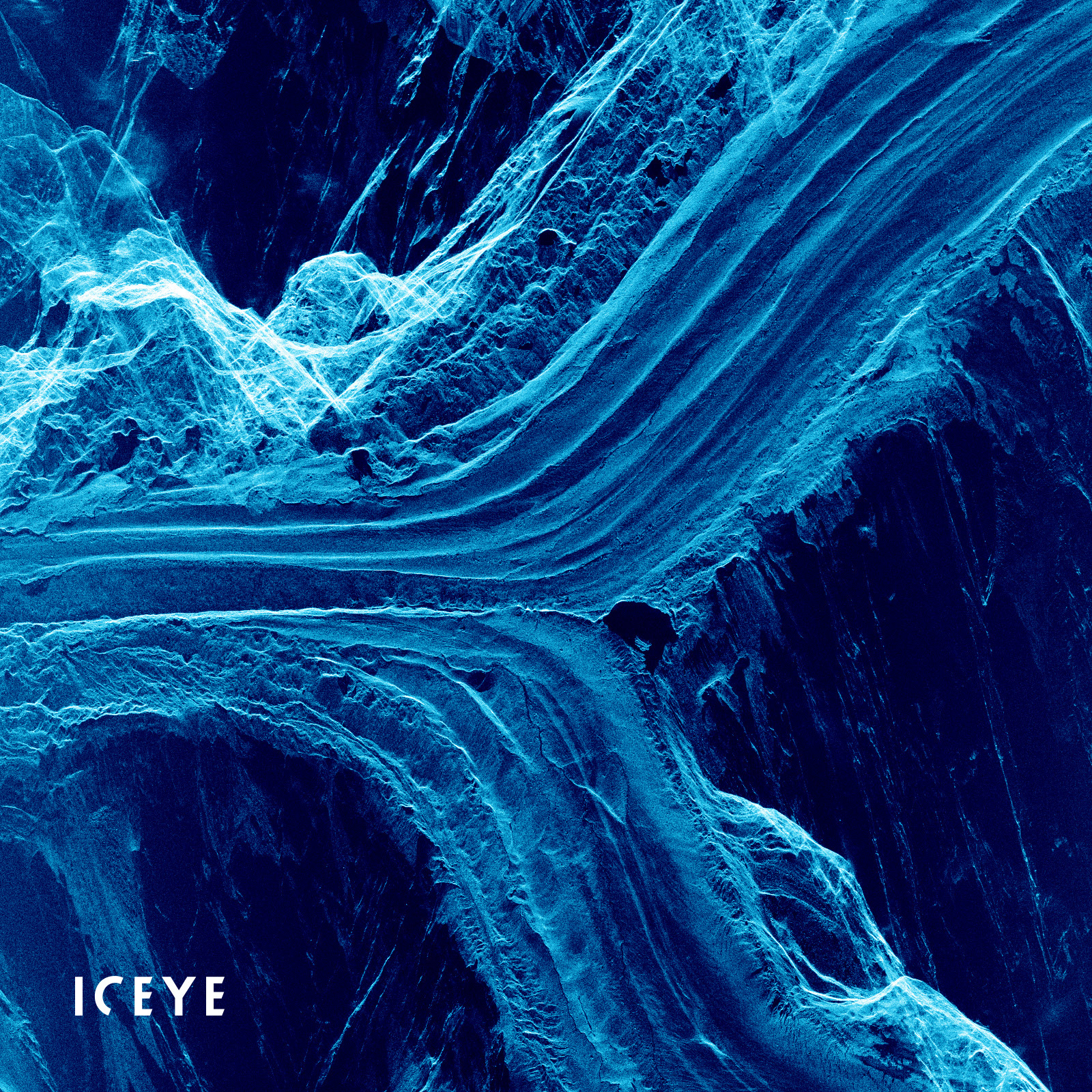
Figure 1. ICEYE SAR satellite Spotlight High image of Gangotri Glacier, India, acquired on 8th of August 2020.
Furthermore, radar is a very capable technology for identifying and tracking drifting icebergs. Knowledge of the velocity of the drifting ice is essential to ensure risk free shipping routes. The radar capability of capturing images during rain and foggy weather conditions is of great advantage and ensures reliable near-real time information.
Figure 2 shows animated ICEYE SAR satellite images of the Thwaites Glacier calving into the Pine Island Bay, part of the Amundsen Sea, in Antarctica. It illustrates the drifting of the icebergs and ice floes.
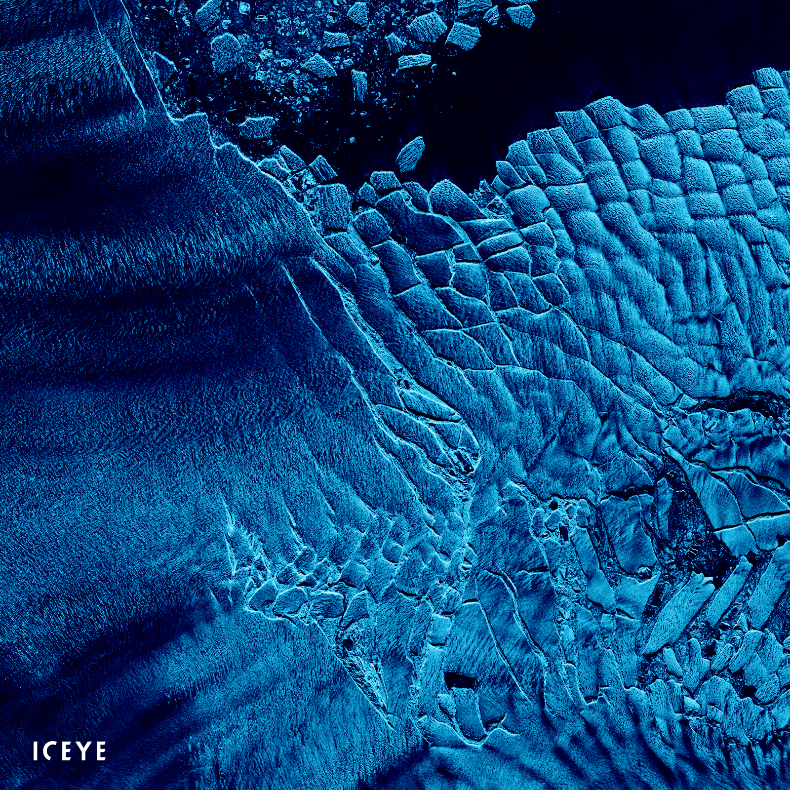
Figure 2. Animated ICEYE SAR satellite Strip images of Thwaites Glacier in Antarctica acquired on 19th of April and 3rd of May 2020.
ICEYE SAR satellite constellation offers rapid satellite revisits and very high-resolution satellite imagery covering large areas. It supports the delivery of time series for monitoring glacier movements and for identifying and tracking icebergs.
ICEYE SAR satellite images can be accessed free-of-charge through ESA’s Third Party Mission (TPM) program. This offer is available for all scientific research institutions and universities. However, commercial companies can apply for ICEYE imagery as well if the data is used for research purposes only.


03 June 2026

23 January 2026

06 November 2025