Contact us
Get in touch with our experts to find out the possibilities daily truth data holds for your organization.

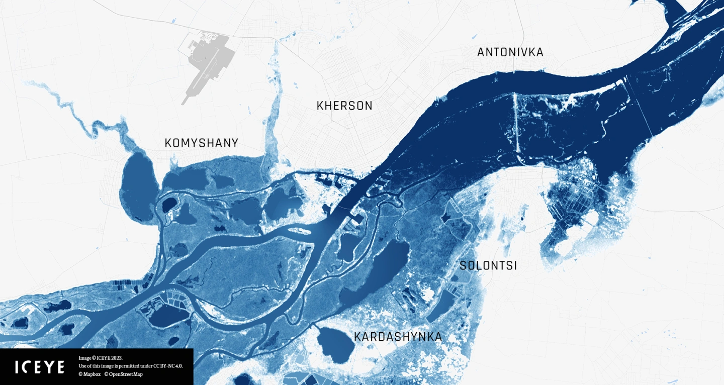
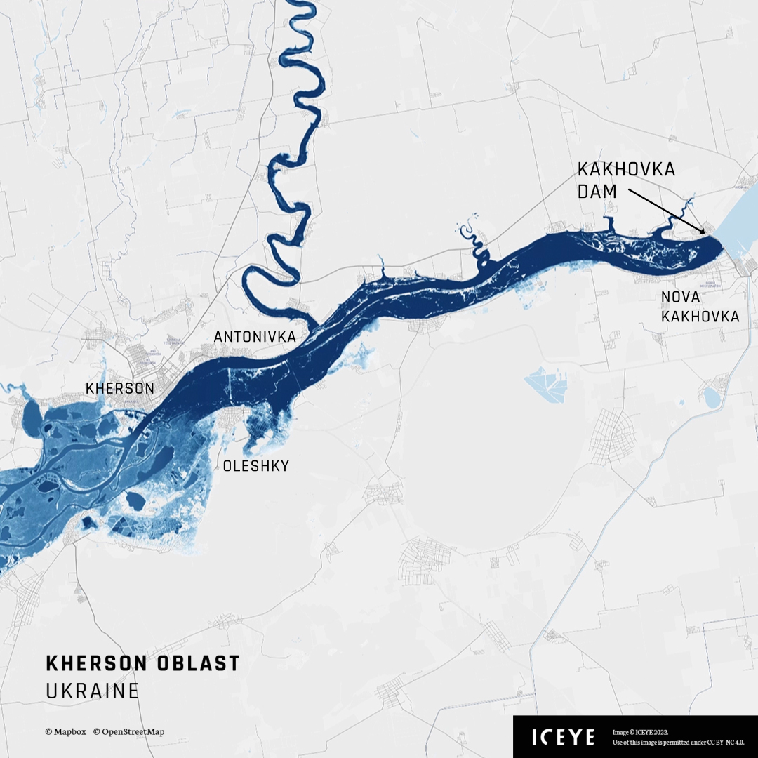
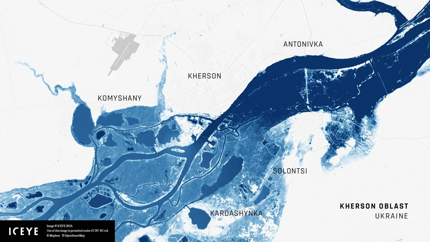
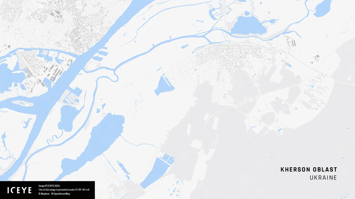
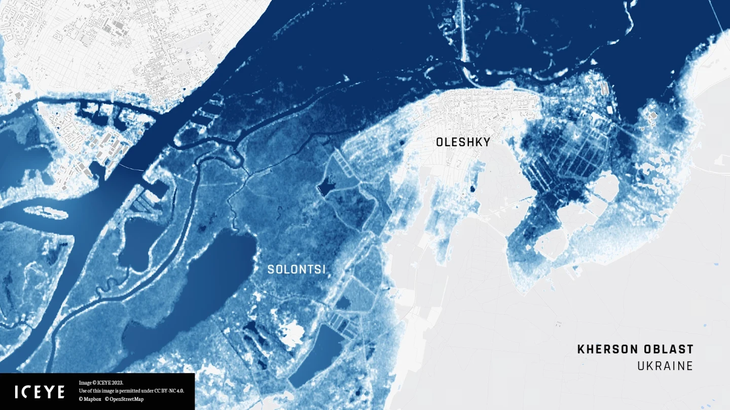
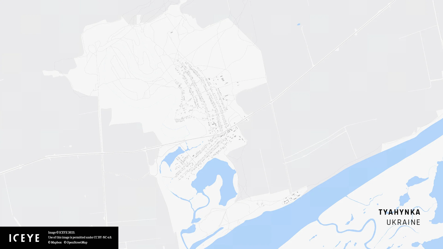
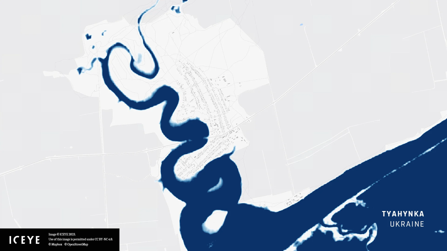
ICEYE’s analysis is based on observations of the flooding, not modeled outputs, and details the impact at a significantly improved resolution compared to other data available. According to our analysis, covering the entire extent of the flood, several towns and villages along the Dnipro River have been either partially or completely inundated. Some districts of Kherson have been significantly impacted, too.
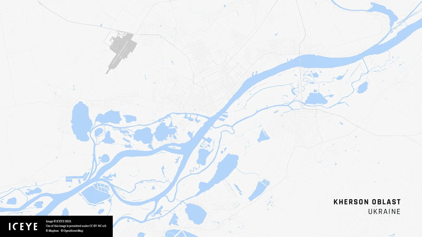
Before-after animation of the full extent of the flood in the southern Dnipro River region.
Among others, our evidence-based flood analysis has been used by The Washington Post, Al Jazeera, and Helsingin Sanomat, to show the impact on Kherson Region after the Kakhovka Dam breach.
ICEYE’s flood data is also available in ArcGIS via Esri's Disaster Response Program (DRP) to assist organizations' response and recovery activities.
“Our analysis shows that several towns and villages along the Dnipro River (Nova Kakhovka, Antonivka, Oleshky, and Solontsi) have been either partially or completely flooded. ICEYE prides itself in rapidly tracking and responding to real-time natural catastrophes. Our 24/7 global operations team provides the highest fidelity flood analysis for mapping damage and aiding rescue efforts,” said Shay Strong, VP of Analytics at ICEYE.
ICEYE owns and operates the largest constellation of Synthetic Aperture Radar (SAR) satellites. By combining satellite imagery with auxiliary ground-level information, the company delivers reliable, consistent, and comprehensive insight into the extent and depth of major flood events around the world, in near real-time.
“We are committed to supporting the public good through our Earth Observation and flood monitoring capabilities. In this instance, we are collaborating with a growing list of agencies and organizations assisting the situation on the ground. Our analysis enables them to quickly understand the true breadth of impacts in the Southern stretch of Ukraine's Dnipro River,” shared Andy Read, ICEYE’s Global Head of Government Solutions.
Disclaimer: The current analysis represents flooding captured from SAR and other sources throughout 7 June 2023. ICEYE is evaluating new evidence and monitoring the situation continually.

14 May 2026

18 March 2026

11 December 2025