Contact us
Get in touch with our experts to find out the possibilities daily truth data holds for your organization.

Every country has the right to secure the peace and prosperity of its citizens. Border security is a key priority for every country around the world. But nations face a number of challenges when it comes to efficiently and effectively protecting their land, sea and air borders.
It’s always been difficult for nations to take proactive action to prevent illegal activity at their borders. And when it does occur, things usually evolve quickly, forcing them to scramble to respond. Nations need to be able to make decisions in hours, if not minutes to secure their borders and protect their citizens. ICEYE’s constellation of SAR (synthetic aperture radar) satellites gives them something they’ve never had before – a powerful, effective and economically-viable tool to not only respond to illegal border activity, but to prevent it before it even happens.
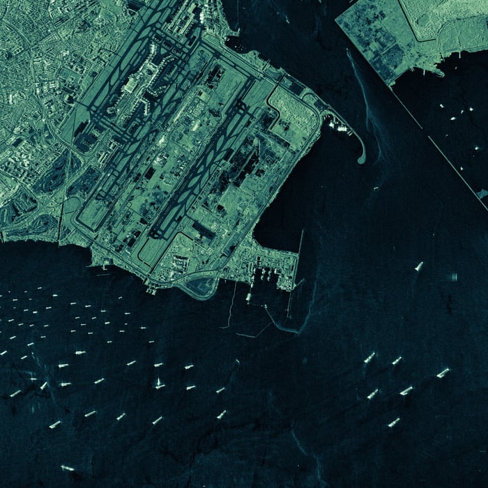
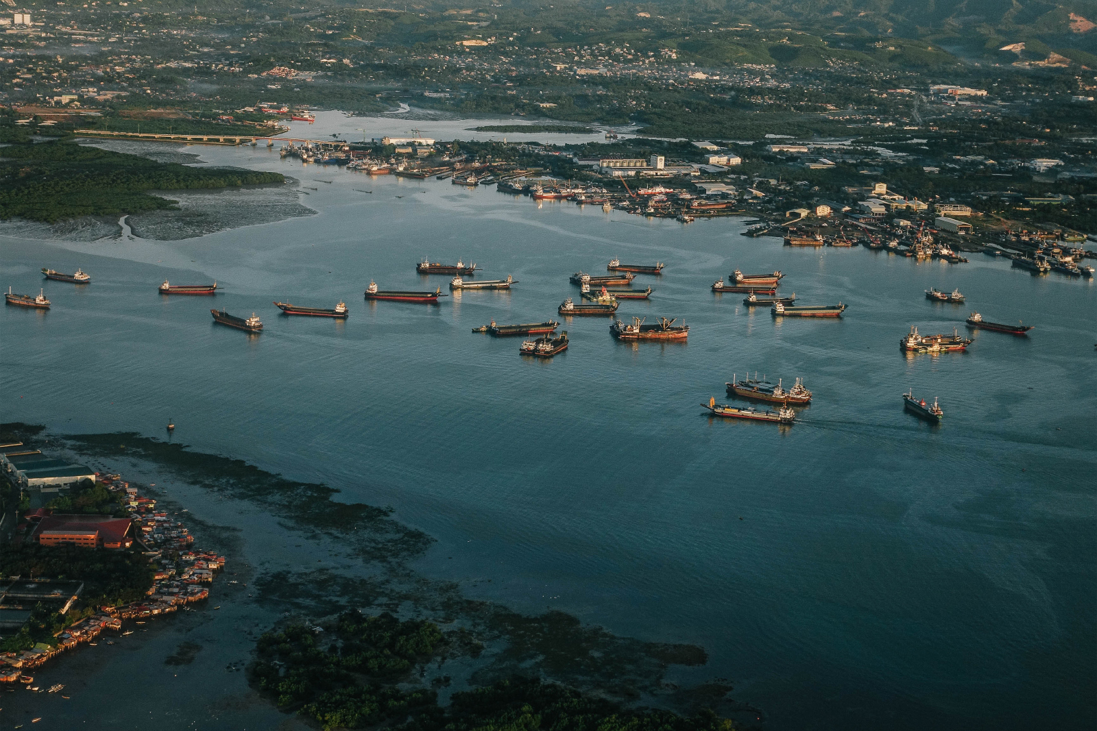
Image 1. ICEYE's very high-resolution, Spot Extended Area (SLEA), nighttime SAR satellite image of the Port of Singapore.
Hundreds of thousands of illegal border crossings occur every year for developed nations. Those border crossings threaten the public wheel and the economic prosperity of the country in question. And they make it very difficult to plan what resources are required to support the population.
As an example of that, I can talk about one case where a national partner approached ICEYE with a compelling problem. This nation was really struggling with illegal drug trafficking, human trafficking, illegal economic activity, and migration in general. They had advanced ground-based equipment that was able to see across their border to a certain extent. But that equipment failed to provide response teams with the time or level of context they needed to act when illegal activity was detected.
They asked ICEYE to put together a program for them. So we harnessed the power of our satellites to collect imagery over tens of thousands of square kilometers of area at a time, allowing us to give this nation a completely new level of context into what was happening further across their border. With a system that allows imaging to be completed in high resolution, very frequently, at large scale, a nation can use that data to determine how to take the right course of action to mitigate the threat that they see.
Image 2. A closer look at the vessels sailing at the Singapore Strait, near the Port of Singapore, at 3:19 AM local time.
By providing them with a different layer of collection capability from space, where you have the ultimate bird’s-eye view of what’s happening on the ground, they were able to make that binary decision of “Yes, we need to invest in this set of resources to mitigate this particular problem.” Without this insight that ICEYE’s SAR satellites was able to provide, they wouldn’t have even known this problem existed.
Ultimately, this nation was able to go from reacting to events as they unfolded to using ICEYE’s system to gain an advanced understanding of patterns that they saw developing so they could proactively respond. The value that ICEYE is able to offer our national partners is access to information that they’ve never had before, which allows them to make decisions that they couldn’t make before.

Application study
Download our Application Study to learn how to use ICEYE SAR data to counteract illegal human trafficking and smuggling in your maritime borders.

03 June 2026

23 January 2026

06 November 2025