Contact us
Get in touch with our experts to find out the possibilities daily truth data holds for your organization.

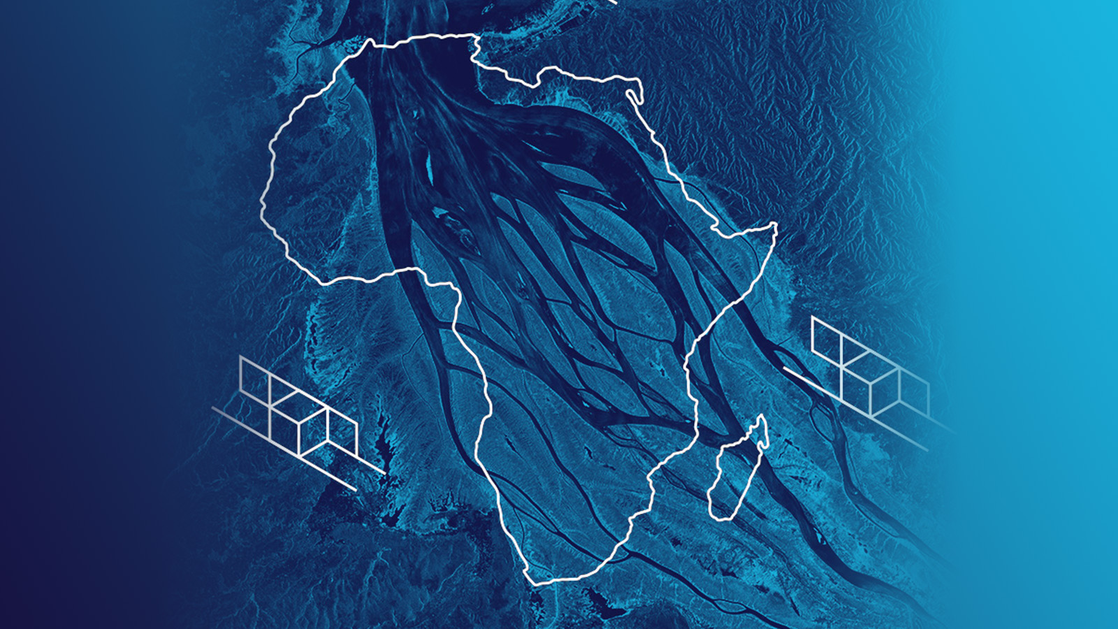
Africa is the second-largest continent in the world and the second most populous continent after Asia. The climate in Africa varies from tropical to Mediterranean. Holding the record for the highest ever measured temperature, Africa bears the nickname of the hottest continent on Earth. The geographical location of Africa makes it the most tropical continent, hosting the world’s second-biggest rainforest as well as vast savannahs that are home to many rare flora and fauna species.
Africa is a truly fascinating place. The quote by Beryl Markham, an English-born Kenyan aviatrix, adventurer and author, supports this statement.
“Africa is mystic; it is wild; it is a sweltering inferno; it is a photographer’s paradise, a hunter’s Valhalla, an escapist’s Utopia. It is what you will, and it withstands all interpretations.” — from Beryl Markham’s memoir “West with the Night”.
Acknowledging Africa’s beauty, uniqueness, and importance to the world’s biodiversity and climate stability, we are sharing several radar satellite images of the most marvelous regions of the continent.
"See one of the most fertile farming regions in the world: the Nile Delta! This ICEYE #SAR satellite image shows a part of the Nile River, the city of Kafr El-Zayat, Egypt, and various built-up areas and fields which are characteristic of this region."
— ICEYE (@iceyefi) June 12, 2020
Satellites equipped with a Synthetic Aperture Radar (SAR) antenna can acquire images of Earth’s surface day and night, regardless of clouds, rain, haze and sandstorms. SAR satellites actively transmit radar waves and measure the signals reflected from the ground. These are then processed into imagery.
ICEYE builds and operates the world’s largest constellation of commercial SAR satellites and offers multi-mode, high-resolution imaging.
All the imaging modes are operationally available for acquisitions worldwide.
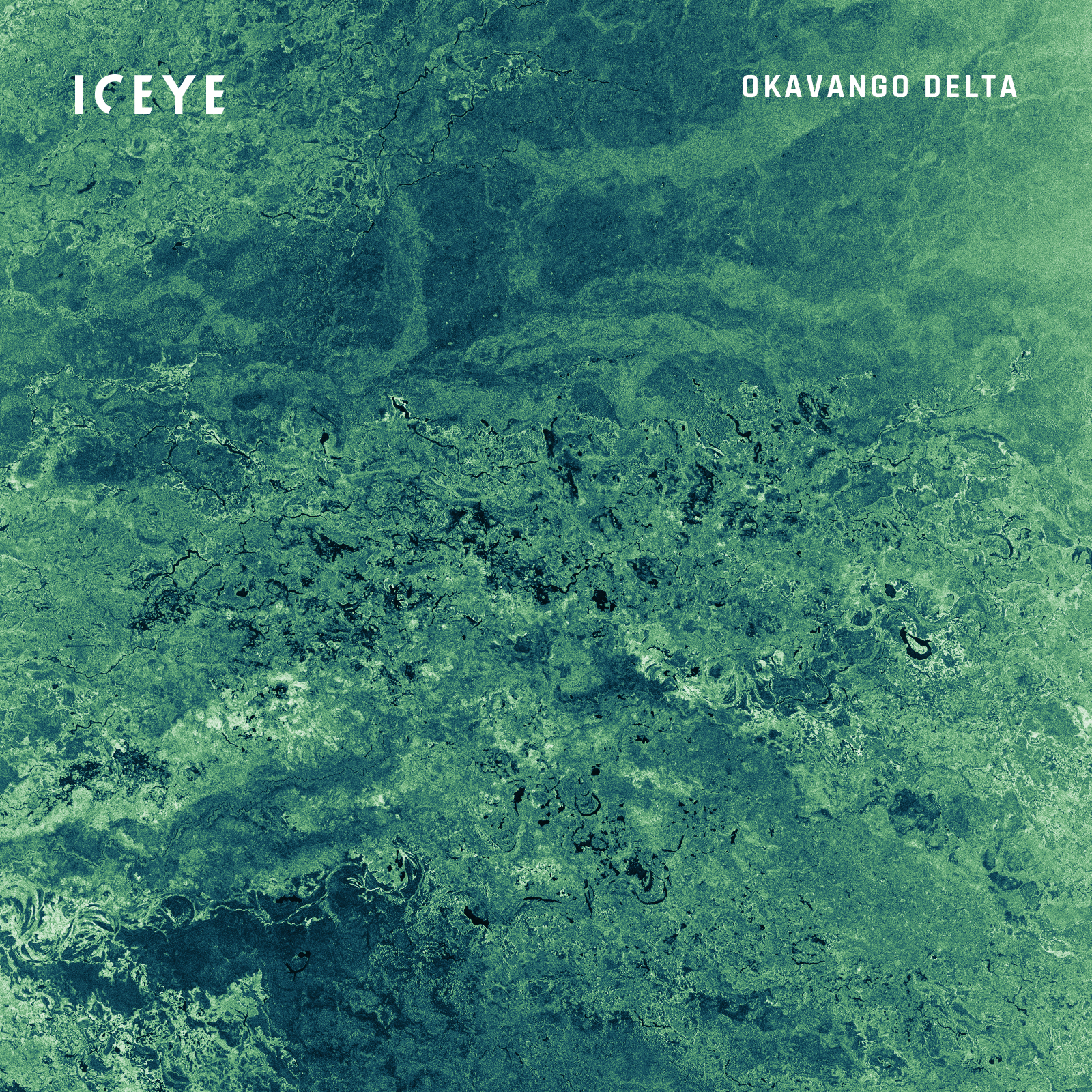
Okavango Delta, one of the Seven Natural Wonders of Africa, located in northwest Botswana. This delta is a unique wetland that is home to a great wildlife diversity including some of the world’s most endangered species of large mammals. This image was acquired with an ICEYE SAR satellite in the Strip imaging mode.
Below are multiple SAR satellite images and related facts about several famous regions in Africa. These locations are home to some of the most exceptional ecosystems and habitats and are important to the world’s biodiversity, climate stability, and the livelihoods of people living in these regions.
The Congo Basin is a 4-million-km2 basin of the Congo River located in Central Africa. This is one of the most important wilderness areas in the world. Its vast rainforest makes it the planet’s second lung after the Amazon rainforest in South America.
The Congo Basin’s tropical forest is home to several endemic and endangered species. The livelihoods and well-being of millions of people in the region are also dependent on the Basin’s forests and rivers.
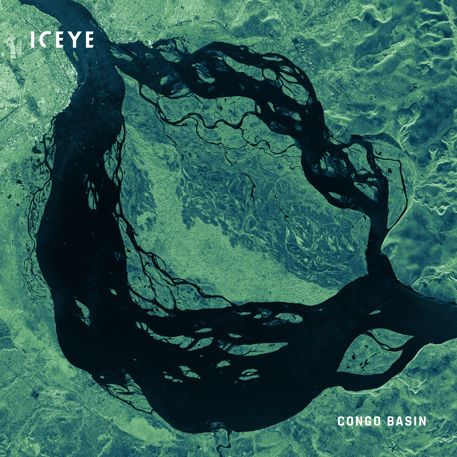
ICEYE Strip image of the Congo Basin rainforest.
The rainforest is vital for the Earth’s climate regulation and biodiversity, and deforestation in this region can lead to devastating outcomes. The Congo Basin rainforest, with its 1.5-million-km2 area, is one of the cloudiest places on Earth making it a very challenging region to observe from space using traditional imaging methods. ICEYE’s constellation of SAR satellites can help monitor the vast area through the cloud cover, providing data for timely and accurate deforestation mapping.
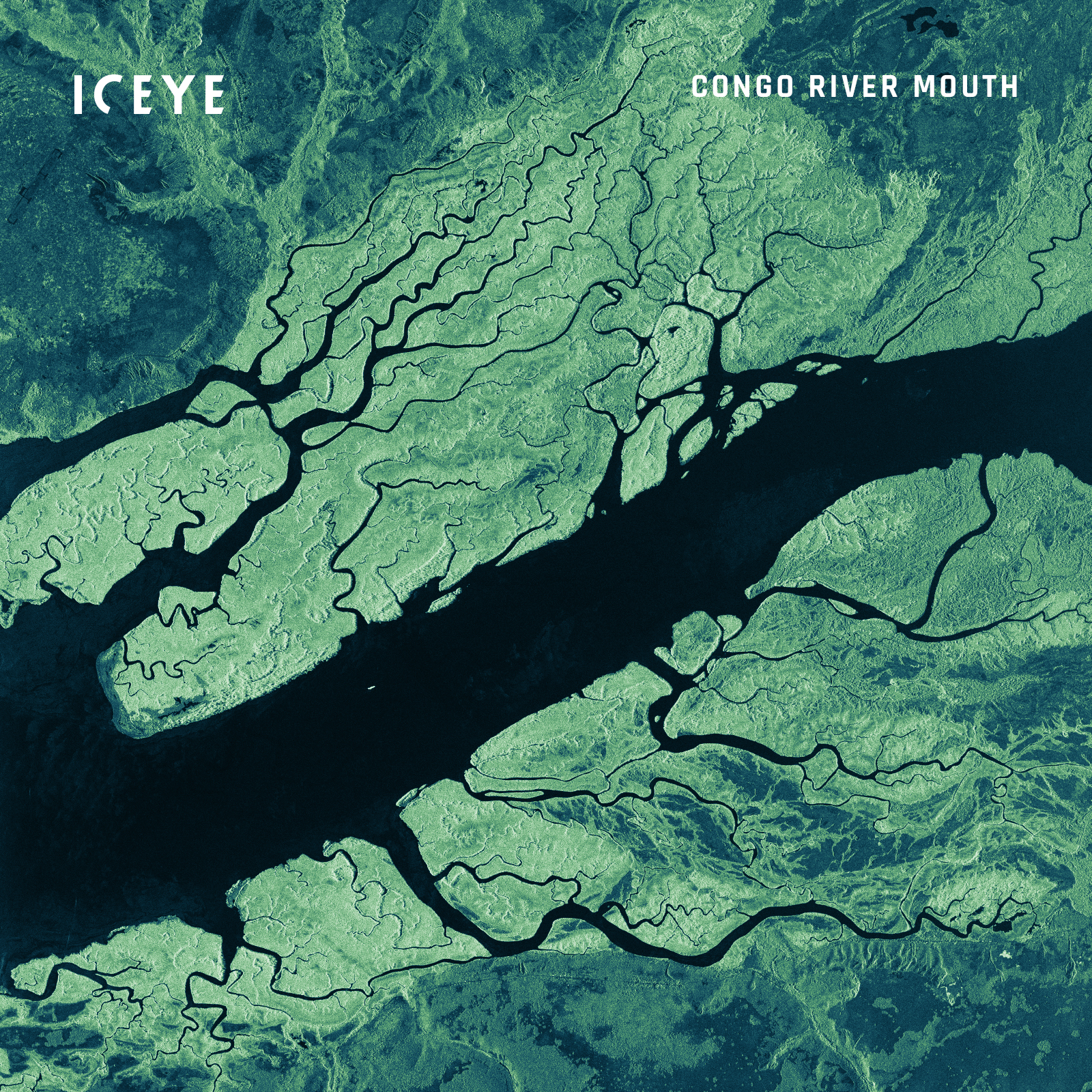
ICEYE Strip image of the mouth of the deepest river on Earth – the Congo River – on the border between the Democratic Republic of the Congo and Angola.
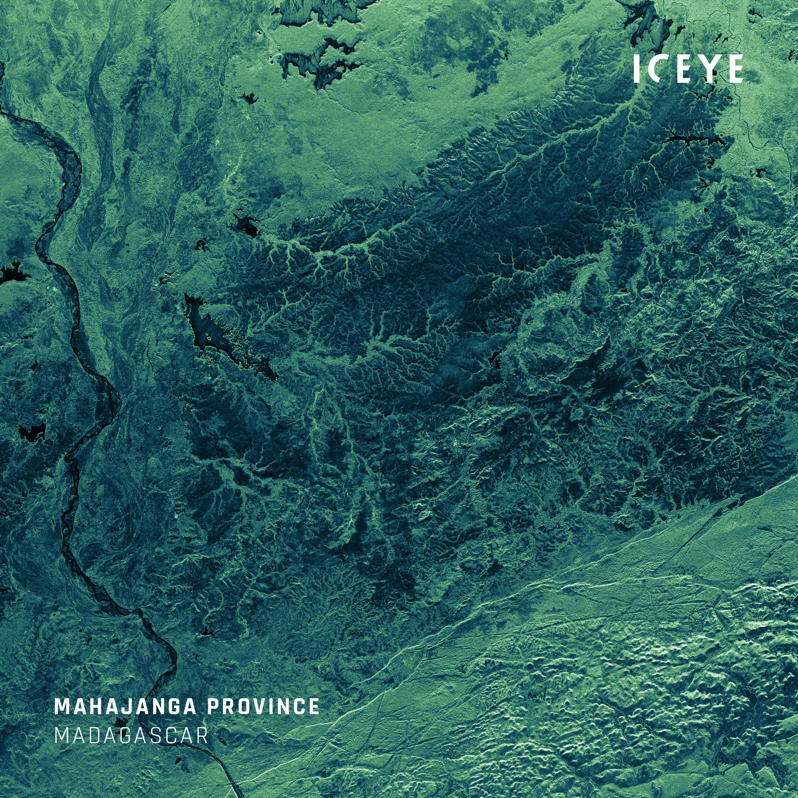
Madagascar is a country in East Africa, occupying the world’s fourth-largest island. The country is home to many endemic species: approximately 95% of Madagascar’s reptiles, 89% of its flora and 92% of its mammals cannot be found anywhere else on Earth. Important for global biodiversity, Madagascar’s flora and fauna are endangered by human activity. This makes the country one of the most pressing biodiversity hotspots.
This ICEYE SAR satellite image shows the Antsalova district and the southern part of Tsingy De Bemaraha National Park, Madagascar. The national park is known for its marvelous geological formations: the Great Tsingy and the Little Tsingy. It is also a UNESCO World Heritage Site.
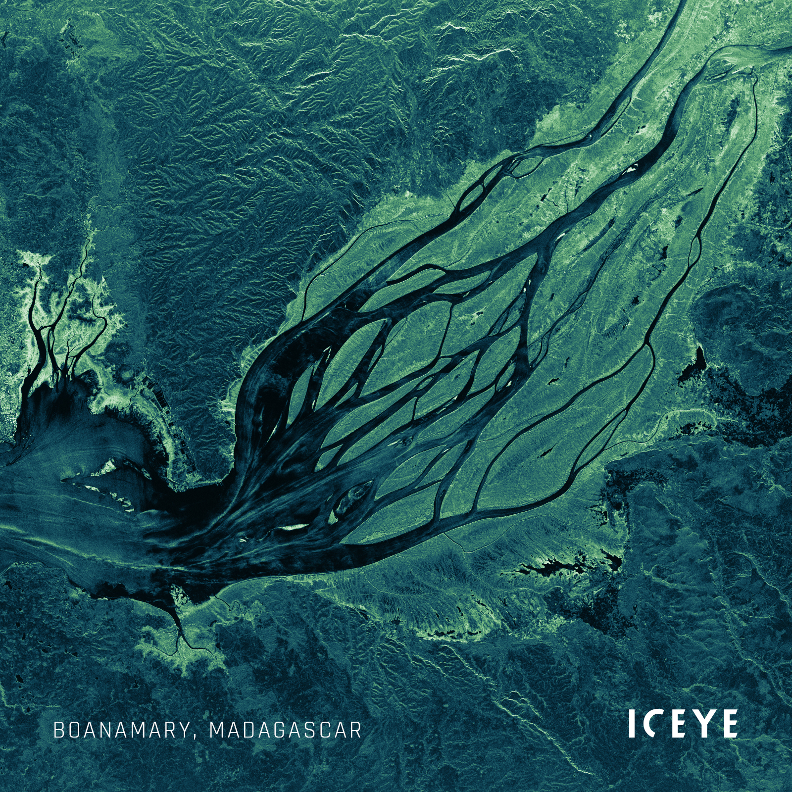
Tropical storms and cyclones that form in the Indian Ocean bring heavy rains and deadly floods to Madagascar. The cyclone season usually runs from November to April and affects the country almost every year. With ICEYE’s transformative flood monitoring capabilities, local authorities and insurance companies can get timely information on flood extent and depth, and utilize it for mitigation measures and faster claim processing.
ICEYE SAR satellite image of the southern part of the Betsiboka River estuary, Madagascar.
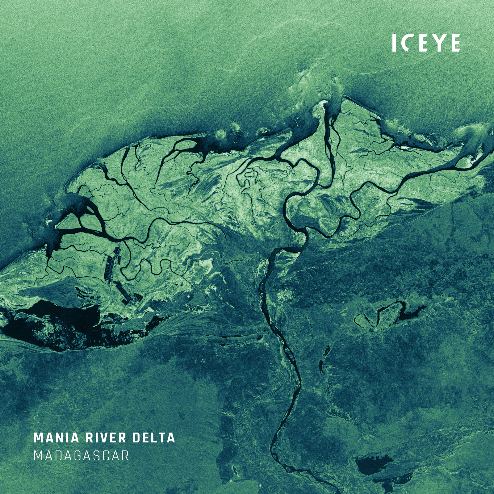
ICEYE SAR satellite image of the Mania River delta, Madagascar.
The African Great Lakes are a series of lakes, located in East Africa, containing around a quarter of the world’s unfrozen freshwater. Millions of people depend on these lakes as a source of drinking water. This unique ecosystem is also the ancient home of many endemic species of plants and animals living in the region and in its lakes.
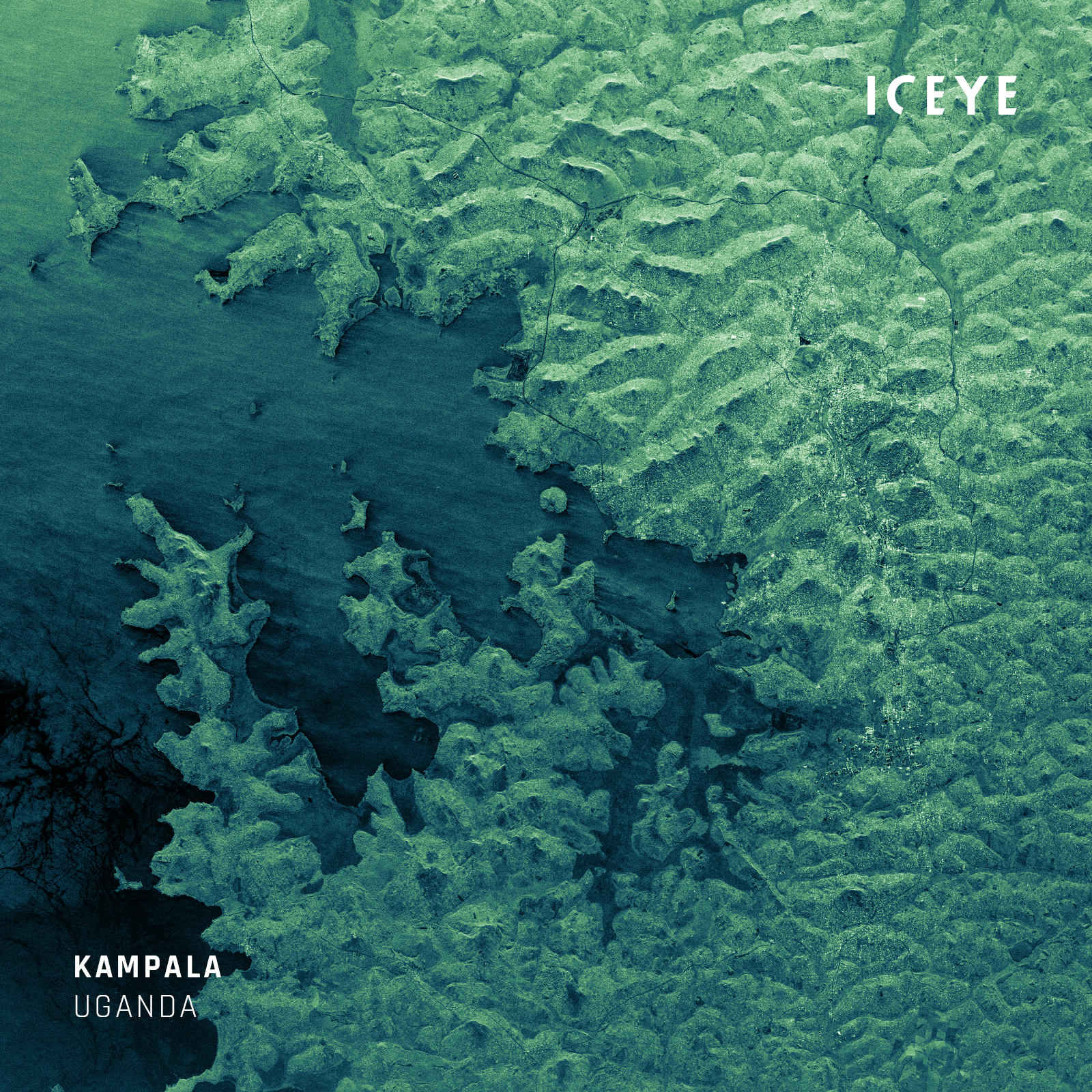
ICEYE SAR satellite image of Lake Victoria, the third-largest freshwater lake in the world.
The lakes’ ecosystem is, however, jeopardized by climate change and human activities. Oil drilling, unregulated fishing, population growth, invasive fish and weed species – all these pose the threat of pollution and devastation to the lakes and their species.
Persistent SAR satellite monitoring can help detect unreported fishing activities and oil pollution in near-real-time, even at night or on a cloudy day.
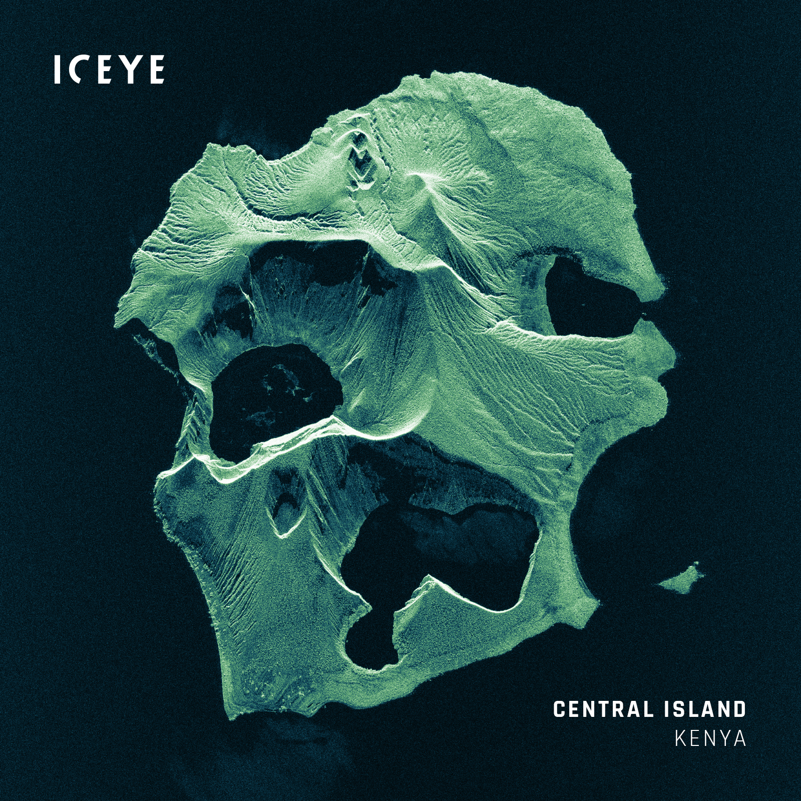
A very high-resolution radar image of Central Island, a volcanic island located in Lake Turkana, Kenya. This Spot image was acquired using an ICEYE SAR satellite.
The Nile Delta is a rich agricultural region, ranked among the world's most fertile farming areas. The delta’s wetland system supports a considerable number of fish, bird, animal, and plant species.
Being home to about 40 million people, it is the only water and irrigation source for its inhabitants. The region currently does not receive enough silt and sediment to further build up the delta and enrich its soil, which has a great impact on the livelihood of the local population and wildlife. As a consequence, there is a gradual decrease in the fertility of agricultural lands and an increase in erosion along the Mediterranean Sea, resulting in the delta's shrinking.
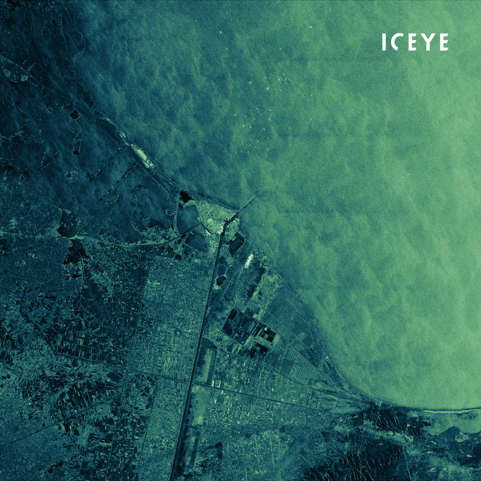
ICEYE Scan image of Port Said, Egypt, located on the east side of the Nile Delta.
With persistent SAR satellite monitoring of vast crop areas, regardless of cloud cover and sunlight, it is possible to detect agricultural activities, such as planting and harvesting. SAR satellite data enables accurate measurements of field boundaries and sizes, and assists in assessing crop damage caused by natural disasters, such as floods.
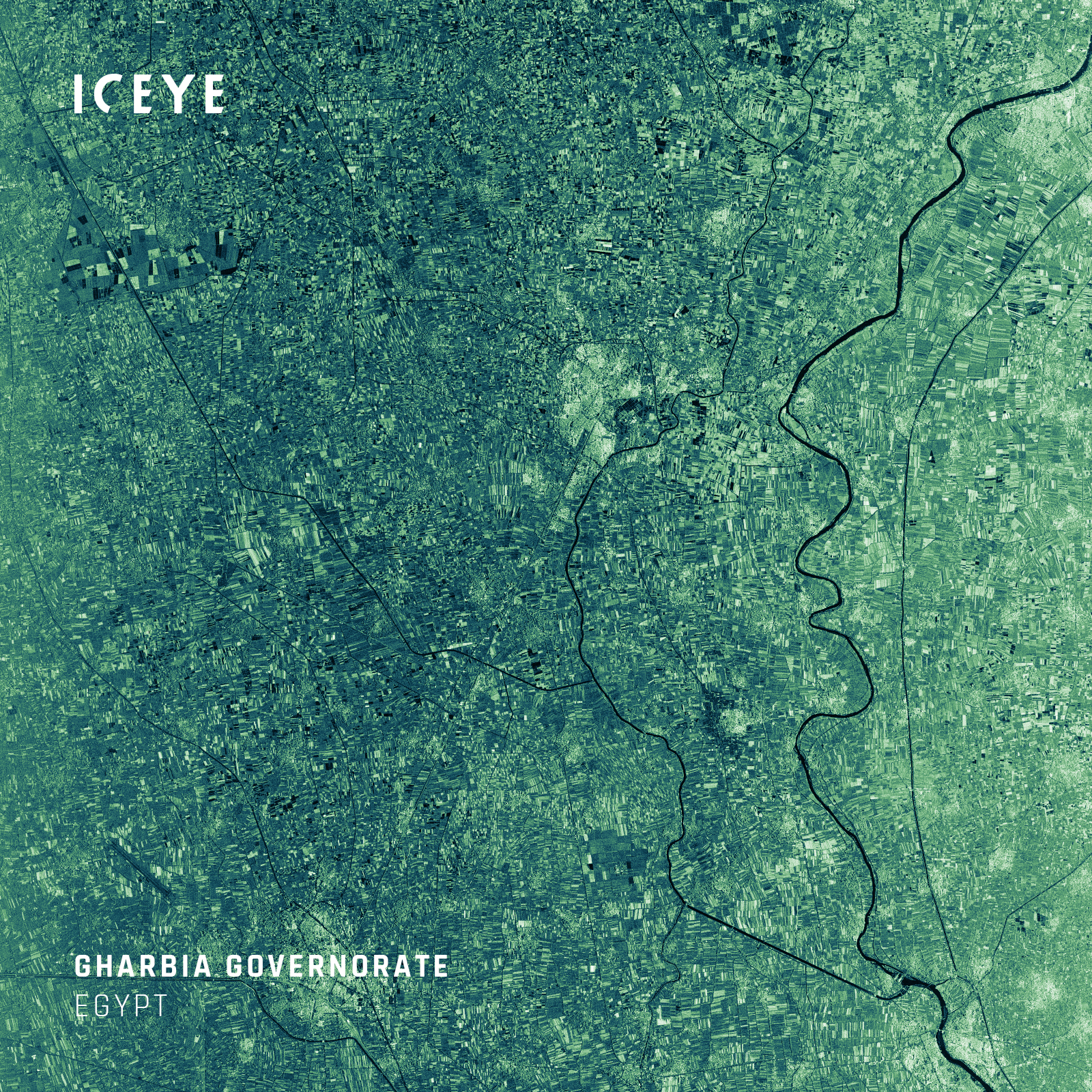
ICEYE Strip image of Gharbia Governorate in the Nile Delta, Egypt.
ICEYE’s SAR satellite constellation allows for persistent monitoring of remote and wide areas. It enables users to detect deforestation, oil pollution, and illegal fishing in a timely manner. Besides this, SAR imagery is also a valuable information source for construction monitoring, city planning, agricultural monitoring, and land subsidence tracking. To familiarize yourself with ICEYE SAR data, download our latest Scan dataset for free, containing two SAR images, each covering an area of 10,000 km2.
Download 


03 June 2026

23 January 2026

06 November 2025