Contact us
Get in touch with our experts to find out the possibilities daily truth data holds for your organization.


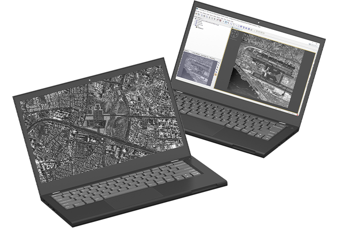
This blog post summarizes information about a Spot dataset of Oman including a SAR image of the downtown area of Muscat and an image of the Muscat International Airport. Both high-resolution images show many features of the city structure and activities.
Note: The Oman dataset is no longer available for free download. Explore other ICEYE's datasets available for free on our website. These datasets provide the opportunity to assess the quality of ICEYE's SAR imagery and allow testing their suitability for your applications.
In Spot imaging mode, a very fine image resolution of 0.5 m x 0.25 m (slant range x azimuth) is achieved.
The information content of these very high-resolution images enables detection and identification of small objects and feature extraction in urban areas. Analysts can use repeated data acquisitions to detect newly constructed and destroyed buildings, measure building sizes and urban densities, and obtain information on urban sprawl and vertical growth, to name a few. The images can also serve as input for updating cadastral maps.
Precise monitoring and change analysis of activities on ground can be performed with ICEYE satellites. With an approach of imaging the location multiple times analysts can track urban development over time.
The images of a Spot dataset are available in both data formats, SLC (single look complex) and GRD (ground range detected). For more information on these data formats, read the SAR Product Guide.
Both images in the dataset are standard Spot products, each covering an area of 5 km x 5 km (width x length). All the technical information about the data, such as the satellite look angle, the time of acquisition, and the orbit direction is included in the XML files. These files are provided in the corresponding ZIP folders available for download.
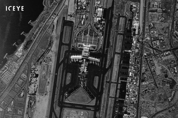
Figure 1. Spot ICEYE SAR satellite image of Muscat International Airport, Oman.
Image #1 - Muscat International Airport, Oman
Muscat International Airport is the main international airport in Oman and is located 32 km from the old city of Muscat. The image shows the area surrounding the airport, the feeder roads, and the coast facing the Gulf of Oman (Figure 1).
The Spot imagery provides high-resolution details of the entire airport site: in addition to the two parallel runways and taxiways, parked aircraft and an airplane on a taxiway can be detected. Many individual features of the terminal and airport buildings are visible, as well as the evenly spaced lamp posts of the parking lot.
A golf course is located directly on the coast. West of it, four breakwaters are built into the sea.
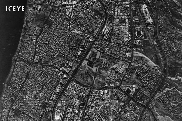
Figure 2. Spot ICEYE SAR satellite image of the city of Muscat in Oman.
Image #2 - City of Muscat, Oman
The image shows Muscat, the capital city of Oman (Figure 2). It is located in a key geographical location at the crossroads of the sea routes that connect Asia with Africa and Europe.
This Spot image shows some great features on a building level. For instance, the Sultan Qaboos Grand Mosque (Figure 3) and the Sultan Qaboos Sports Complex (Figure 4) are clearly visible in full detail. Analysts can detect the road network and map the local buildings and vegetation.
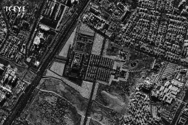
Figure 3. Sultan Qaboos Grand Mosque in Muscat, Oman.
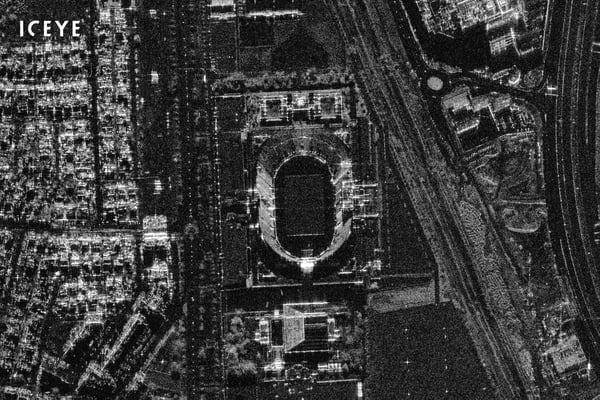
Figure 4. Sultan Qaboos Sports Complex in Muscat, Oman.
We frequently publish SAR images for free download to allow users to experience the quality and evaluate the suitability of the various ICEYE image products for different applications and use cases. Download a Spot dataset:
Download  - in SLC & GRD formats -


03 June 2026

23 January 2026

06 November 2025