Contact us
Get in touch with our experts to find out the possibilities daily truth data holds for your organization.


This blog post provides an overview of a recently released ICEYE Strip SAR dataset that includes radar imagery of agricultural areas near Copeland, Kansas, and Brawley, California, in the U.S. It is available as a free download from our website from the link above. The data contains information about the agricultural landscape, different crop types, and enables the measurement of the fields’ boundaries and sizes, and the mapping of the local infrastructure.
The dataset gives you an opportunity to get familiar with the quality of ICEYE’s Strip SAR data and to assess its suitability for agricultural use cases free of charge.
The combination of high-resolution and wide-area coverage makes ICEYE’s Strip images a perfect choice for persistent monitoring of large agricultural areas.
A consistent data stream, enabled by ICEYE’s SAR satellite constellation, allows to detect changes within the area of interest and to indicate harvest activities. ICEYE data provides input for analyzing harvested areas, assessing crop damage in the event of natural disasters, and much more. Using time-series analysis, it is also possible to identify different stages of crop growth (e.g., ploughing, plant growth, harvesting) and monitor other activities of the agricultural cycle: regardless of weather, clouds, and daylight.
Table 1 lists some parameters of standard Strip images for the two main data formats: SLC (single look complex) and GRD (ground range detected). ICEYE’s SAR datasets contain images in both data formats, thus users can evaluate both.
| Parameter | Strip |
| Nominal Swath Width x Product Length | 30 km x 50 km |
| SLC, Slant Range Resolution | 0.5 - 1.5 m |
| SLC, Azimuth Resolution | 2.5 - 3.0 m |
| GRD, Ground Range Resolution | 3.0 m |
| GRD, Azimuth Resolution | 3.0 m |
Table 1. Parameters of ICEYE’s Strip imaging mode: the coverage of a full Strip scene and the product-corresponding resolutions. For more information, read the SAR Product Guide.
Both images from the dataset are subsets of a full Strip scene, which means that the nominal swath width and image length differ from the standard Strip product. All the technical information about the data, such as the satellite look angle, the time of acquisition, and the orbit direction is included in the XML files. These files are provided in the corresponding ZIP folders available for download.
Below is an overview of the main highlights and structures that users can identify in the images from Kansas and California.
Image #1 - Agricultural Area in Gray County, Kansas
The image features the three towns of Copeland, Montezuma, and the eastern part of Sublette (Figure 1). They are all located in Gray County, Kansas, along US Route 56 which runs nearly east to west, and is clearly visible in the image.
The area is characterized by crop fields of various sizes and shapes. The majority of these fields are circular, which is typical of several areas in Kansas. Such a field shape is the result of the so-called center-pivot irrigation, an irrigation method in which water is taken from a well in the center of the field and piped to the plants. The pipes can be identified in the image.
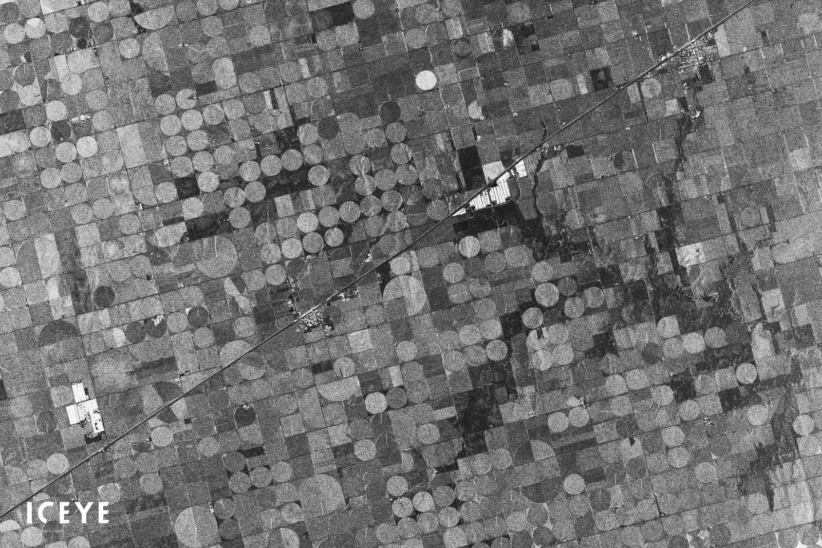
Figure 1. A subset of the Strip ICEYE SAR satellite image of Copeland and Montezuma, Kansas, U.S.
Image #2 - Agricultural Area in Brawley, California
The image shows the two towns of Brawley and Westmorland in Imperial County in Southern California (Figure 2 and Figure 3). Year-round agriculture is a major economic activity in this region. The area has fertile soils and a favorable climate for optimal all-season vegetation yields. In addition, Brawley has a substantial cattle and feed industry.
By using the image, analysts can detect the road network connecting the towns, the surrounding fields, and the unincorporated communities in the area. The image is well suited for segmenting fields and measuring field boundaries and sizes, and is a good example for urban construction monitoring using ICEYE Strip SAR data.
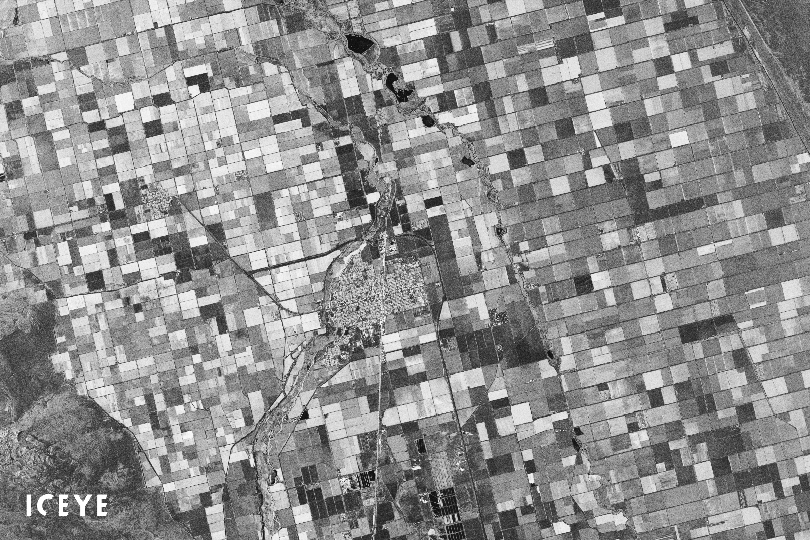
Figure 2. A subset of the Strip ICEYE SAR satellite image of Brawley and Westmorland, California, U.S.
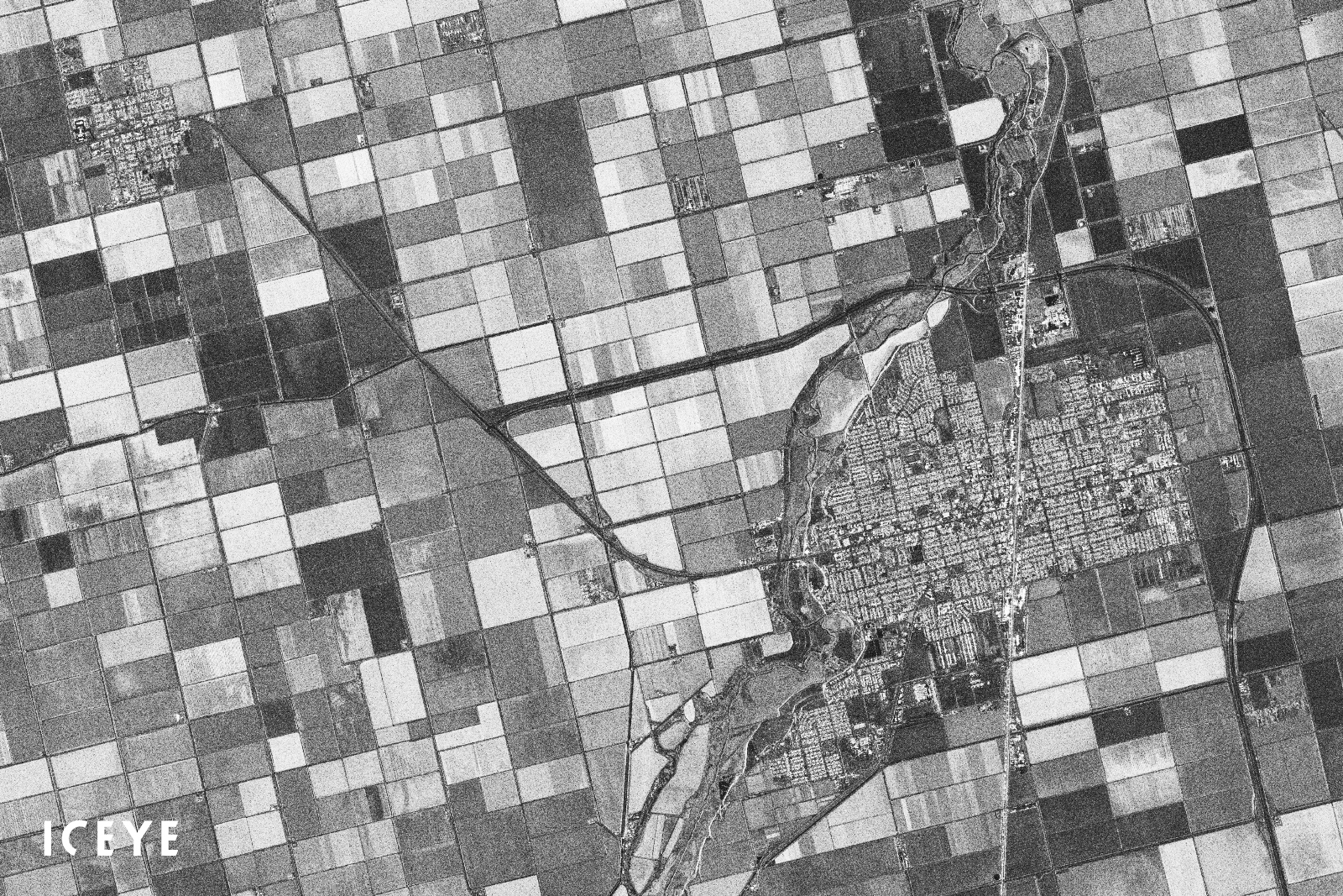
Figure 3. Agricultural area and road network near Brawley and Westmorland, California, U.S.
We regularly release, free of charge, SAR datasets for public access to give users an opportunity to evaluate the quality of ICEYE imagery and its suitability for different applications and use cases. Download the Strip dataset we described in this blog:
Download Example Strip SAR Imagery - in SLC & GRD formats - U.S.
Download 


23 January 2026

06 November 2025

27 June 2025