Contact us
Get in touch with our experts to find out the possibilities daily truth data holds for your organization.

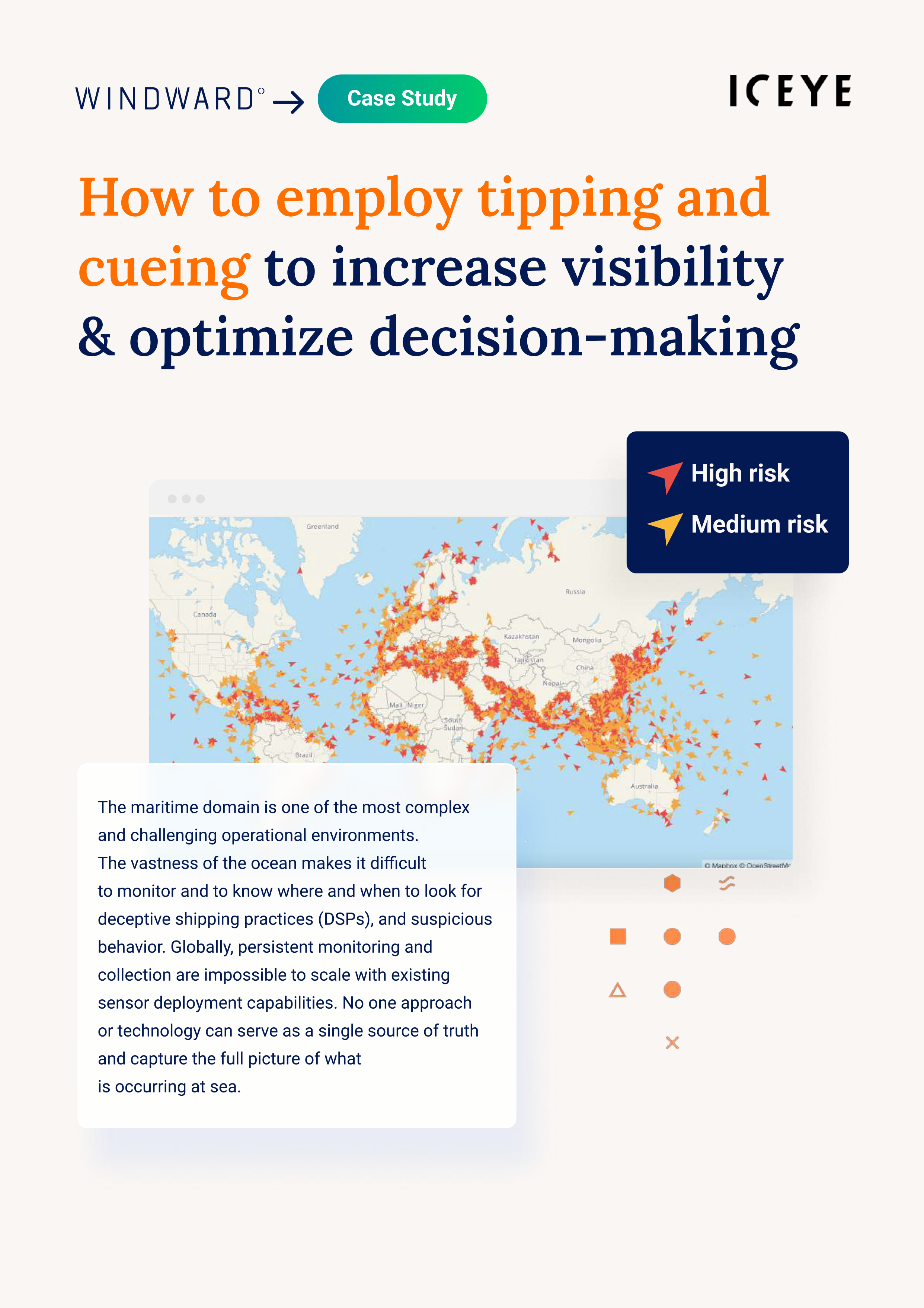
In many cases, nations attempting to detect and counter suspicious maritime activities must employ multiple sources of data from highly classified National-level sensors. Unfortunately, this methodology drastically limits the ability to share relevant information with Allies and Partners.
Like ICEYE, our partner Windward AI believes information sharing is the foundation of future solutions, and encourages military and law enforcement organizations to multi-laterally address nefarious maritime activities. Windward recently performed an impressive feat, by incorporating ICEYE SAR data with AIS and advanced AI algorithms; helping a leading intelligence unit obtain evidence of foreign military presence in the Philippines EEZ. Windward’s solution seamlessly integrated SAR imagery with maritime AI and optical imagery, which produced actionable insights for host-nation decision makers to address.
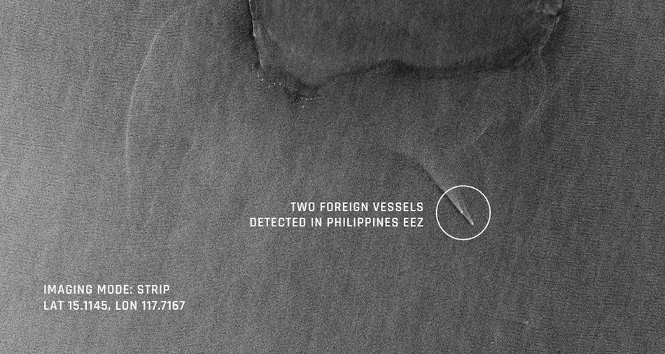
 This Strip mode image acquired by ICEYE SAR satellite constellation enabled detecting suspected vessels in Phillippines EEZ. Next, the image was integrated it into the Windward platform, overlaid with Windward AI’s fused identity layers, the actionable insights were highlighted to help drive the investigation deeper. See our Case Study with Windward below to discover more.
Matthew Morris, Director, Defence & Civil, ICEYE US – “To achieve persistent awareness in the maritime domain, military and law enforcement organizations must pursue comprehensive and holistic tactics. This includes the fusion of multi-source intelligence, from both National and Commercial, to provide a timely and accurate depiction of open sea activities; ideally integrated into an interoperable common operating picture (COP). The luxury of commercial remote sensing data is that it is infinitely shareable to our Allies and Partners, which typically cannot be done with National Technical Means (NTM). Never before has persistent data and seamless integration into the Intelligence Cycle been so readily available.“
Interested? Learn more about the method and results below.

03 June 2026

23 January 2026

06 November 2025