Contact us
Get in touch with our experts to find out the possibilities daily truth data holds for your organization.

As Hurricane Melissa stalled over the Caribbean in late October 2025, relentless rainfall caused catastrophic flooding across Jamaica. More than 500 mm (19 in) of rain fell between October 23 and 28, submerging homes, hospitals, and infrastructure. As the storm finally made landfall on October 28th, it brought with it Category 5 winds and catastrophic storm surge, destroying even the most well-built structures. In the wake of the storm, ICEYE made its Flood Rapid Impact data and Hurricane Rapid Impact freely available to government agencies and NGOs through Esri’s Disaster Response Program, helping response teams prioritize resources and protect lives.

Flood Rapid Impact Map of Jamaica following Hurricane Melissa - October 30, 2025
ICEYE's constellation of Synthetic Aperture Radar (SAR) satellites captured high-resolution images of flooded areas in Jamaica as early as October 24, enabling rapid flood and damage mapping even through persistent cloud cover. ICEYE identified approximately 191,000 buildings as damaged across the entire island of Jamaica. ICEYE also provided Hurricane Rapid Impact data to reveal the most extensive damage across western Jamaica, particularly around Black River. In this area, tens of thousands of buildings were affected.
By combining satellite observations with machine learning, ICEYE delivered near real-time insights on where water levels were rising fastest and which structures were most at risk. This near-instant information, available through Esri's open-access Disaster Response Program allowed responders to assess conditions on the ground without waiting for weather to clear for an in-person or aerial assessment to be completed.
Within hours of landfall, ICEYE delivered its first Flood Rapid Impact assessment — empowering first responders, governments, and insurers to make informed decisions faster and support recovery efforts when every hour counts.
Government of Jamaica
ICEYE's data supported Jamaica's Prime Minister in preparing for a parliamentary presentation. The insights stemmed from a swift, countrywide assessment covering approximately 428,000 buildings, of which about 116,000 were identified as damaged. After collecting more data, a total of 960,000 buildings were evaluated, and roughly 191,000 exhibited signs of damage.
“This was our first national rapid assessment, because of ICEYE and Esri. We’ve never been able to push this data out to our international partners within a week of a hurricane before, until ICEYE and Esri.”
– Alicia Edwards, Principal Director at the National Spatial Data Management Branch (NSDMB), Kingston, Jamaica
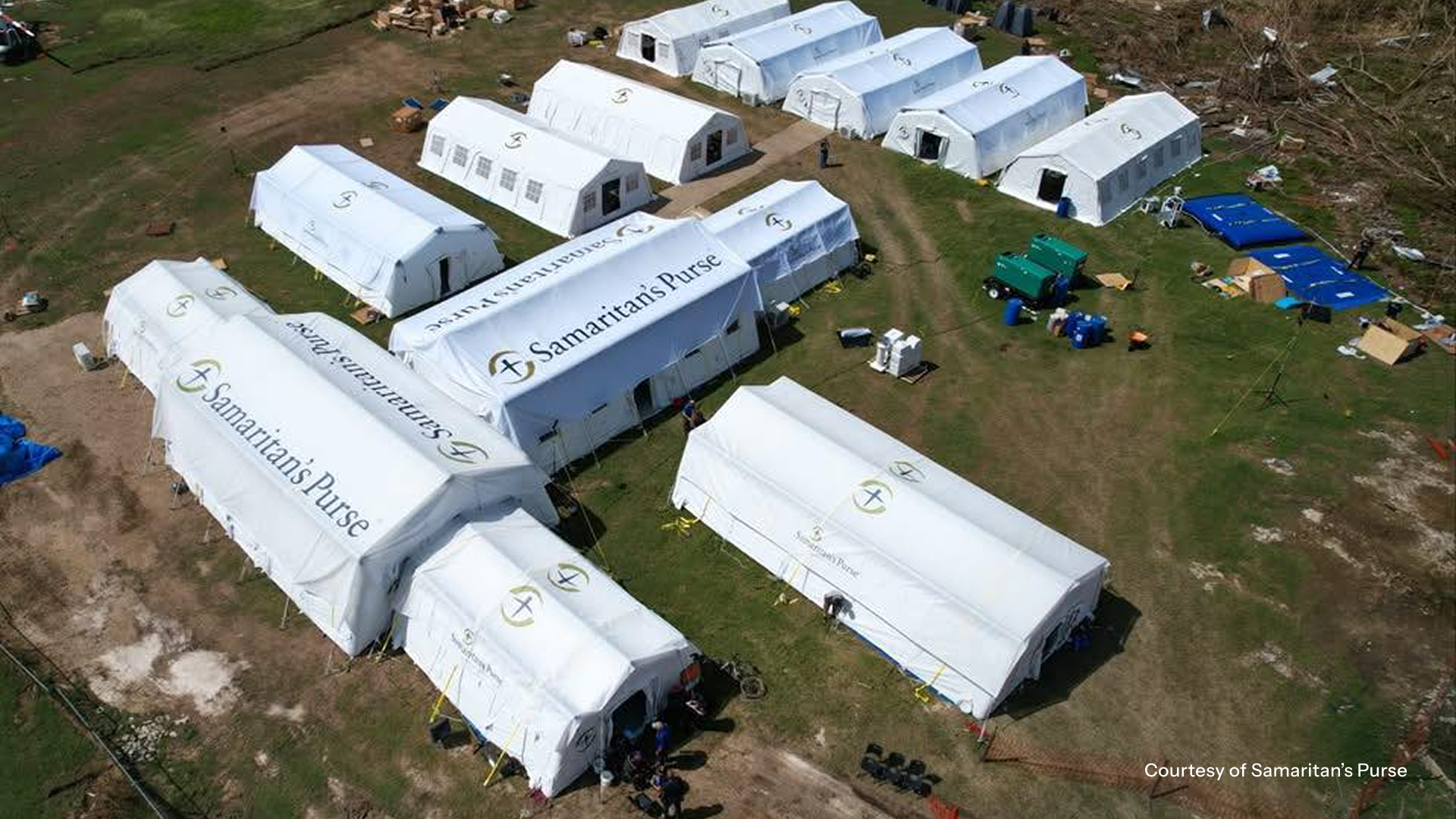
Samaritan’s Purse
Samaritan’s Purse is a nonprofit based out of Boone, North Carolina. Following Hurricane Melissa, medical teams were caring for patients in Black River and isolated communities as relief efforts continued. Disaster specialists delivered over 590,000 pounds of relief to the island.
By combining ICEYE’s analysis with local assessments, they could prioritize clean water, medical care, and recovery efforts more efficiently.
“During the Hurricane Melissa response, ICEYE data enabled us to see where the damage was most severe and act without delay. That information helped us get relief to isolated communities faster than would have otherwise been possible, making a measurable difference in the number of people we could serve and how quickly we reached them. This level of clarity and speed directly strengthened our effectiveness in the field and improved outcomes for families who urgently needed support.”
– Jonathan Stone, Senior Programs Specialist, Samaritan’s Purse Hurricane Melissa Response
Team Rubicon
Team Rubicon is a veteran-led humanitarian organization that serves global communities before, during, and after disasters and crises. Team Rubicon utilized ICEYE data to identify damaged infrastructure and potential clinic sites in coordination with Jamaica’s National Works Agency and the Ministry of Health and Wellness.
“Our volunteers used ICEYE’s flood and damage imagery to evaluate hospitals in Westmoreland Parish for possible field clinic sites where our medical team could support degraded healthcare infrastructure, as well as overall damage impacts to determine where we might apply our volunteers' chainsaw and roof tarping skills. The data we accessed through Esri’s Disaster Response Program gave us valuable situational awareness and helped ensure we effectively deployed our teams of highly-skilled volunteers where they could have the greatest impact for the people of Jamaica.”
– Adam Martin, Manager, Mission Support (Planning), Team Rubicon
Map Action
MapAction is a UK charity that provides emergency geospatial analysis to UN agencies, NGOs, and national disaster management agencies. MapAction deployed several rotations of geospatial analysts to support the UN Disaster Assessment and Coordination team, the World Food Programme, and the humanitarian community.
When MapAction arrived, it harnessed ICEYE’s Hurricane Rapid Impact solution to give arriving UN agencies and NGOs an overview of the damage.
“The rapid impact analysis was very popular as it gave a good overview of the spread of damage. There was more detailed imagery analysis done later but none of it covered the same extent as the ICEYE or gave the same overview.”
- Kirsty Ferris, Team Lead, GIS and Information Management Volunteer, MapAction
ICEYE’s support during Hurricane Melissa demonstrated how space-based insights can transform emergency response. By partnering with Esri and sharing data openly, ICEYE empowered responders from across the humanitarian community to act faster, safer, and smarter.
To request access to ICEYE’s Flood Rapid Impact or Hurricane data for ongoing or future weather events, contact us here.

25 June 2026

22 June 2026

03 June 2026