Contact us
Get in touch with our experts to find out the possibilities daily truth data holds for your organization.
Persistent Monitoring
Natural catastrophe solutions
Protect forests through clouds, darkness, and distance. Actionable intelligence designed to detect and prevent deforestation in near real time.
within hours
ICEYE’s Deforestation Solution is a global service that enables governments, corporations, and NGOs to detect, verify, and respond to deforestation in near real time. Powered by ICEYE’s SAR constellation, the product delivers continuous coverage, fast updates, and actionable analytics regardless of weather conditions or daylight.
Uninterrupted coverage across the world’s cloudiest and most vulnerable regions.
Detect deforestation and illegal, newly-cleared forest activities fast enough to stop further expansion.
Combine with ground operations to verify permits, enforce regulations, and prosecute illegal activity.
Monitor multiple protected areas or large at-risk regions at once with ICEYE’s growing satellite capacity.
Once integrated with field operations, ICEYE de-forestation intelligence supports predictive monitoring, helping to identify risks before deforestation occurs.
Base your decisions on reliable data from an established partner. ICEYE provides the world’s most reliable persistent monitoring data for your use.
Use the toggle below to switch between the “Before” the real-life ICEYE SAR image, showing no deforestation, and the “After” image, where ICEYE’s detected illegal deforestation activity. Enforcement agencies need reliable, evidence-backed detections, not just promises of imagery. Traditional data sources make promises about revisit and coverage, to be left with in-actionable clouded images.
Tactical awareness with prosecution-grade evidence. Rapid response to active de-forestation with high-confidence detections and imagery that stands up to legal scrutiny. Clear timing enables intervention during active operations.
Conservation region wide monitoring for advocacy campaigns, expedition safety planning, and donor reporting. Track deforestation trends across protected areas and indigenous territories with consistent, verifiable data.
National-scale forest compliance monitoring and environmental impact assessment. Meet international reporting obligations with transparent, auditable detection records and complete coverage documentation.
Watch deforestation activities in the rainforest of Brazil over a 25 day period. Recognize the rapid progress day by day, documenting the rapid change in detail and making it possible to anticipate next steps.
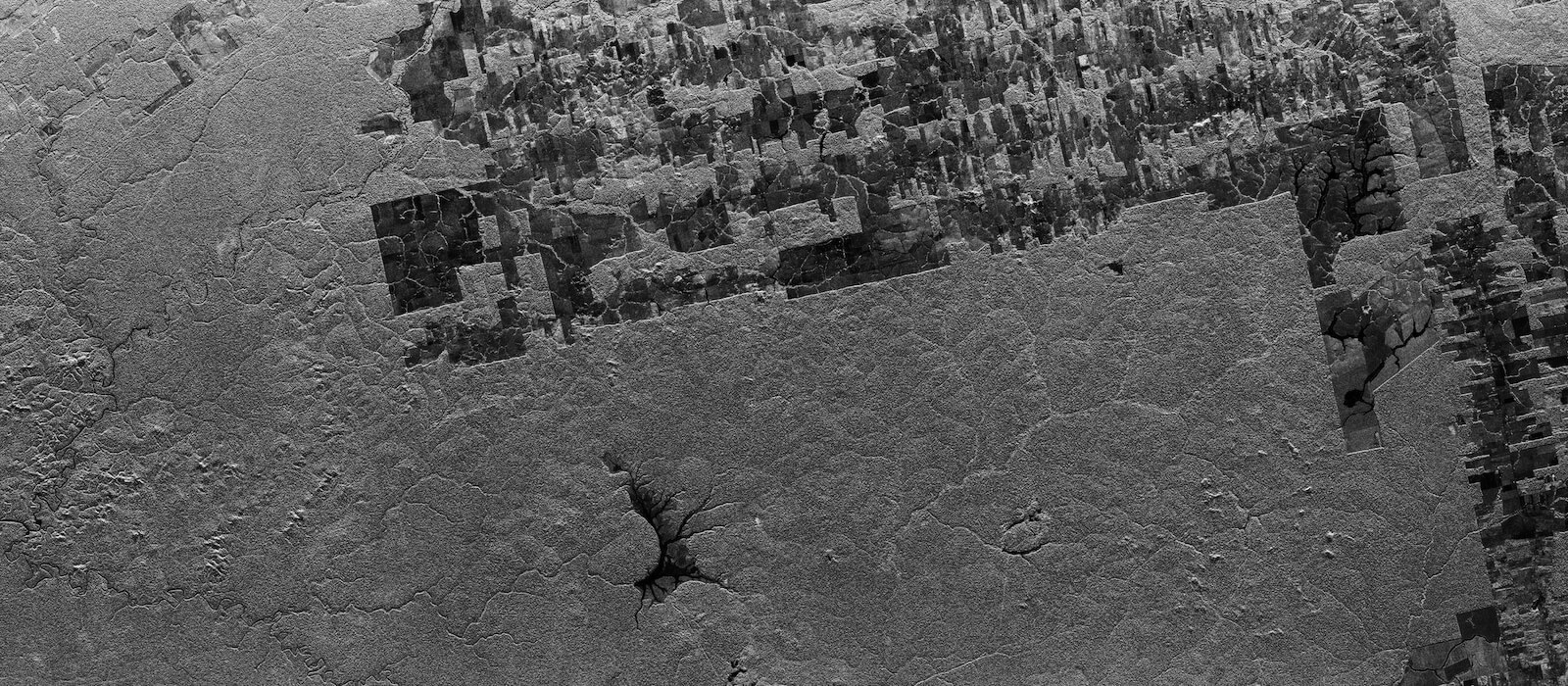
Clear cuts in North Kalimantan Province, Indonesia. SAR data enables early detection of new paths in the forest. Deforestation site often starts with a straight line, cutting deep into the forest. This path is then usually expanded into a rectangle with clear cuts. Such line can also indicate building of new roads, airstrips or illegal mining sites organized in the forest areas.
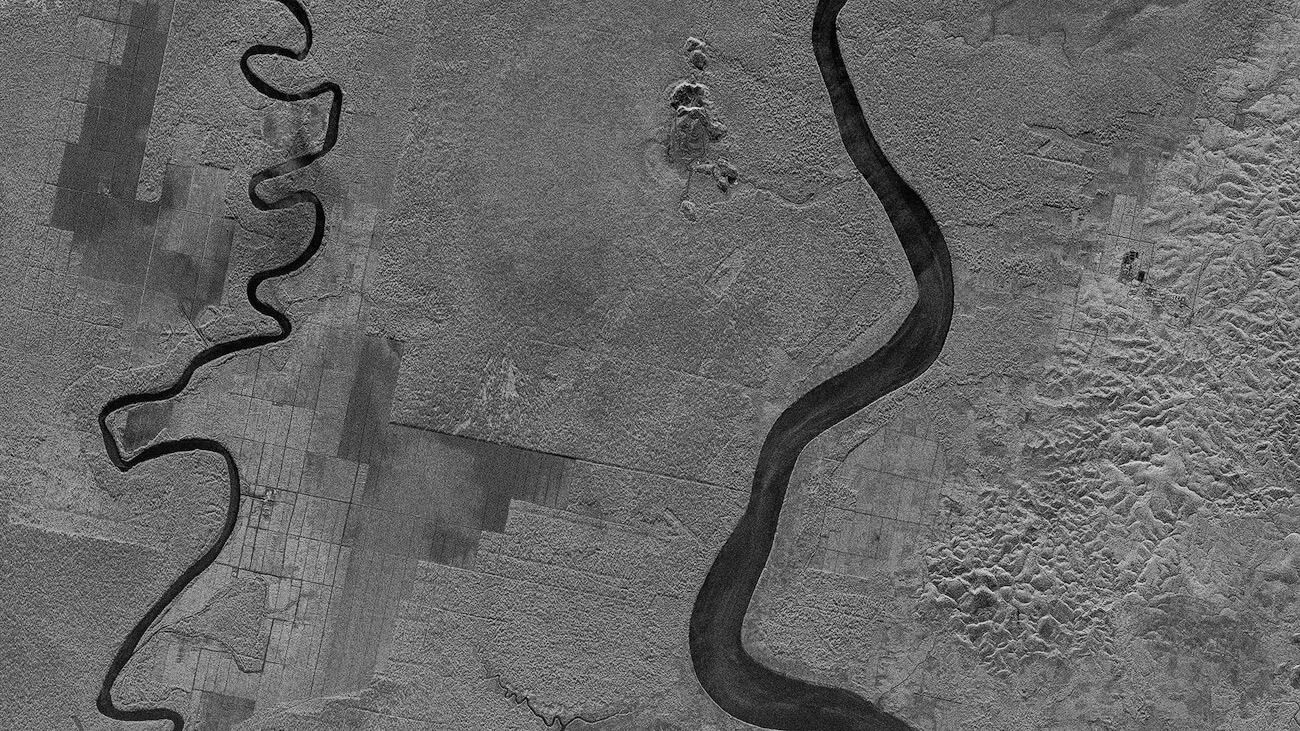
ICEYE SAR imagery showing changes in the forest structure of the Brazilian Amazon Forest. SAR imagery is perfectly suited to analyze various changes in forest structure at nighttime, through clouds, fog, and smoke.
Fill out the form to receive ICEYE’s Deforestation Solution 2-pager and see how near-real-time monitoring can help you detect change faster.
You can also request to speak with our team to confirm coverage and explore how the solution can support your operations in your specific area.