Contact us
Get in touch with our experts to find out the possibilities daily truth data holds for your organization.


It was the sound I remember most. A deep, bone-rattling roar.
Or maybe it was the visuals: peeking through a crack in the shutters and seeing only a wall of wild energy racing by, a white void swallowing up the landscape and everything in it. Houses, trees, even cars parked a few feet away.
Or was it the sensations? The pulsing, painful feeling in my ears. The vibrating in my chest.
Maybe it was all of the above.
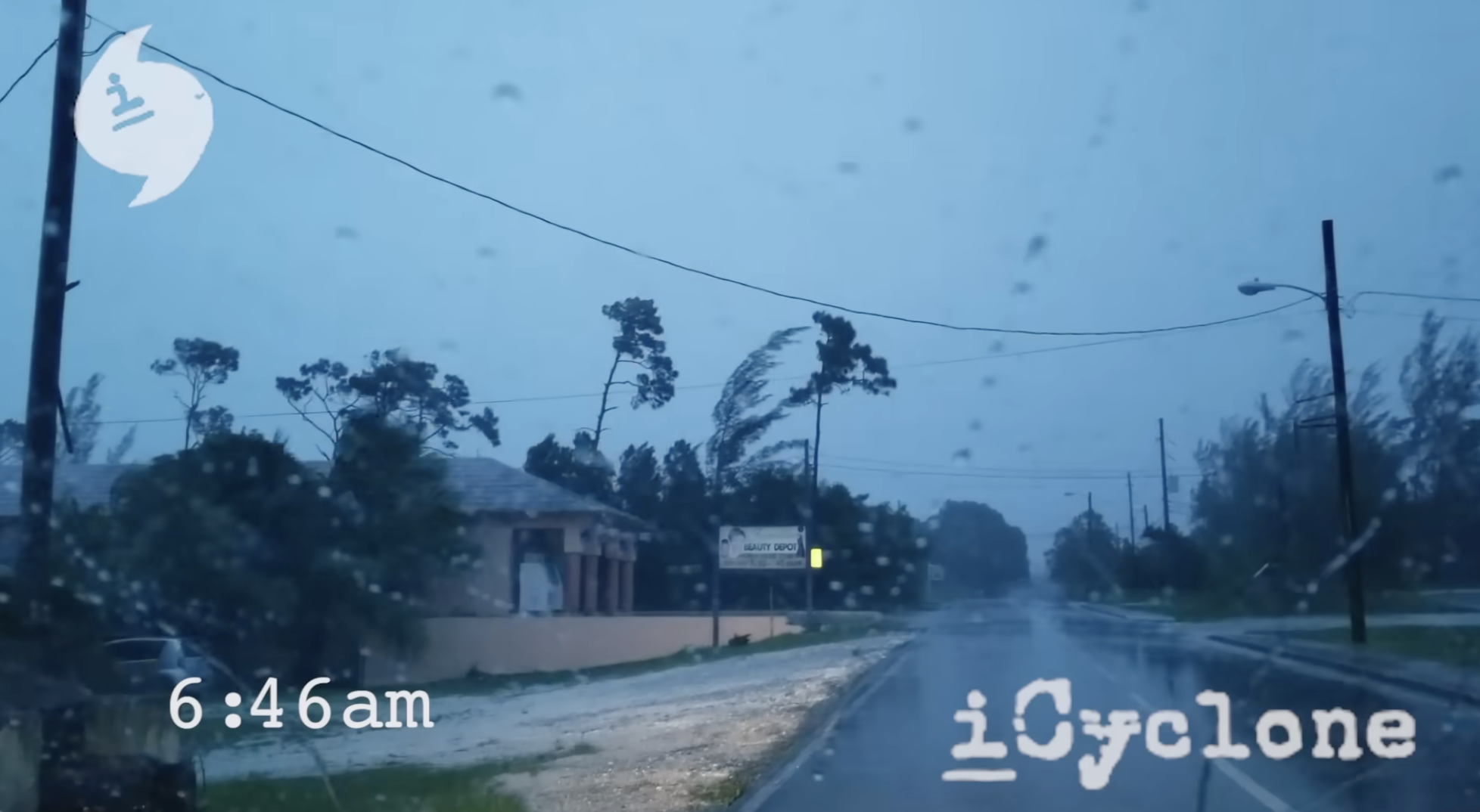
It's hard to capture in words, yet I remember it so well: riding out the inner core of Category 5 Hurricane Dorian in Marsh Harbour on Great Abaco Island in the Bahamas. It was 2019.
This was the strongest hurricane landfall on record in North America (tied with two other events). And I was at Ground Zero. In the worst of it. In a tiny concrete classroom getting pounded by gusts estimated at over 220 mph.
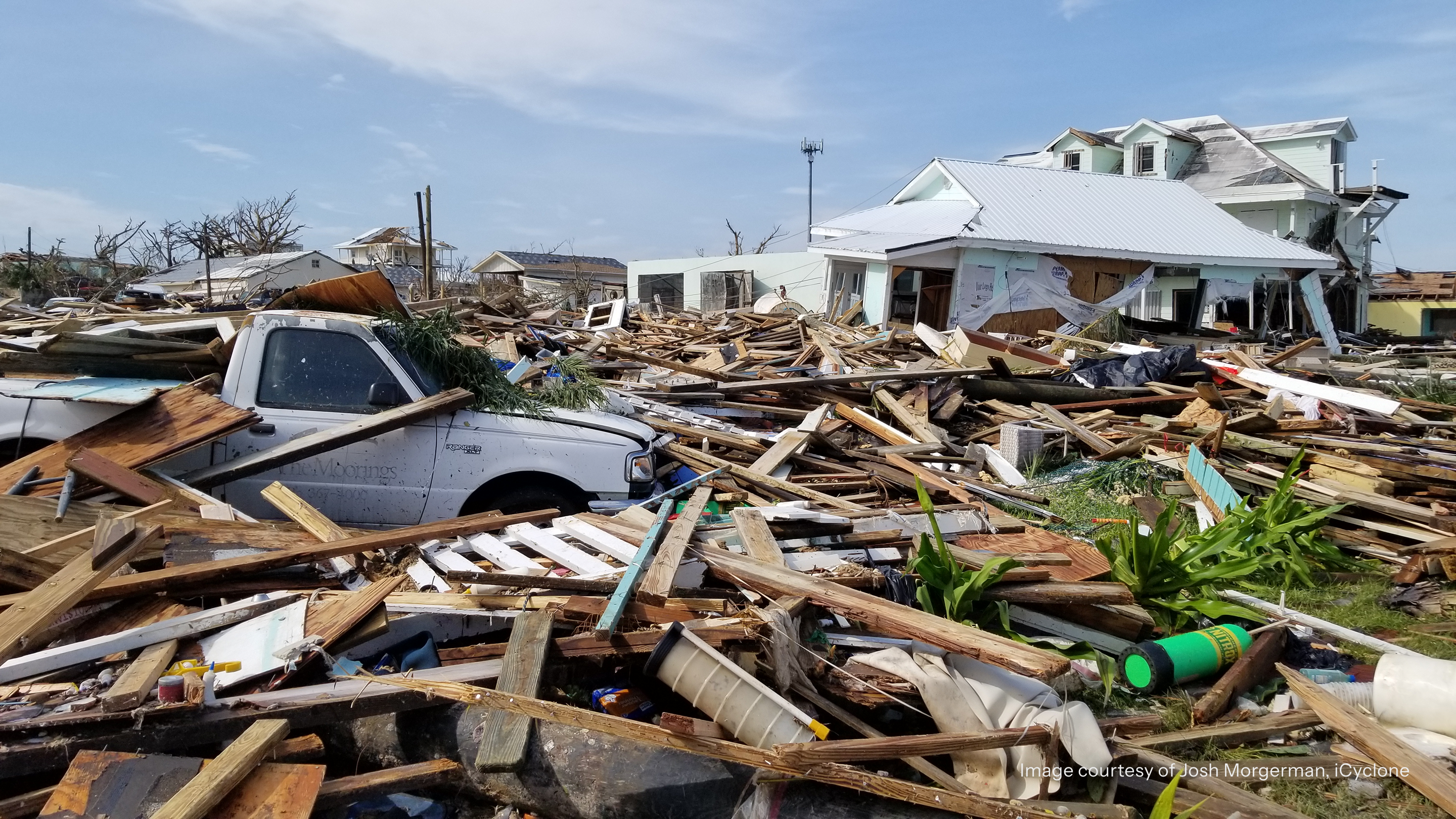
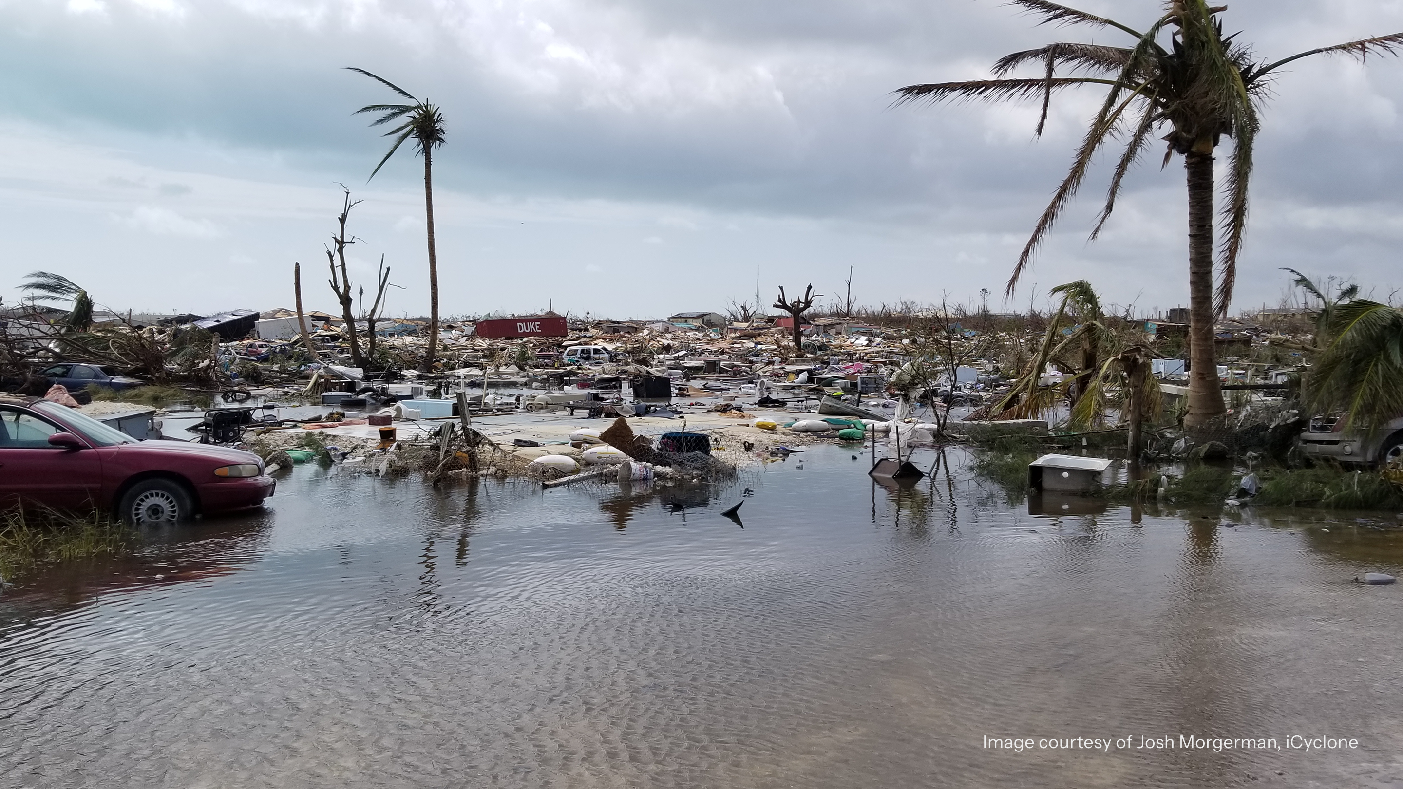
When I ventured out into the scarred landscape after the hurricane passed, the destruction was shocking. Hard to process.
Houses flattened. Concrete smashed. Cars thrown like toys. Whole neighborhoods literally erased. Gone.
That's what I call a tough day at the office.
Yep, getting inside hurricanes is my work. I chase them all over the globe: in every hemisphere, on any continent, in places where they're not even called hurricanes. To date, I've penetrated the inner cores of 88 hurricanes on the ground—a world record.
My purpose: documenting the storms as they strike land, not just with video and imagery, but with hard data.
Before a landfall event, I deploy devices across the expected impact zone to measure key metrics like minimum sea-level pressure, pressure gradients, and pressure fluctuations. These are the numbers that tell us how strong the hurricane was and what kind of structure it had.
I also survey and document damage. In many impacts, especially in remote corners of developing nations, my photos and videos are some of the first images to make it to the outside world.
This part of my work is especially important, because that's when help comes: when the rest of the world sees pictures from the impact zone.
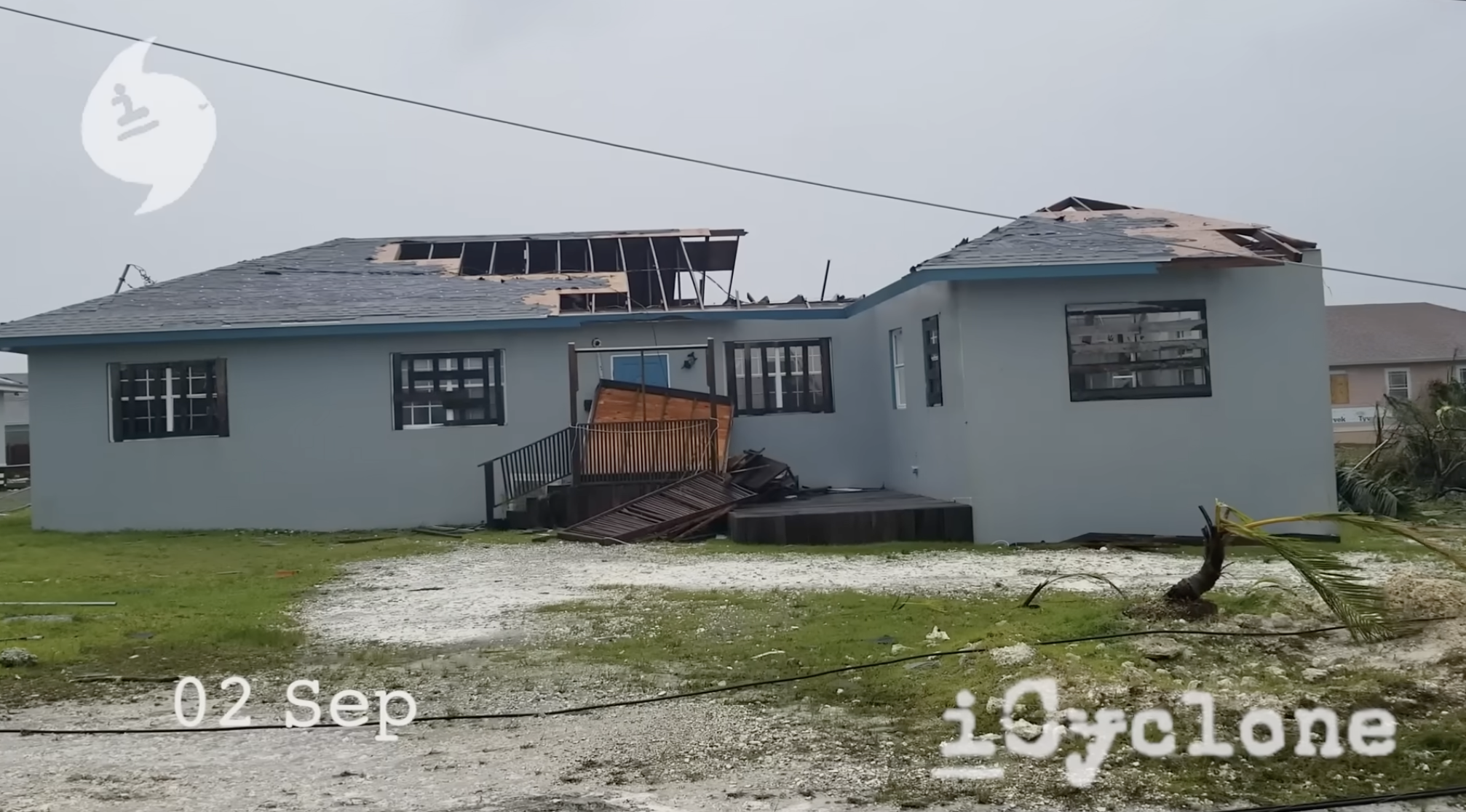
I'm good at what I do. But with Hurricane Dorian, I felt completely inadequate.
The impact was so extreme I knew I couldn't do it justice. I wouldn't be able to capture its scale and scope, no matter how hard I tried. And it would take proper ground teams weeks or even months to uncover the full extent of the destruction.
Not only was the impact zone huge (tens of miles wide), it was deep. The wind and water damage was exceedingly severe. In Marsh Harbour, the poorer, low-lying neighborhoods, like the Mudd and the Pigeon Pea, had been obliterated, with all structures swept away. I couldn't even find the streets. Even the wealthier, higher parts of town saw widespread, heavy wind damage, with many complete structural failures.
All communications were down. The island was cut off from the outside world. The small medical clinic was overflowing with the traumatically injured.
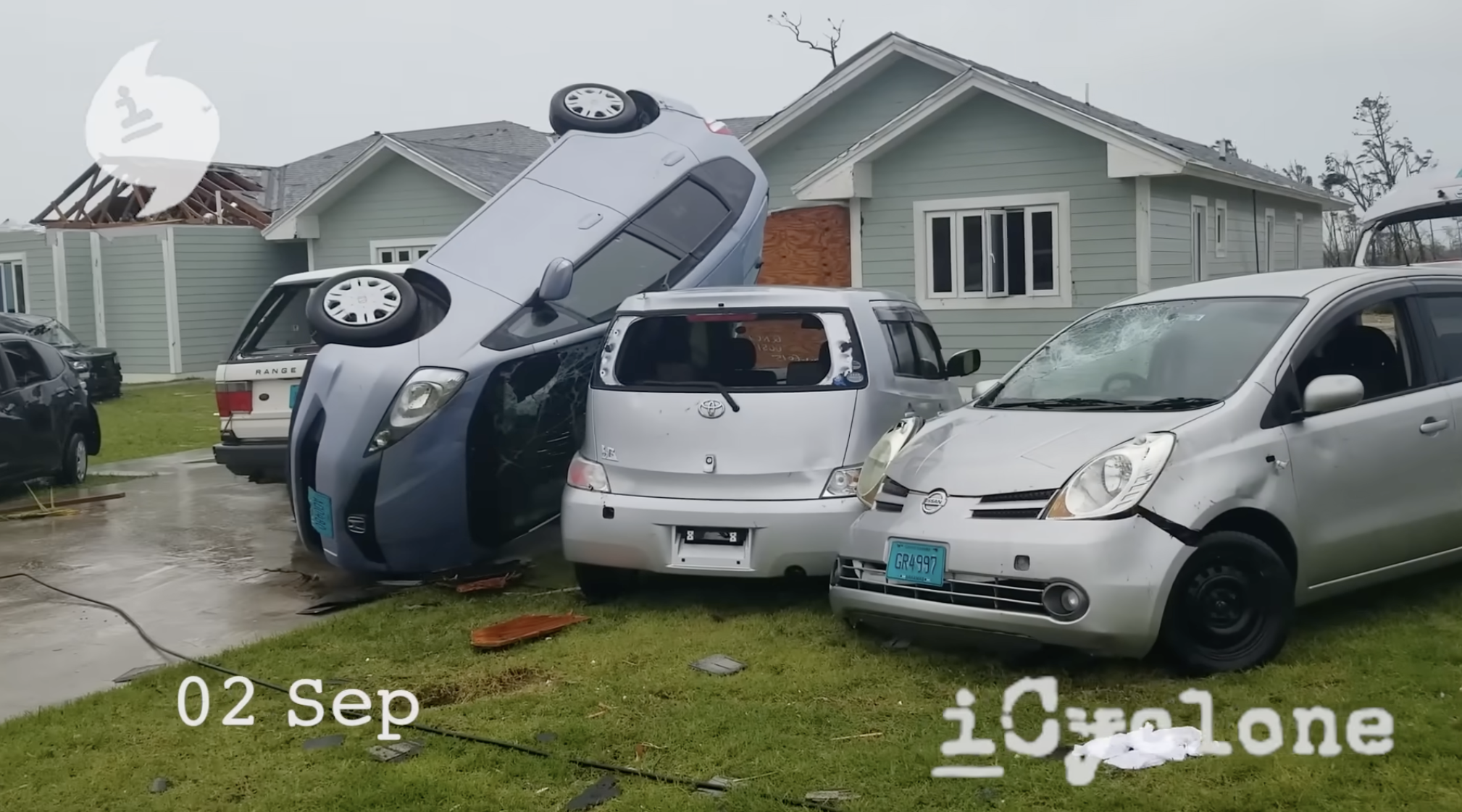
Worse, Dorian was extremely slow-moving, so even 48 hours after the hurricane's violent core struck the island, Marsh Harbour was still getting hammered by rain and tropical-storm-force winds. This delayed aerial damage surveys, which require clear skies, as well as the arrival of outside relief.
On the ground, things were spinning out of control. With many hundreds dead, missing, or injured, thousands displaced, no power or running water, and very little food, a humanitarian crisis was brewing.
But did the outside world even know? Did they understand the extent of it?
For me, the Dorian catastrophe really drove home the need for immediate impact assessments.
When an entire society is smashed beyond recognition, days later is not good enough. Governments, rescue crews, NGOs, and insurance companies need to know what happened now.
The answer is synthetic aperture radar—or SAR, for short.
It's a remote-sensing technique that uses pulses of microwave energy to create images of Earth's surface and the things on it, like buildings and infrastructure.
Using SAR beats traditional aerial damage surveys and ground teams for a bunch of reasons:
Faster. Aerial and optical satellite surveys use cameras that need daylight and clear skies. That means big delays in getting images when cloud cover lingers over the stricken region for days after impact, like it did with Dorian. ICEYE doesn't have this problem. Because it uses SAR technology, it can capture images anytime, through darkness and cloud cover. So, images are ready fast: just hours after impact, and continuously as the event evolves. This enables near-real-time impact assessment, which means faster response, faster funding, and faster relief for victims.
Better. Synthetic Aperture Radar imaging can be wide—able to capture a disaster's entire footprint over hundreds of square miles—yet also extremely detailed, showing inundation down to the inch and wind damage down to the individual building. These depictions aren't estimates or computer models; they're observed evidence of what happened. This combination of breadth and detail lets responders immediately know the range and severity of the impact, and where ground teams need to go first.
Cheaper. Aerial reconnaissance is pricey (often over $1,000 an hour) and dependent on conditions, time of day, and airspace. A global constellation of SAR satellites is always at the ready, which makes it more cost-effective.
Easier. For emergency responders, it’s best to use a SAR provider like ICEYE, because their data come as ready-to-use ArcGIS layers. That's the platform 95% of their clients already run! So, there's no new system to learn and no big, complicated ramp-up to start using it.
ICEYE launched its Hurricane Solution in March 2025, ahead of that year’s Atlantic hurricane season, to deliver wind and flood impact data for US landfalls within 24 hours. It pairs multiple radar-based products. Because radar sees through cloud and darkness, both work while skies are still overcast and aircraft are grounded.
Hurricane Rapid Impact compares satellite images taken before and after landfall to flag where the ground has changed, with results within 24 hours. One layer shows which neighborhoods were hit hardest; a finer 1.5 m layer resolves damage to individual buildings. After Hurricane Milton in 2024, it picked up the torn roof of Tropicana Field in St. Petersburg.
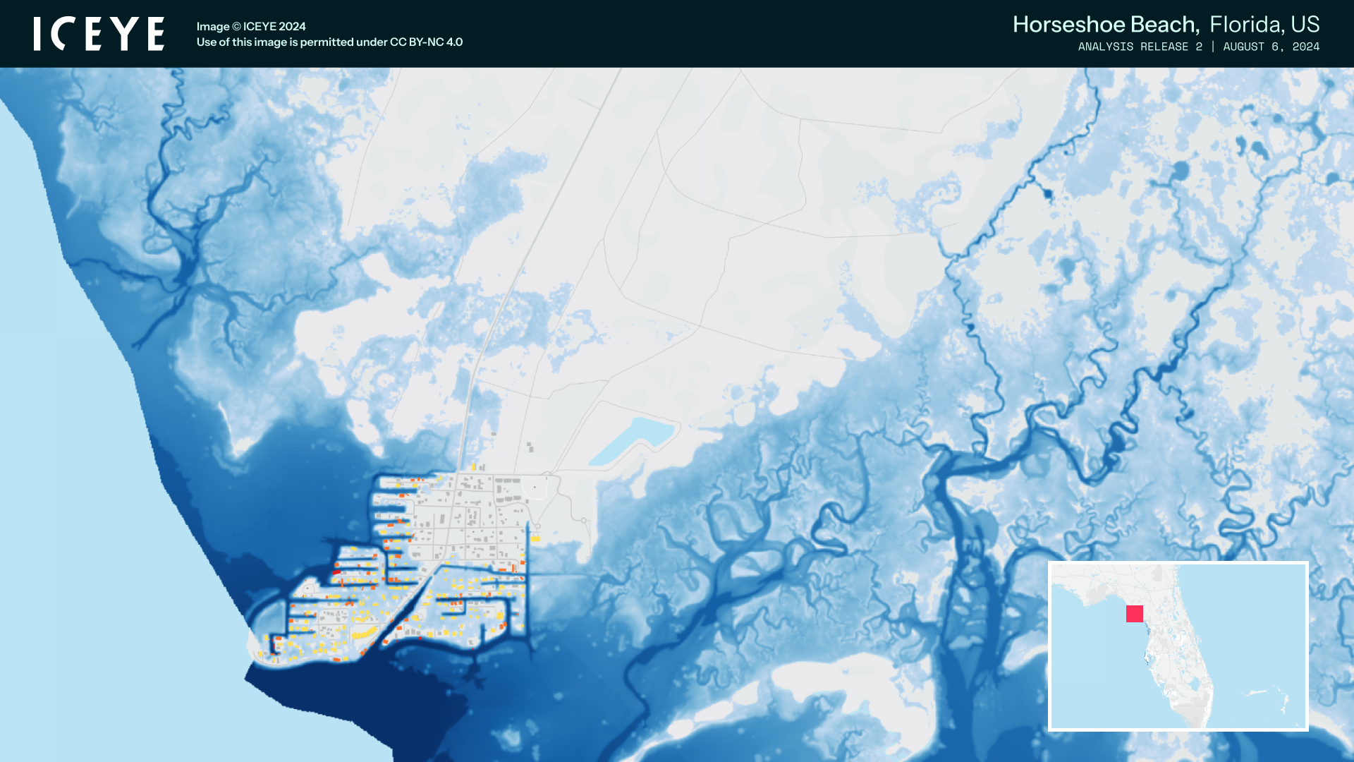
Flood Rapid Impact highlights flood extent every 6 hours, from pre-landfall until the water has receded—leveraging the full constellation and a machine-learning process to extract water within the imagery.
And Flood Insights maps the maximum flooding within 24 hours of its peak, showing how far the water reached and how deep it was at 4 m horizontal resolution, with updates as it spreads.
For emergency managers on the ground, that means knowing which roads are passable, which neighborhoods need search teams first, and where to stage supplies—all before a single survey flight can take off. After Dorian, Marsh Harbour waited days for that picture.
When I’m not chasing hurricanes, I’m on the speaking circuit, sharing what I’ve seen on the ground with emergency managers and insurance folks. My goal is to help them prepare for the big impacts that will inevitably come their way.
I often think about how differently Dorian could have played out with today’s tools. The storm’s core struck Great Abaco on September 1, 2019, and then it stalled. For days, clouds sat over the islands, survey aircraft couldn’t fly, and the phones were dead. The outside world was largely guessing.
With today’s SAR capabilities, a damage map of Marsh Harbour could have been in responders’ hands within about a day of landfall, while the rain was still falling. It would have shown, block by block, that the Mudd and the Pigeon Pea were gone, how deep the water ran, and which higher neighborhoods had lost roofs and walls. Search teams could have gone straight to the worst-hit areas. Relief organizations could have planned supply drops around what was actually still standing. And insurers could have started sizing losses days earlier, which gets money to people who need to rebuild sooner.
That’s the difference between responding to what you can see and responding to what actually happened.
Here are three things I’d encourage every emergency management and insurance team to take back to their organization:
I was blown away when I first saw what ICEYE can do, and what science now allows. Dorian taught me what it costs to wait for the clouds to clear. Responders shouldn’t have to anymore.
Additional resources:
Set up a demo of near-real time flooding here.
Reach out to Mike Bennett, Head of North America for Solutions, at michael.bennett@iceye.com or LinkedIn.
To follow me on my next hurricane journey, subscribe to iCyclone here on YouTube.
Case Study
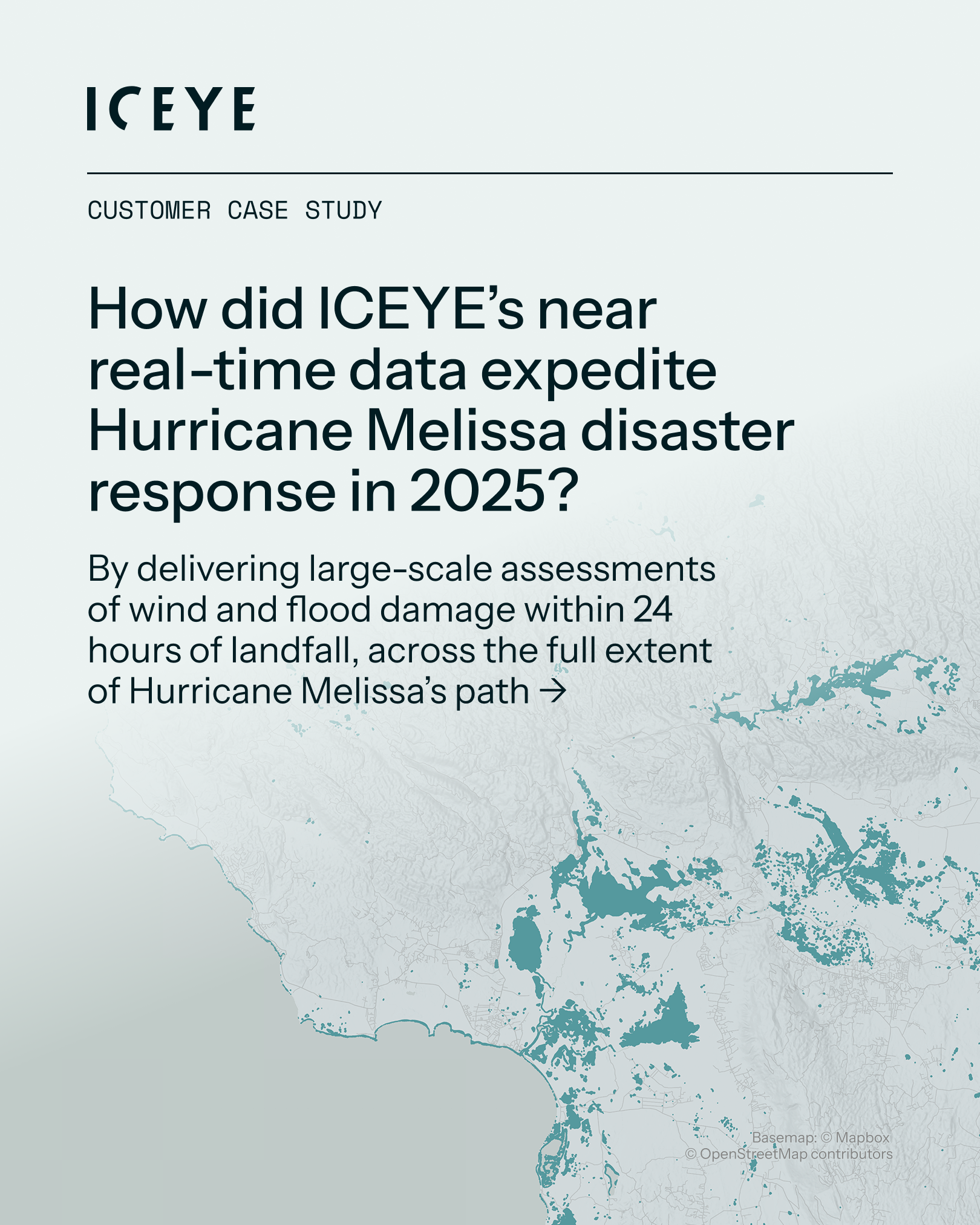
As Hurricane Melissa stalled over the Caribbean in late October 2025, relentless rainfall caused catastrophic flooding across Jamaica. In the wake of the storm, ICEYE made its Flood Rapid Impact data and Hurricane Rapid Impact freely available to government agencies and NGOs through Esri’s Disaster Response Program, helping response teams prioritize resources and protect lives.
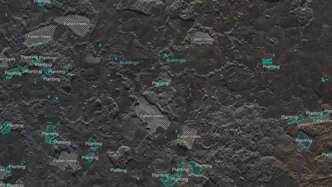
28 October 2026
02 October 2026
30 September 2026