Contact us
Get in touch with our experts to find out the possibilities daily truth data holds for your organization.

The need for satellite-based, near real-time target acquisition, area observation and event monitoring has always existed and has been growing fast in recent years. From tracking fast-moving objects like vessels in wide sea areas to assessing flood damage on land to monitoring movement during humanitarian crises, truly effective change detection requires persistent monitoring – day and night and even through the clouds.
ICEYE’s New Space approach and constellation of small and agile SAR satellites deliver unprecedented access to valuable data with their ability to produce everything from wide-scan images of areas up to 10,000 km² to detailed images with up to 25 cm resolution. ICEYE’s satellites are able to provide customers with strategic overviews and detailed information on literally any location on Earth, multiple times per day.
This is the first in a series of blogs focusing on how ICEYE manages persistent monitoring by delivering the capacity, performance and flexibility needed to detect and observe activities and changes anywhere in the world.
The continuous monitoring of areas around the globe enables the detection and analysis of fast and slow changes to the environment and human activity. The ability to identify changes early enables fast accurate situational assessment and response.
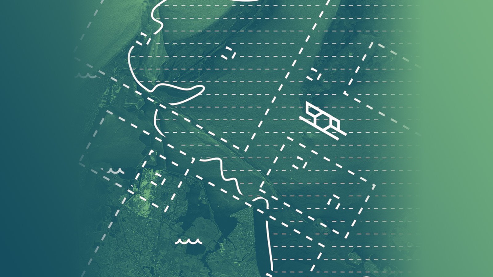
The Earth’s surface is continuously changing. Tracking and observing these changes is crucial to understanding the nature of events, predicting future events, and assessing the need for action. To do that effectively, a satellite-based persistent monitoring approach is needed. One that can be rapidly activated, flexibly maneuvered and that is able to provide the right kind of information at the right time.
ICEYE’s new approach to quickly deploying small high-performance radar satellites helps deliver a time series of reliable images taken every few hours, making it easy to detect changes, identify differences and track ongoing actions almost in real-time – day and night and in any weather.
This is an essential capability that enables a wide range of time-critical applications and services for a wide range of customers. For example, it supports sea ice and iceberg monitoring that is critical to the shipping industry, promotes vessel detection and border control for security and intelligence, and helps detect and monitor expanding oil spills and enable emergency responses. And as ICEYE continues to develop and provide this service to a growing number of customers, new and never-before-seen use cases can be expected in the future as well.
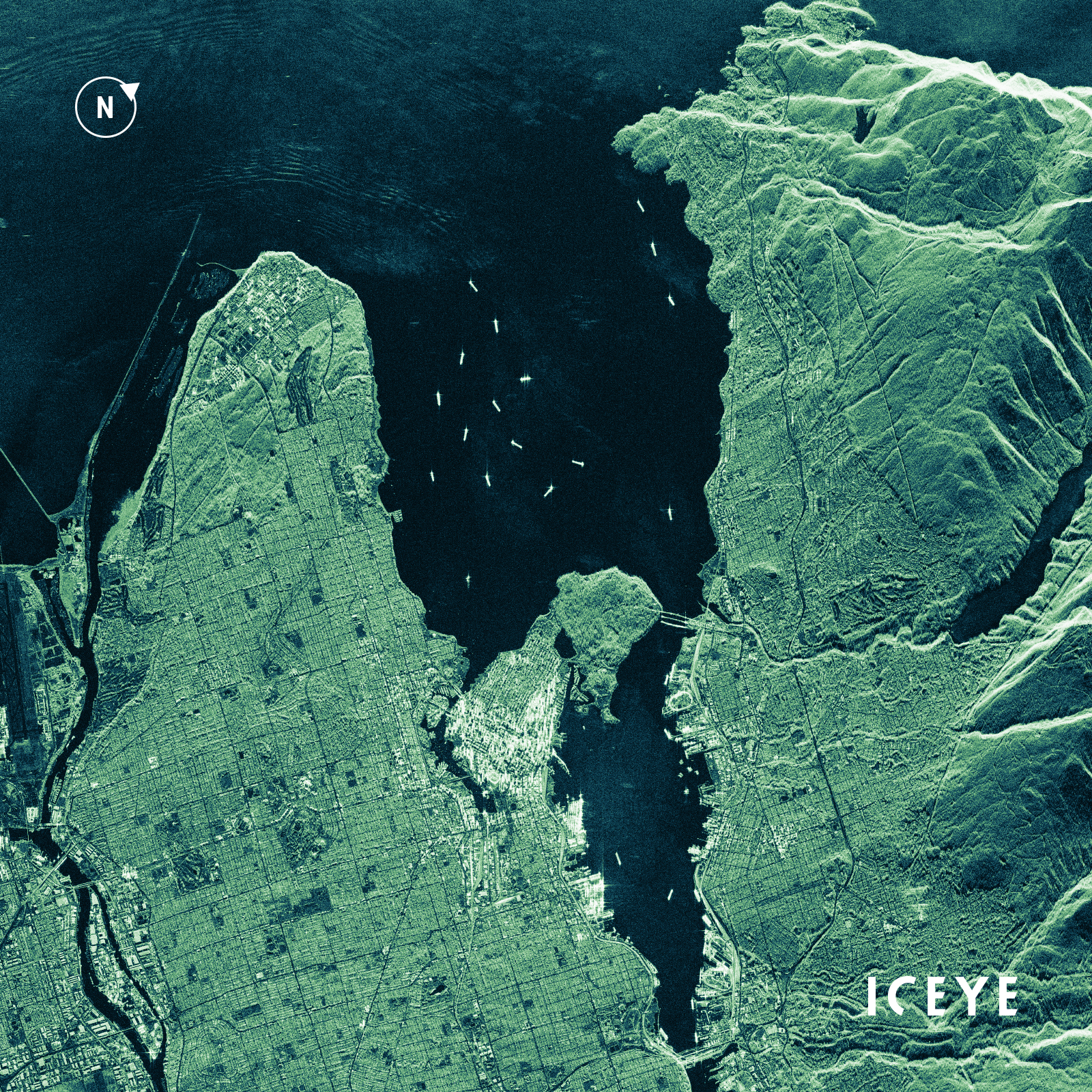
Figure 1. ICEYE Strip SAR image showing the City of Vancouver, Canada, with vessel traffic in Burrard Inlet and Port of Vancouver Harbor during the night.
ICEYE's optimized SAR satellite system is a game changer in the market. It is the world’s first system to perform persistent monitoring that delivers truly valuable information and meets the requirements of the most demanding use cases.
It enables the definition of optimal image resolution, area coverage and monitoring frequency depending on the changes to be observed and allows the customer to respond to location changes over the course of an observation.
Fast data acquisition can only be achieved by a large number of agile satellites that can be tasked quickly, with the capability to capture images in different look directions and switch between different image modes. This guarantees that there is always a satellite near an area of interest that can capture the requested image without delay.
Satellite image modes offer different spatial resolutions, which are connected to the size of the area captured in one acquisition. When a single target or object is under observation, very high-resolution images are requested, typically covering an area of only a few kilometers around the target. When observing large areas, coverage is key and lower spatial image resolution is sufficient.
When it comes to monitoring areas, the revisit rate, meaning how often images can be taken over the same area, is critical. Different activities or situations have different needs, sometimes up to multiple acquisitions a day.
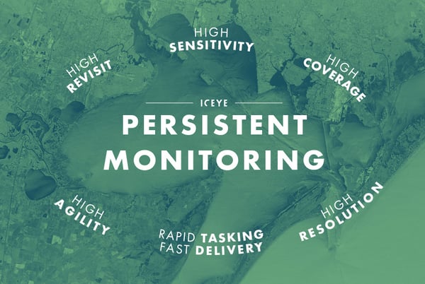
Figure 2. ICEYE’s suitability for persistent monitoring through the advanced combination of key capabilities.
ICEYE’s satellites collect SAR data in three different imaging modes: Spot, Strip, and Scan mode. These modes comprise different spatial resolutions from very high to high-resolution offering coverages between 5 km x 5 km and 100 km x 100 km. The latter can be even extended up to a 400 km image length on request. The satellites are capable of switching image modes quickly and provide different resolutions and coverages even in areas with multiple clustered locations.
ICEYE is the only New Space SAR satellite company offering Scan mode imagery for wide area monitoring.
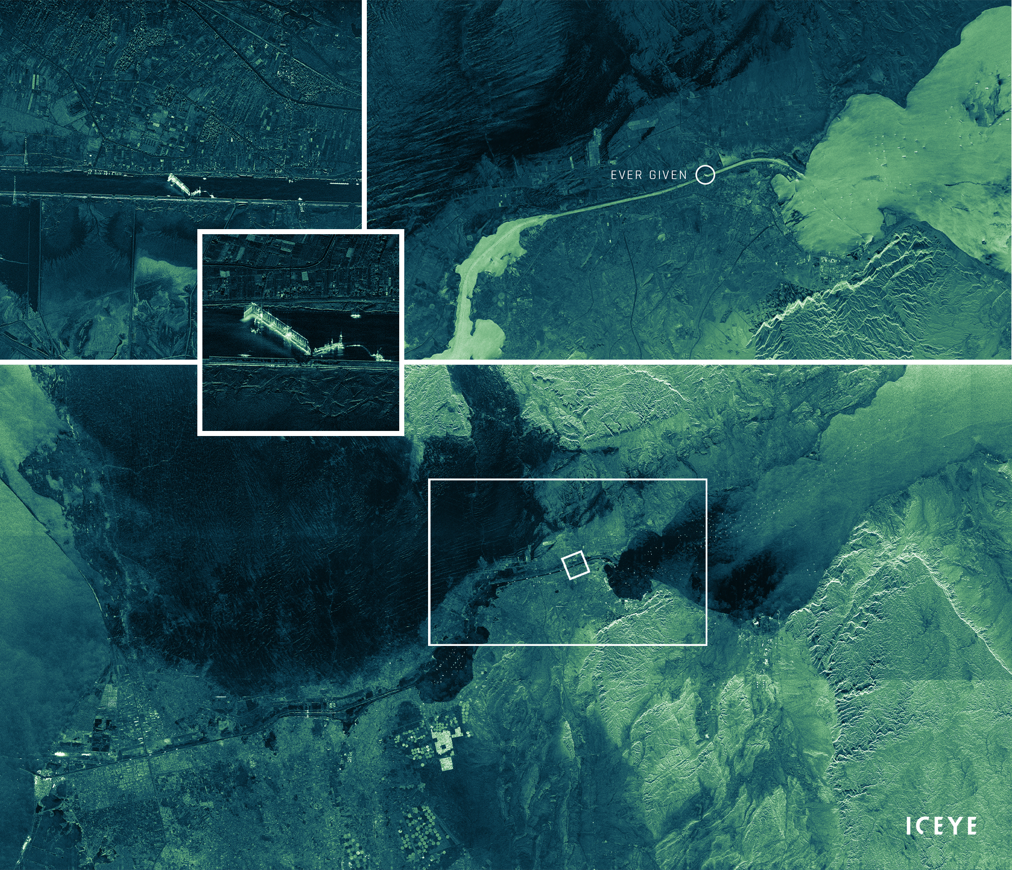
Figure 3. Suez Canal around the time of the obstruction by a container ship in March 2021, captured with ICEYE satellites in various resolutions and coverages: Spot mode (taken at night, upper left, with zoom in), Strip mode (upper right, showing the position of the container ship), and Scan mode (bottom) mode. The dimensions of the Spot and Strip coverages are shown in the Scan image.
ICEYE’s large and constantly growing constellation of agile satellites is designed to rapidly revisit any area in the world multiple times a day. There are two ways of monitoring an area: images are captured with varying look angles or with exactly the same image geometry, in the so-called ground track repeat operation.
Ground track repeat is best suited to interferometric processing and coherence change detection. Coherence change detection is extremely sensitive to changes and has the potential to identify and monitor differences within the range of millimeters.
The ICEYE constellation has already demonstrated interferometric capabilities, and in the future daily coherent imaging is no longer an impossibility.
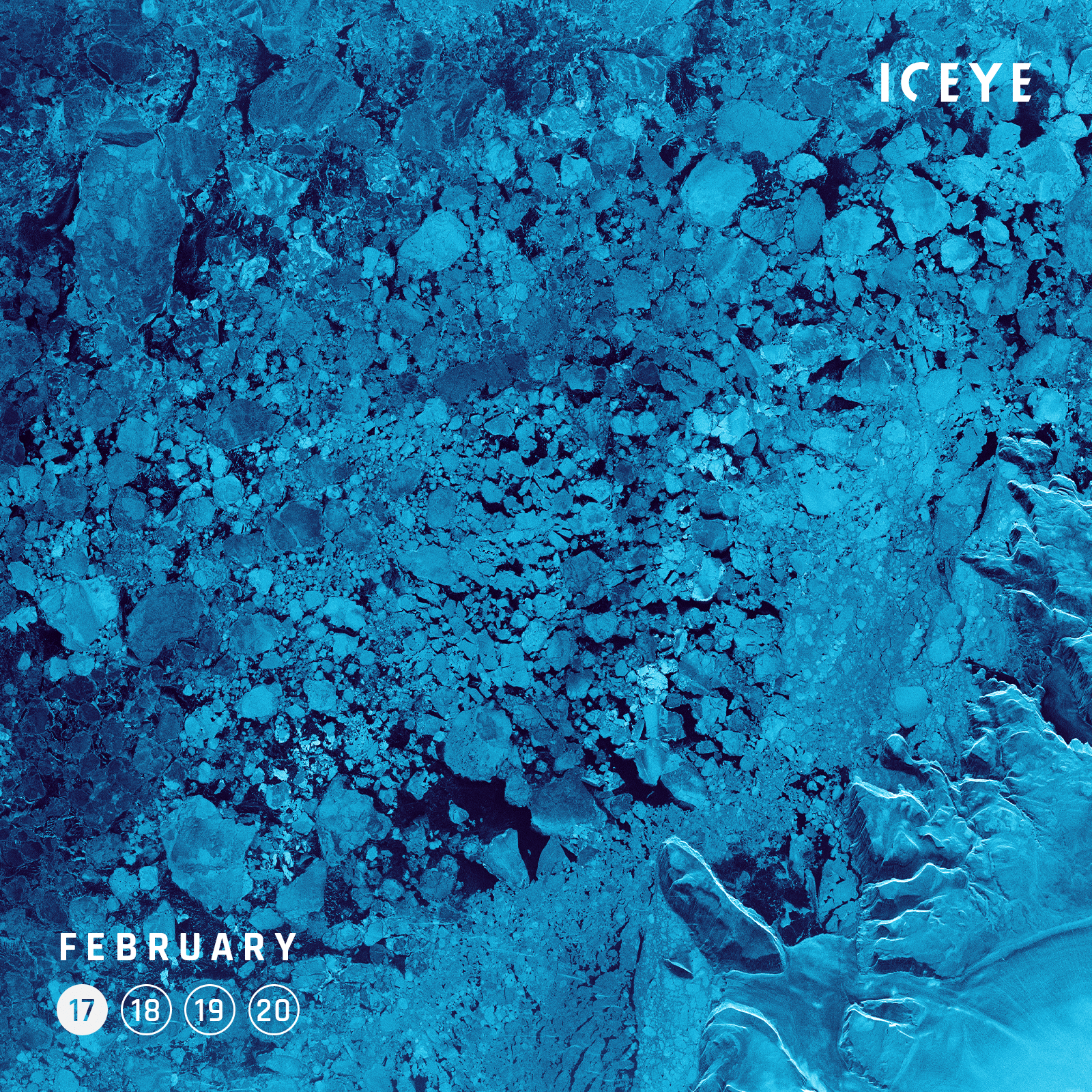
Figure 4. ICEYE monitoring of floating sea ice in the Nares Strait on four consecutive days in 2021 over an area of 1500 km2.
ICEYE's goal is to optimize persistent monitoring and continue to increase access to valuable satellite data. Ultimately, we are building the infrastructure, technology and model for a new era in the availability of data and information. And we are arming our partners and customers to take action and make critical decisions when it matters most.
Explore the quality of the unique scan mode imagery for high revisit, wide area monitoring:
Download 


03 June 2026

23 January 2026

06 November 2025