Contact us
Get in touch with our experts to find out the possibilities daily truth data holds for your organization.


For most of its history, ICEYE has answered one question for the insurance industry: what is happening. A flood recedes, a wildfire moves through a region, a hurricane makes landfall, and within hours ICEYE's satellites deliver a picture of the damage that adjusters and underwriters can act on immediately.
That question is still central to the business. But over the past year, in conversations with insurers, reinsurers, and governments, a second question has started to matter just as much: what is about to happen.
Both questions have the same owner. The claims director deciding where to send field adjusters. The underwriter deciding whether to implement a moratorium. The loss modeler being asked for a cost number before the claims have arrived. Each of them is making a call in the first days of an event, when the information is worst, and the cost of being wrong is highest.
Assessing the probability and severity of events over years and decades is a job cat models do well, and will keep doing.
But a cat model cannot tell an insurer what is happening to their portfolio right now. It was never built to. It answers a question about the loss exceedance probability in the next year, and in a catastrophe situation the questions are about the actual loss, right now, not modeled loss.
That gap is where the cost sits. In the first days of an event, a carrier chooses between a modeled estimate and an early claims picture, and both are different and incomplete pictures. The model does not know which buildings actually flooded, and may not even have a simulation in the area in the catalog. A specific event forecast takes longer to release and still has uncertainty in the footprint. Claims data only reflects customers who have already notified, and those may not be the worst affected.
Direct observation closes the gap. Instead of estimating what might have happened, a carrier can see what did happen and size losses against that information. The two are complementary, not competing, and the industry's own move toward pairing model output with real-time observation reflects that.
For years, ICEYE's flood product has told insurers where water is and how deep it is during a flood, based on direct satellite observation.
Extent is the easy part. Depth decides whether a claim is a dehumidifier or a substantial restoration, and property-level depth is the data point almost nobody has.
ICEYE's acquisition of Flood ID changes that. By combining physics-based flood modeling with weather forecasting and ICEYE's own archive of past events, the goal is to tell a customer in advance where flooding will occur and how deep it will get, at high resolution.
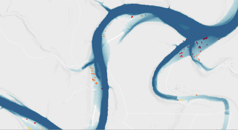 Pictured above: A flood map from Texas Hill Country.
That archive is crucial. When calibrated with thousands of observed events and known depths at specific addresses, it becomes a different tool. One that provides observation where the industry has never had it: before the event.
The decision that unlocks is a different kind of decision. Having this data during a longer event and ahead of a location flooding unlocks the potential to actually work on mitigation. At a minimum, it allows preparedness. An insurer with a four-day warning can secure adjuster and contractor capacity before the market prices it as scarce. Time to first field visit, cost per inspection, claims cycle time: all of them are decided before the first claim is filed, by people who currently have to guess.
The plan is to extend this predictive capability across other perils and other geographies over time, rather than keep it limited to flood.
The value of real-time observation depends entirely on resolution. Knowing that a neighborhood was affected by wildfire is useful. Knowing which specific buildings were destroyed is what makes a meaningful parametric insurance product possible. Observing the change actually proves the loss.
That is the basis of Liberty Mutual's new parametric wildfire solution, built on ICEYE's ability to detect building-level destruction using synthetic aperture radar, which works day or night and through smoke that would blind an optical satellite.
The same building-level change detection extends beyond wildfire and beyond the US and Australia, wherever a parametric product needs a trigger that can withstand scrutiny.
Resolution like that depends on the constellation behind it. ICEYE's satellites can task an image and downlink it within a single orbital pass, and each generation sees more detail than the last, which is what makes building-level detection possible at all.
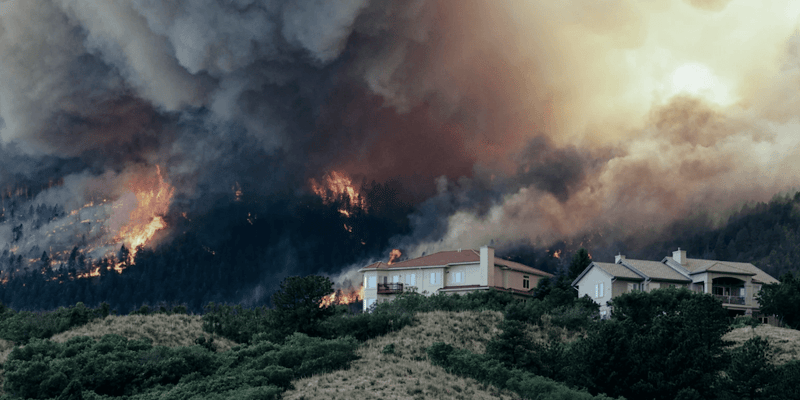 Pictured above: A wildfire spreads through Colorado, US, destroying homes.
Once a primary insurer has real-time visibility into how an event affects its own book, a reinsurer has a reason to want the same visibility. A reinsurance relationship depends on both parties sharing an understanding of exposure and loss. Speeding up this information flow allows quicker settlement of reinsurance recoveries, faster and more accurate reserving, and, ideally, a better data basis for negotiations for next year’s coverage.
That is why reinsurance interest in this kind of data has grown alongside interest from primary carriers. Reinsurers are starting to look at portfolio-level accumulation and individual-carrier impact using the same near-real-time observations carriers use to manage their own retentions.
Every piece of this - prediction, partnership, resolution, scale - points in the same direction: from responding to individual events toward persistent monitoring and reporting of risk and impact on individual assets. These are powerful new capabilities, powered by new space technology and deep data science, that opens use cases across lines of business well beyond catastrophe response.
The next step is not a bigger version of what ICEYE already does. It is a different question answered with the same infrastructure, moving from what happened to what is about to happen to what is happening to a specific asset right now, continuously.
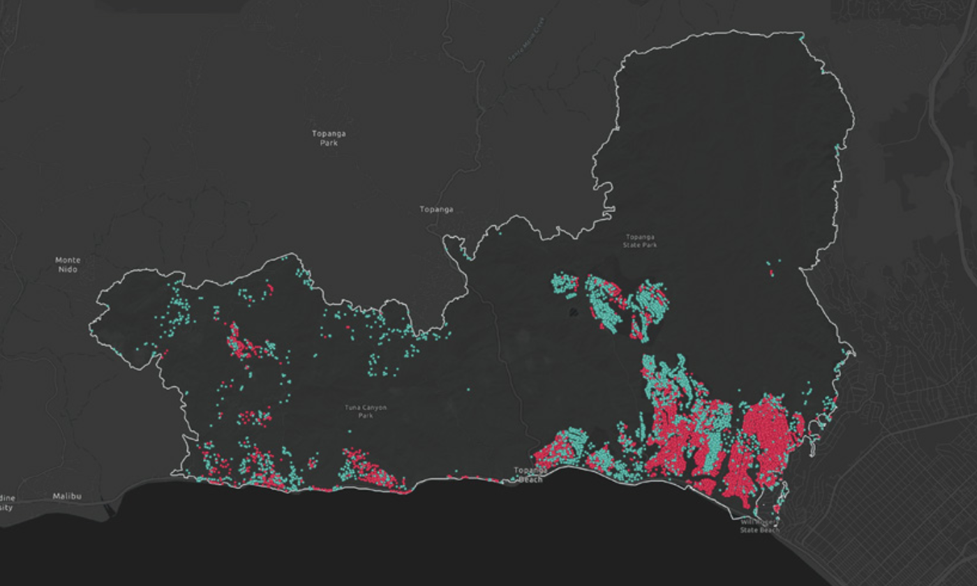
LA Fire Briefing
See damage assessments across 37,000+ total analyzed acres.
03 September 2026
14 May 2026
18 March 2026