Contact us
Get in touch with our experts to find out the possibilities daily truth data holds for your organization.


Deforestation alerts tell you where forest has been lost. They rarely tell you why, and they say almost nothing about who is responsible. For an enforcement agency, that is the gap that matters. A forest-loss polygon is a lead, not a case. Before anyone commits a team to a remote site, they need to know whether they are looking at a licensed concession, a smallholder clearing, or a mining operation with equipment on site.
Over the past year ICEYE has been building a deforestation monitoring capability to answer that second question with radar. Internally we call it the drill down.
It runs as a complement to our existing deforestation monitoring service.
The first stage is wide-area monitoring. The customer's area of interest is imaged on a fixed cycle, weekly or twice weekly depending on the deployment, powered by ICEYE’s Stripmap imaging mode. Change detection on that time series flags forest loss and produces alert polygons. Because SAR supplies its own illumination and X-band signals pass through cloud and smoke, the cadence holds through the wet season. This is the deforestation product customers use today.
The second stage is targeted characterisation with on-demand tasking from customers. Alert locations, along with other cues from customer operations, are used to task Dwell collections. In Dwell mode the satellite stares at a single location for an extended period, which lets us combine many looks of the same scene. The result is an image with far less speckle than a standard spotlight acquisition. Scenes read much closer to a black and white photograph, and objects on the scale of only a couple meters become readily discernible. Combined with ICEYE’s detections, an analyst without a radar background can interpret them with limited training, which matters for enforcement teams that do not have SAR specialists on staff.
ICEYE’s detection model runs over each Dwell scenes and flags objects of interest for analyst review: the presence of buildings, mining, cultivation, and airstrips.
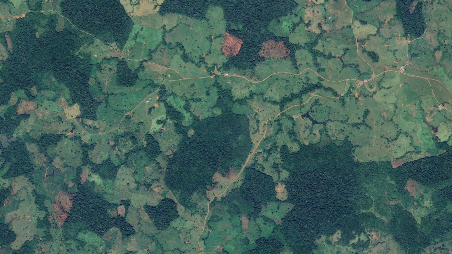
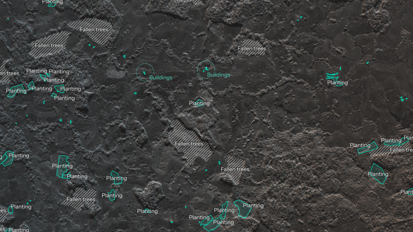
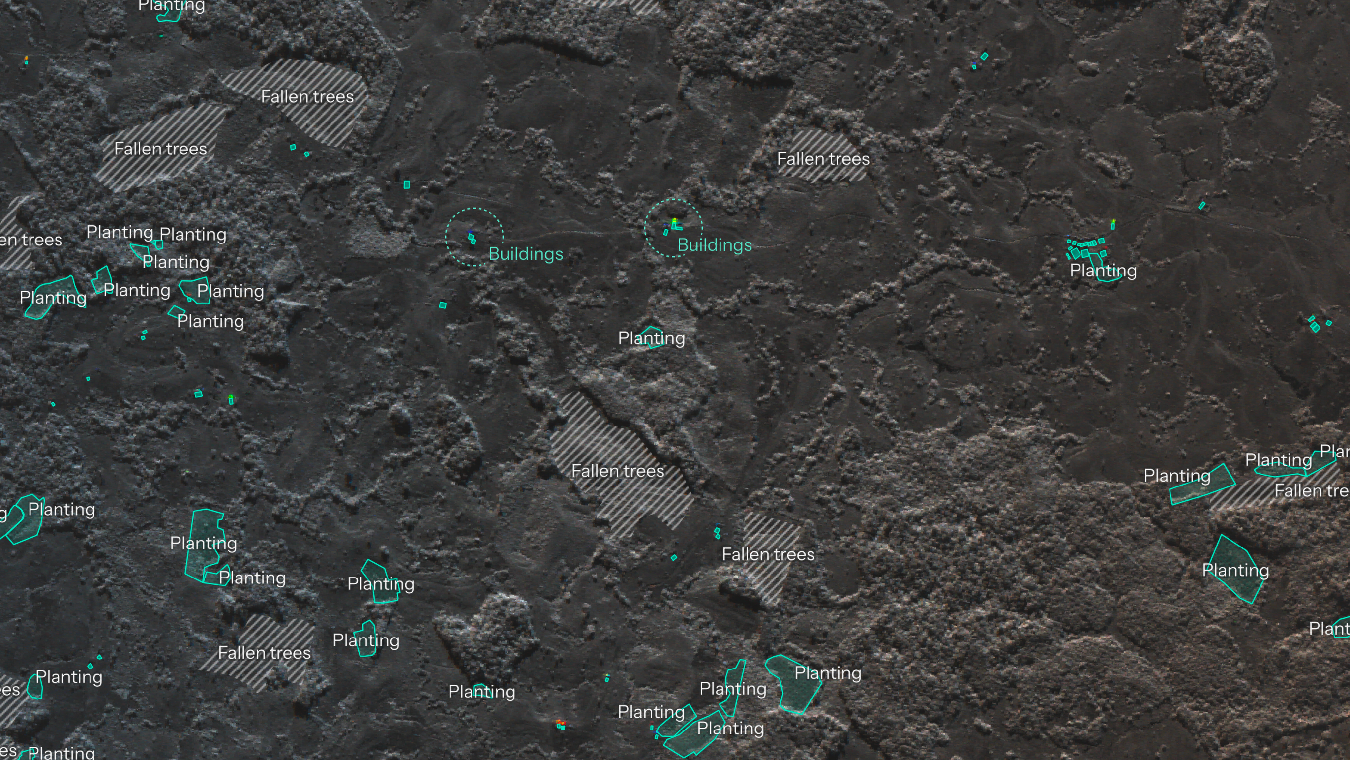
The wide-area alert flags small, recent clearings inside standing forest. At that resolution, a clearing is just a clearing.
At Dwell resolution the internal structure becomes visible. Intact canopy scatters radar energy in many directions and appears bright and textured. Cleared ground is smoother and darker. Felled trunks lying on the ground show up as bright linear debris. Cultivation plots stand out through their geometry: straight edges, consistent spacing, and row structure that does not occur in natural treefall.
In one recent scene, we identified plots inside standing forest next to small structures and next to areas of very recent felling. Fresh felling adjacent to active plots and buildings is a reasonable indicator of where the next expansion will happen. That gives an agency a view of where an operation is heading, not only a record of where it has already been.
Whether a clearing warrants follow-up depends on context the imagery does not carry, such as protected-area boundaries, land tenure, and access routes. That determination sits with the authority. Dwell drill down empowers those authorities with additional information while saving the time and resources to visit a site.
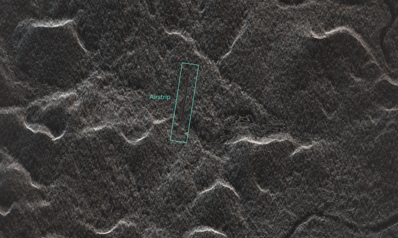
Clandestine airstrips move fuel, equipment and people into remote operations, and product out.
In radar they are distinctive. A cleared, graded strip is a smooth surface and appears as a dark, straight, elongated feature cut through bright, textured canopy. The forest edges on either side cast radar shadow and produce bright returns, which sharpen the outline. Dimensions fall in a fairly narrow range set by what light aircraft need, which helps separate a strip from roads or linear clearings.
Dwell imagery adds detail on condition and use: whether the surface is maintained or overgrown, structures or aircraft at either end, and tracks linking the strip to rivers or nearby clearings. Repeat collections show whether a strip is active, through fresh grading, extension, or the absence of regrowth.
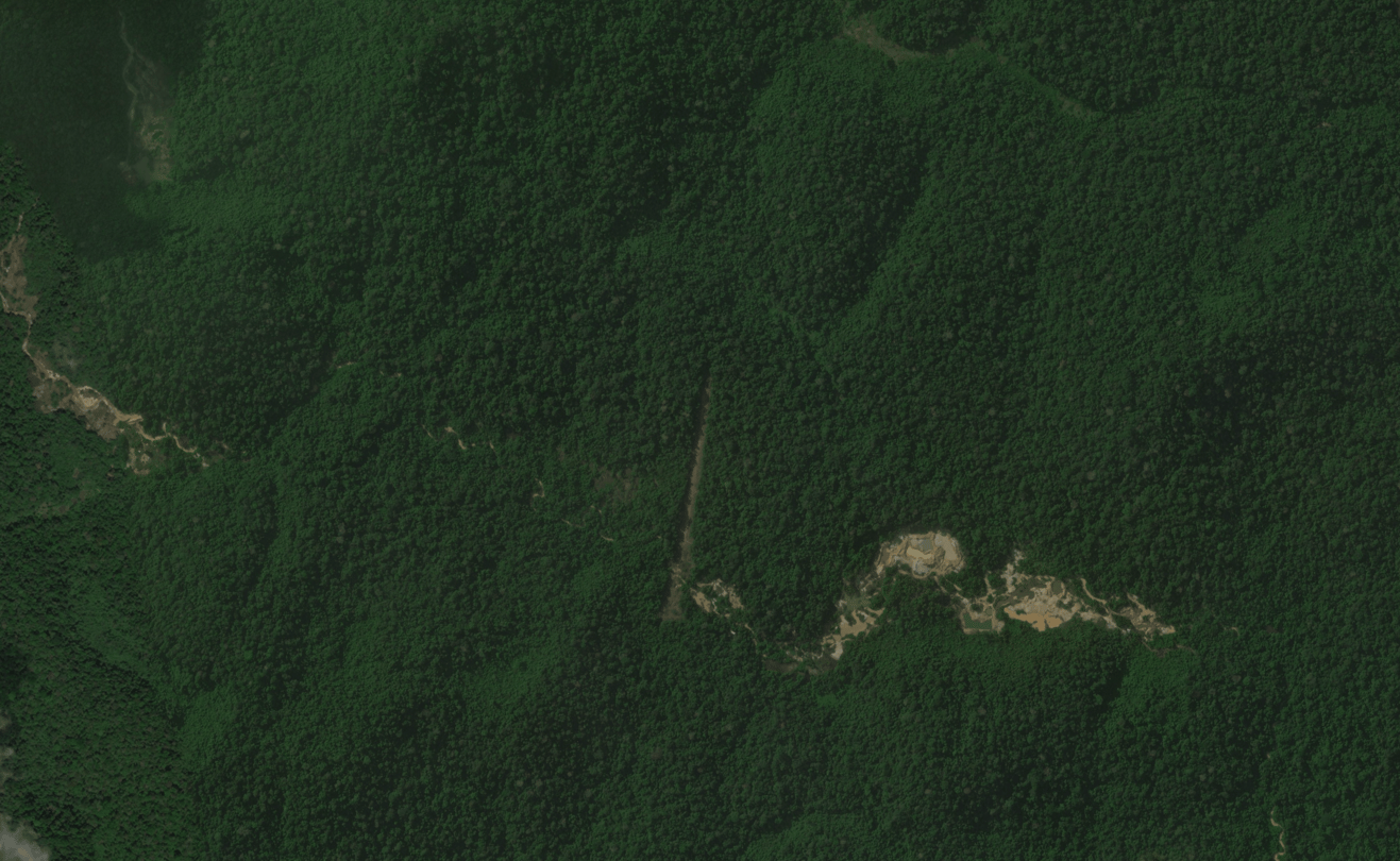
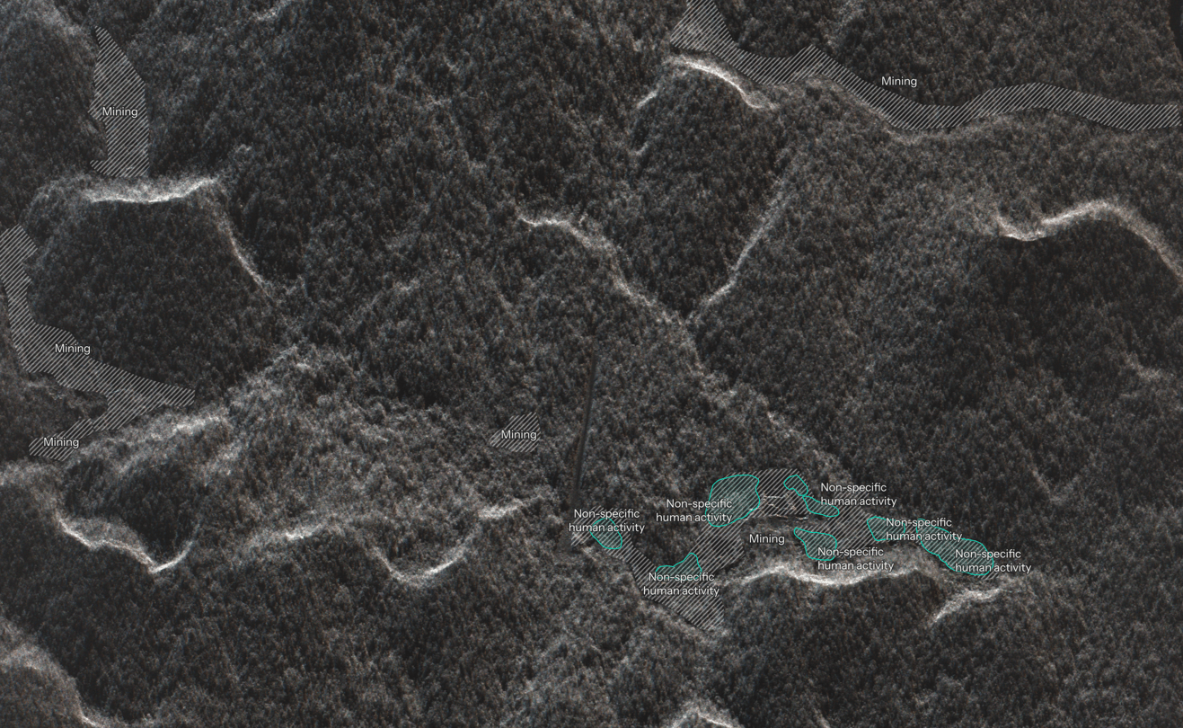
Land-based alluvial mining strips vegetation and topsoil, then excavates pits that quickly fill with water. In radar, this produces a recognisable pattern. Standing water in the pits is smooth and appears dark. Spoil heaps and churned ground around them are rough and appear bright. The result is a cluster of irregular dark ponds set in bright, disturbed ground, typically along a stream or river terrace, with a hard edge against the surrounding canopy.
The site in Case 2 is a good example of what continuous monitoring adds once a mine is under way. Each wide-area acquisition registers new clearing at the edges of the site, and each Dwell collection shows where new pits have been opened and where ground is being prepared next. Over a series of weeks, that becomes a measured record of the footprint expanding: how fast, in which direction, and toward what, whether that is a protected-area boundary, a watercourse, or a community.
For an enforcement agency, that record answers two questions at once. It shows whether a site is active right now, which affects whether an intervention is worthwhile. And it documents the extent and growth of the damage over time, which supports reporting and any later legal process.
ICEYE operates the world's largest commercial SAR constellation. We use it to train SAR foundation models: models pretrained on large volumes of unlabelled radar imagery so they learn its general structure, then adapted to specific tasks. The practical effect is that adding a new target, a different vessel type or a new clearing pattern, needs far fewer labelled examples than training a detector from scratch. It becomes a fine-tuning exercise rather than a new development programme. It means that our analytics can adapt to the users' needs as they evolve, tackling new challenges in new environments.
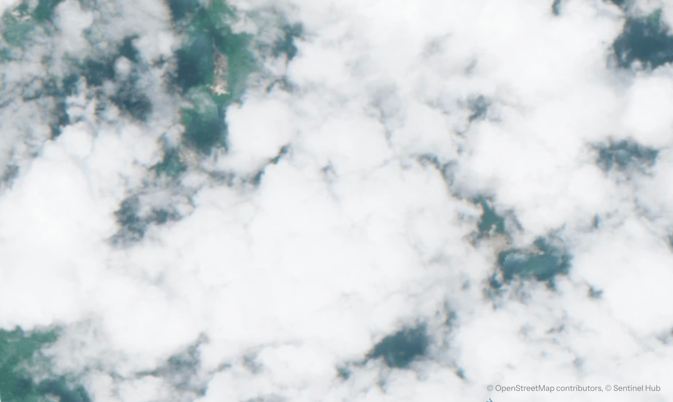
Optical alert systems work well when skies are clear. The difficulty is the wet season, when clouds cover much of the Amazon and can persist for weeks. An airstrip can be built and whole operations can come and go in that time window.
Radar coverage on a fixed cadence closes that gap. When an alert comes in, a high-resolution collection can be tasked over it, so the time between seeing a change and understanding what caused it is measured in days rather than seasons.
Technical note: SAR measures structure and surface: shape, size, arrangement, roughness, moisture, and the presence of metal. It does not record colour, and it cannot reliably identify plant species from a single image. The interpretations below therefore rest on geometry, persistence over time, and context. Each one is an observation that can inform the planning of an enforcement action or support reporting afterwards; it is not, on its own, a legal finding.
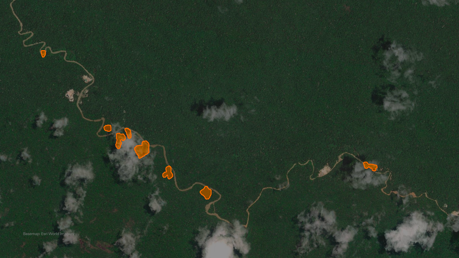
02 October 2026
30 September 2026

24 September 2026