Contact us
Get in touch with our experts to find out the possibilities daily truth data holds for your organization.


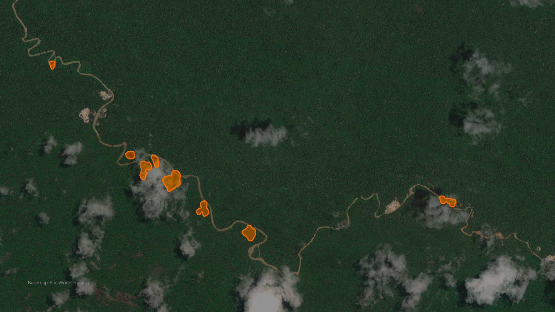
Clarity when it matters most: an observation you can trust and act on, even when cloud, rain, or darkness would stop other tools cold. Here’s what buyers in enforcement and conservation need to know.
Tropical deforestation happens fastest exactly where it’s hardest to see. The Amazon, the Congo Basin, and the forests of Southeast Asia sit under some of the most persistent cloud cover on the planet, and during rainy seasons, optical satellites can go weeks without a clean image.
Only half the problem is solved by free radar-based alert layers and daily optical constellations. Open source radar can see through cloud cover, but typically at a resolution built for broad-area screening rather than the level of detail a team can act on directly. Optical imagery offers finer detail, but only when skies cooperate, which in the tropics is often exactly when it’s needed least.
ICEYE’s Deforestation Solution is built to close that gap by combining the best of both: all-weather, day-and-night acquisition, paired with resolution fine enough to actually act on.
Here’s what we will cover.
Let’s start with the basics.
In 2024, the tropics lost 6.7 million hectares of primary rainforest, according to Global Forest Watch, the fastest rate ever recorded, equivalent to about 18 soccer fields disappearing every minute. 2025 brought a welcome slowdown, but the loss is still measured in millions of hectares, concentrated overwhelmingly in the same tropical, cloud-heavy regions that are hardest to watch consistently from space.
Meeting a problem at that scale means broadening the toolset. Enforcement and conservation teams have historically relied on high-resolution optical imagery, for good reason, but optical alone leaves real gaps during exactly the cloud cover, rainy seasons, night, when illegal activity tends to accelerate. At the same time, advances in radar and AI-driven processing are closing the gap between raw satellite data and a decision a team can actually make, provided that translation reaches the end user in a usable form rather than staying locked in a technical format.
ICEYE built its Deforestation Solution around that shift. It’s a SAR-based monitoring service for customer-defined AOIs, designed so that whenever an observation comes in, whatever the weather or time of day, it carries enough information to make a real decision.
The tropical forest regions where deforestation is most urgent, the Amazon Basin, the Congo Basin, and the Southeast Asian archipelago, are also among the most persistently cloud-covered places on Earth. Optical sensors need a clear line of sight, so during rainy seasons, critical deforestation events can go undetected for weeks at a time.
Free, radar-based alert layers already exist and have meaningfully narrowed this gap. Built on open Sentinel-1 data, they typically offer around 10-meter imagery across the pan-tropics on a six-to-twelve day cycle, valuable for flagging that something changed across a broad area. A single pass at that resolution rarely gives a team evidence to act on directly, though, which is part of why these systems often need several acquisitions stacked over time before a detection becomes confident.
Optical constellations, meanwhile, can revisit daily on paper, but a clear-on-paper pass during peak wet season often isn’t a clean one, which is why cloud-free composites are themselves marketed as a value-add rather than assumed. Cumulative, cloud-gapped records also lack the timing precision to say exactly when clearing happened, which matters for enforcement response, and alerts without verifiable, unobstructed imagery behind them carry less weight in litigation and can undercut the credibility of the reporting built on top of them.
If a team needs higher-resolution, faster-to-confirm intelligence and doesn’t have in-house capacity to process and validate raw satellite signal, that’s the specific gap this service is built to close.
SAR is a fundamentally different imaging format from the optical photos most people are used to reading, and interpreting raw radar returns has traditionally required specialized remote sensing training. ICEYE’s job isn’t just to collect that signal, it’s to translate it. The deforestation polygons and paired changelook imagery exist specifically so a field officer, program manager, or analyst, not a radar scientist, can open a delivery and understand what happened, where, and when.
That translation is only as good as what the underlying signal can do. ICEYE’s satellites carry active synthetic aperture radar sensors, meaning they generate their own signal rather than relying on reflected sunlight. That gives the constellation two capabilities optical systems structurally cannot match in this use case:
What sets ICEYE’s commercial SAR apart from free, open radar sources is resolution. Free radar-based alerts are typically built on Sentinel-1 imagery at around 10 meters, useful for flagging broad-scale disturbance, but a single Sentinel-1 pass rarely gives a team evidence to act on directly, often requiring several acquisitions stacked over time before a detection is confident. ICEYE’s changelook product is delivered at 5m resolution, clear enough that a single acquisition can be visually interrogated on its own. That’s the gap we’re closing with optical, not matching it pixel for pixel, but delivering imagery precise enough, on one all-weather pass, to actually act on.
Each observation cycle produces a structured delivery package:
Everything arrives as GIS-ready GeoPackage and GeoTIFF files, in a standard coordinate system, so it drops directly into a customer’s existing tools.
Access is built to be just as simple. ICEYE’s Solutions Suite file delivery API makes each cycle’s deliverables available as soon as they’re processed, filterable by date, AOI, or file type, with select partner platforms like Esri also supported for teams that would rather not integrate directly.
The Deforestation Solution is built for tropical forest environments, the cloud belt spanning the Amazon Basin, the Congo Basin, and the Southeast Asian archipelago, where rainy-season cloud cover does the most damage to conventional monitoring. Onboarding in tropical forest regions outside these focus areas is assessed case by case, with an initial feasibility review before launch. AOIs today range from targeted, high-risk zones up to regional scale, with coverage expanding as the program matures.
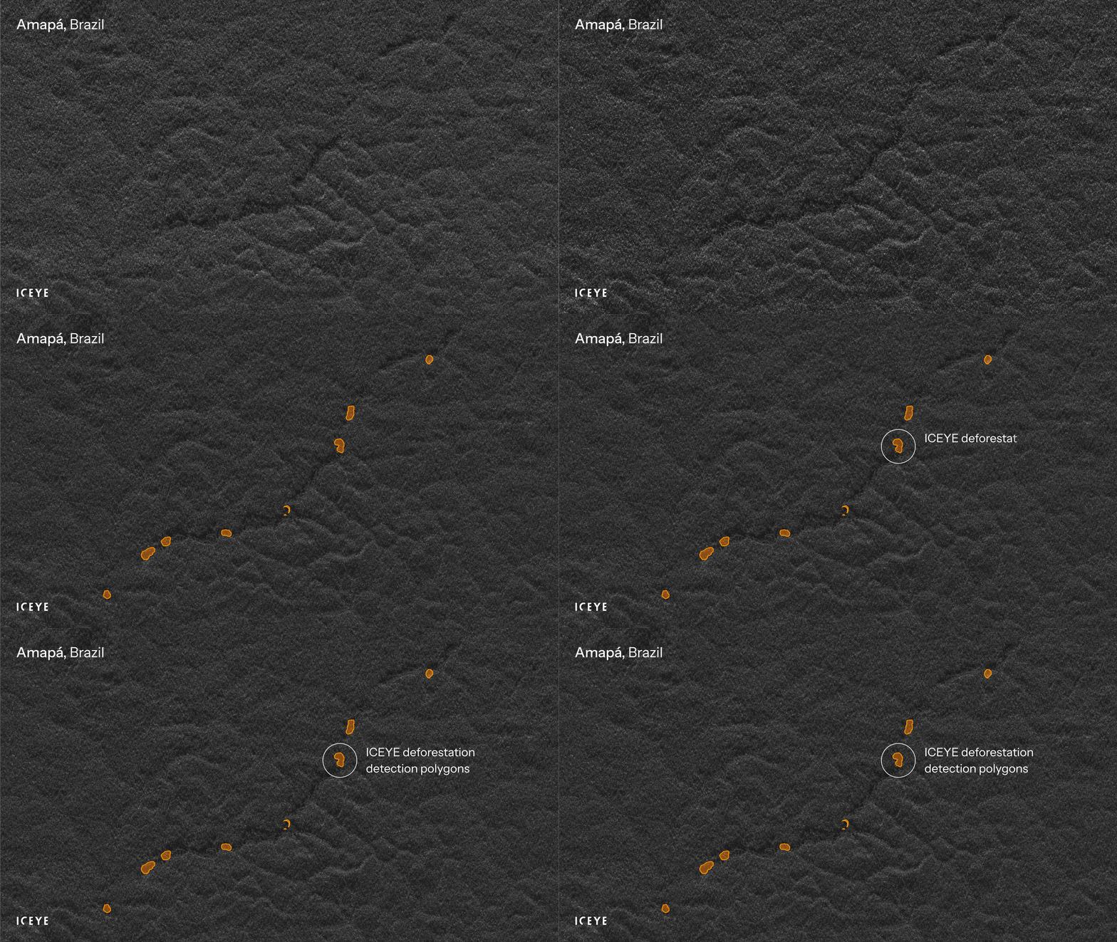
How often will you actually see your AOI? Cadence is calibrated to how a customer prioritizes their monitoring needs and to constellation capacity, rather than a fixed, one-size-fits-all number, and that’s by design. Working with ICEYE, customers can direct capacity toward the specific places and moments that matter most. In one monitoring program over a site in Amapá, Brazil, that meant 14 separate incremental observations in about a month, roughly one every two to three days.
What’s consistent every time: every acquisition is an unobstructed read of the area of interest, backed by imagery a customer can zoom into and inspect directly. Confirmed deforestation is flagged at a one-hectare threshold, a deliberately conservative bar that keeps the signal reliable, and every delivery states plainly what was and wasn’t observed that cycle.
Illegal mining and logging move fast, and a broad-area alert without a defensible account of timing and location doesn’t help much when it’s time to decide where to send a team or to document what happened.
The Deforestation Solution supports that work in a few concrete ways:
No satellite detection replaces an investigation on its own. What the Deforestation Solution provides is a rigorous, independently reviewable starting point, precise enough in timing and imagery to focus where an investigation looks next, and to complement whatever broader screening tools a team already uses to know where to look in the first place.
The Deforestation Solution supports the diverse needs of conservation organizations, helping them:
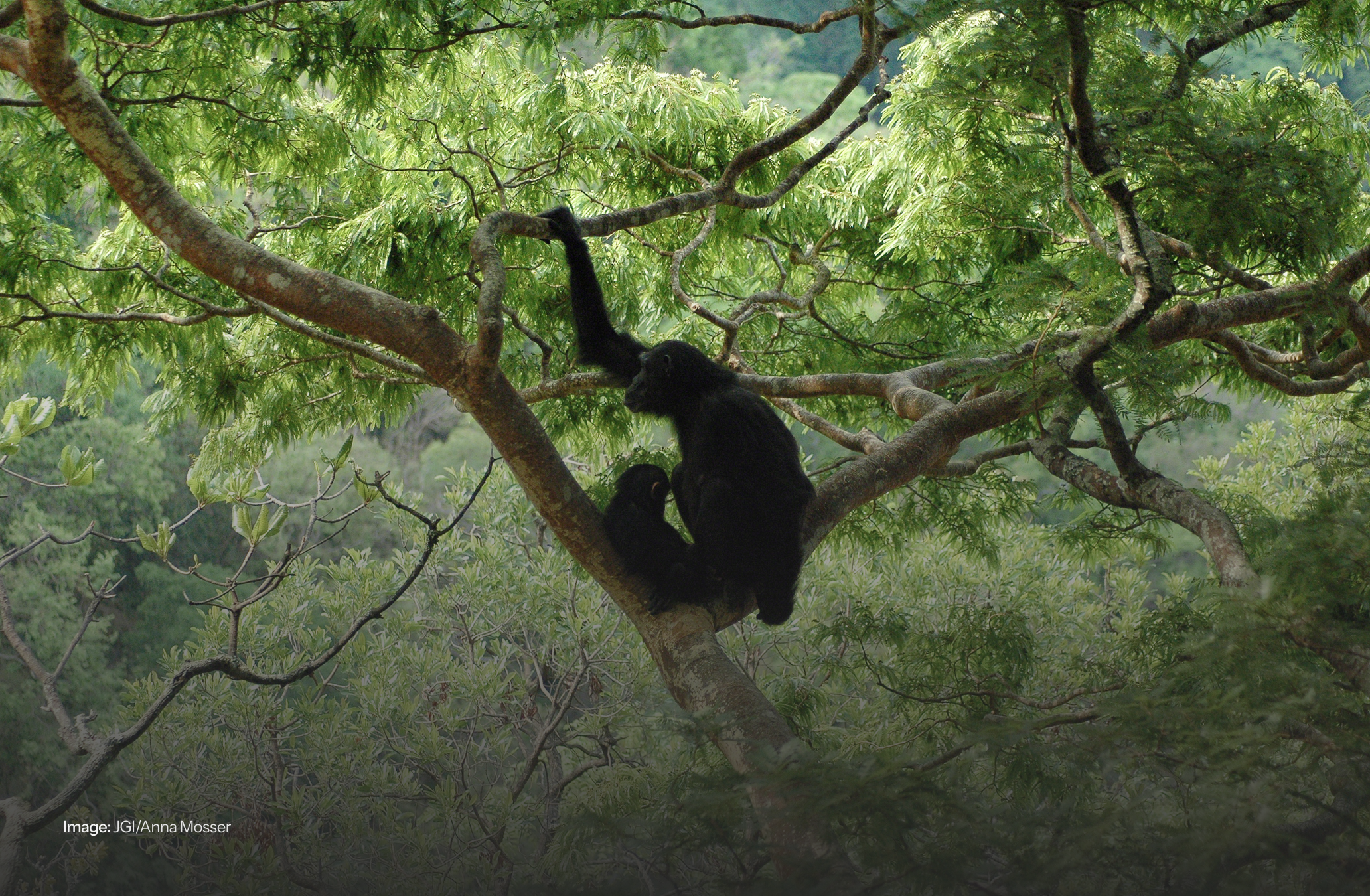
ICEYE’s partnership with the Jane Goodall Institute (JGI) is a live example. The Deforestation Solution is monitoring conservation corridors across the Congo Basin, giving JGI’s field teams near real-time situational awareness for patrol planning and resource allocation. As Dr. Lilian Pintea, JGI’s VP of Conservation Science, put it: “We can now see through the clouds to provide near-real-time insights for vital ecosystems, enabling our conservation partners with actionable information of unprecedented precision.”
Across enforcement and conservation alike, the value is the same: less ambiguity about what’s happening on the ground, clear enough to build a plan, a report, or a case around.
Today’s deforestation detection is deliberately all-cause: it flags a clearing whether it comes from mining, logging, settlement expansion, or something else, without requiring a customer to already know what to look for. Some customers want to go a layer deeper, not just confirming that clearing happened, but understanding exactly what’s driving it, since that detail is often the difference between a flag on a map and a plan of action.
That’s what ICEYE’s Dwell capability is built for. Dwell is a persistent-stare SAR imaging mode, and ICEYE is developing a new capability on top of it, Deforestation Drill Down, designed to help teams move from confirming that something changed to understanding exactly what it is: spotting early signs of illegal infrastructure like access roads and clearings, and sharpening how prioritization and field deployments get planned.
Would you like to know more?
Get in touch with our Solutions Team to see how the Deforestation Solution could fit into your monitoring strategy.

25 June 2026