Contact us
Get in touch with our experts to find out the possibilities daily truth data holds for your organization.

Use cases
Rapidly react to and respond to marine oil spills and oil seeps in coastal waters and vast sea areas far from the shore.

Eric Jensen, CEO / ICEYE US
Oil spills caused by vessels are difficult to detect, especially ones below 7 tons. These small oil spills may represent up to 80% of the total amount globally, and they are very harmful to the environment. A quick, reliable, and cost-efficient method of detection is needed.
With actionable SAR data of oil spills provided to you within a few hours of acquisition, you can identify the source rapidly, take mitigation actions, and possibly file claims against the maritime polluters in your area.
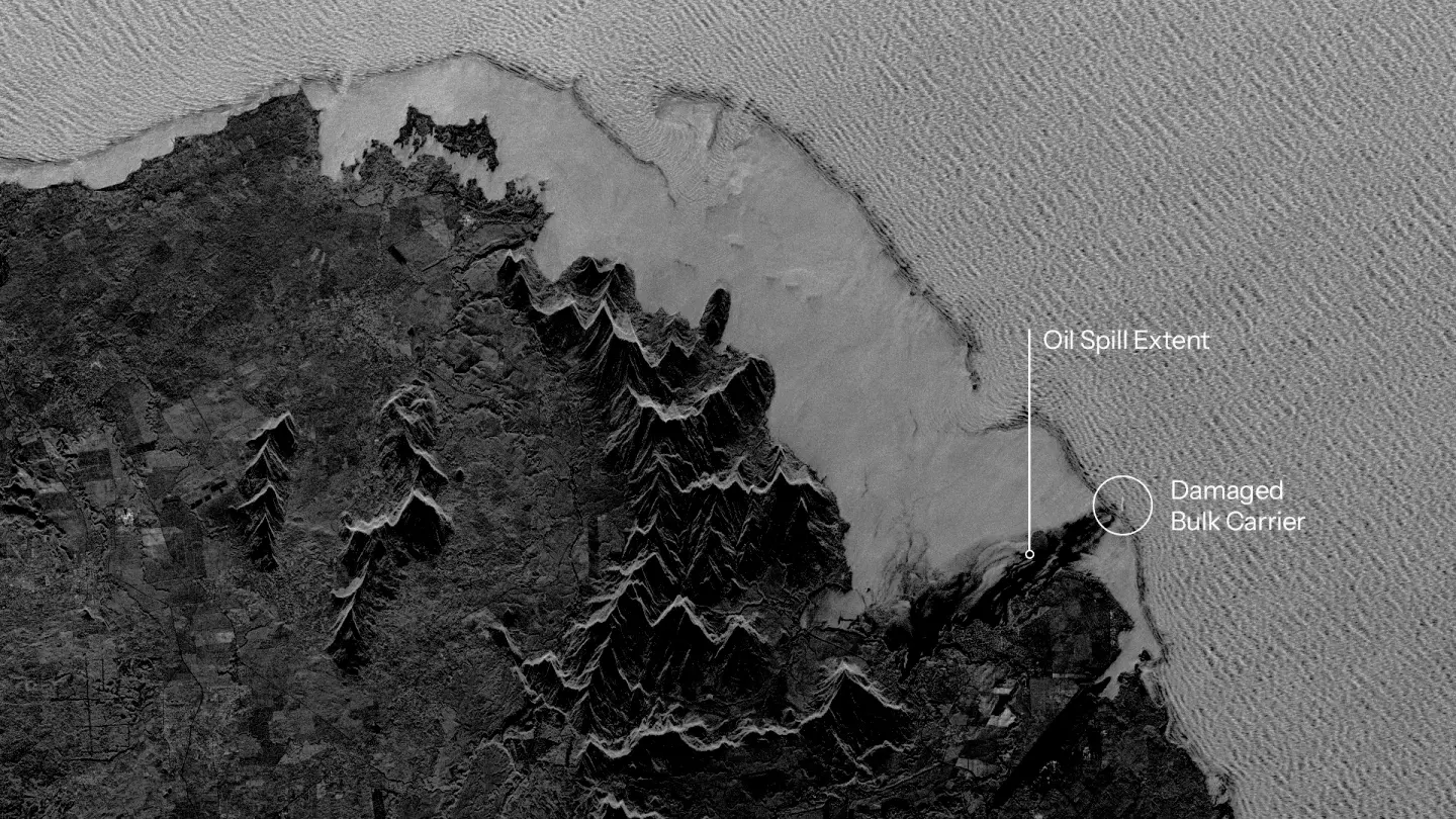
An oil spill caused by a bulk carrier that hit a coral reef off the coast of Mauritius. See the progression of the oil over 5 days. The dark parts of the water suggest oil.
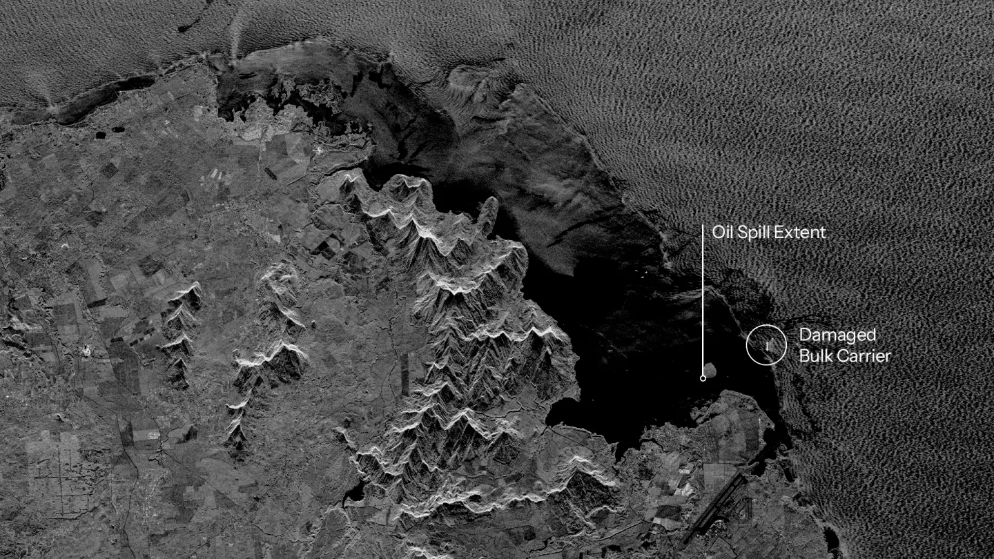
An oil spill caused by a bulk carrier that hit a coral reef off the coast of Mauritius. See the progression of the oil over 5 days. The dark parts of the water suggest oil.
Large oil spills can cause severe damage to your national waters and ecosystems. To plan and execute an effective response, you need to know the extent of the oil spill and be able to track its movement in near real-time.
ICEYE enables wide-area monitoring with the world’s largest SAR satellite constellation. You can monitor coastlines and entire sea routes from coast to coast and counteract oil spills faster and more efficiently to minimize the harm both to the environment and the economy.
Offshore oil rigs are located far from the coast, making it very difficult to detect environmentally harmful oil spills caused by drilling operations
Using SAR data from ICEYE, you can persistently monitor drilling platforms and verify reports to detect any oil spills immediately, determine their extent, and respond rapidly to limit environmental damage.
Download our Application Study to learn how to use ICEYE SAR data to identify vessels responsible for oil spills, detect and monitor spill expansion, and prevent and respond more efficiently.
Know what is happening at your borders and beyond.
Watch strategic sites and detect changes.
Oversee forests and identify activities.
Detect suspicious maritime activities.