Contact us
Get in touch with our experts to find out the possibilities daily truth data holds for your organization.

Use cases
Get actionable intelligence on any activities in your waters of interest.
Eric Jensen, CEO / ICEYE US
Monitoring specific sea routes or maritime areas is crucial for security. However, as these locations are often vast, they are difficult to cover using conventional techniques. Coastal radars have a limited range, and clouds and darkness make it even more difficult to obtain imagery with optical instruments. Additionally, not all satellite systems can provide a sufficient frequency of monitoring for maximum situational awareness.
ICEYE’s SAR satellites can capture an area of up to 50,000 km2 in a single satellite image. You can monitor even entire sea routes anywhere on Earth, up to multiple times a day, regardless of darkness or cloud cover. Persistent monitoring enables you to detect and react to any maritime activity that poses a threat to border security or commerce.
See example dark vessels
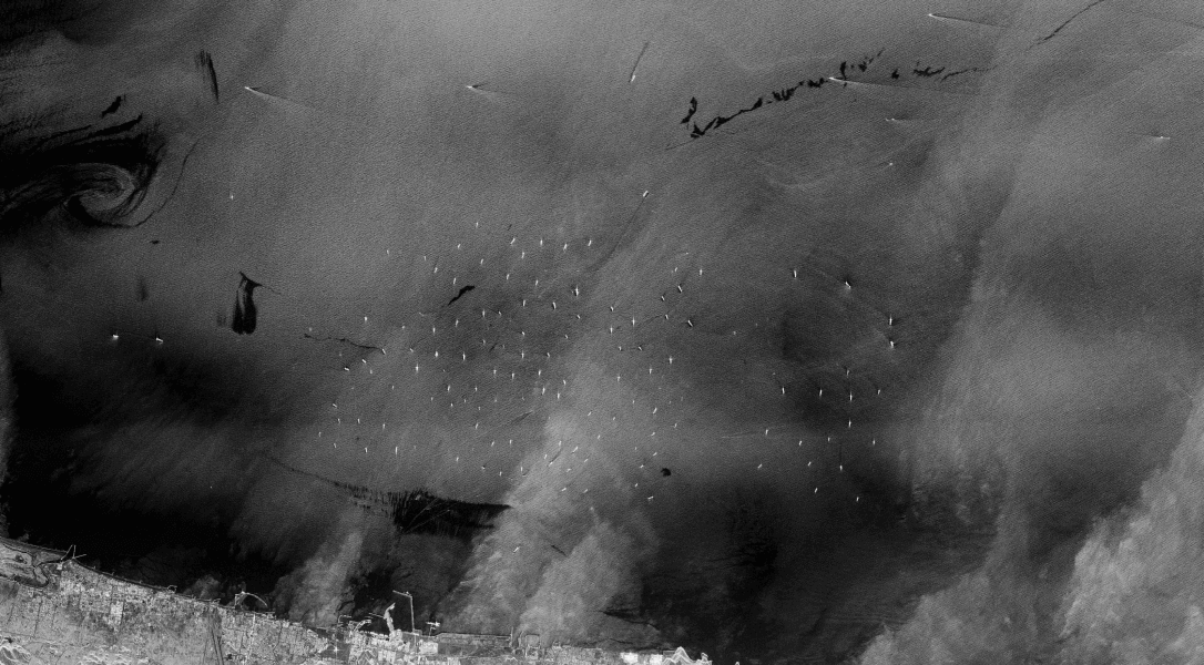
When the automatic identification system (AIS) and ICEYE SAR satellite data are combined, dark and collaborative vessels can be detected. The annotated vessels have been detected via SAR but were not visible to AIS receivers. See the demo here.
To counteract potential security threats, smuggling, illegal immigration, and unregistered fishing, you need timely insights about dark vessels entering your territory and Exclusive Economic Zone (EEZ).
With ICEYE’s SAR satellite constellation, you can persistently monitor coastal and open waters and identify vessels by matching them with external AIS signals. You can locate and track ships, identify their destinations based on their maneuvering patterns, and take immediate action if required.
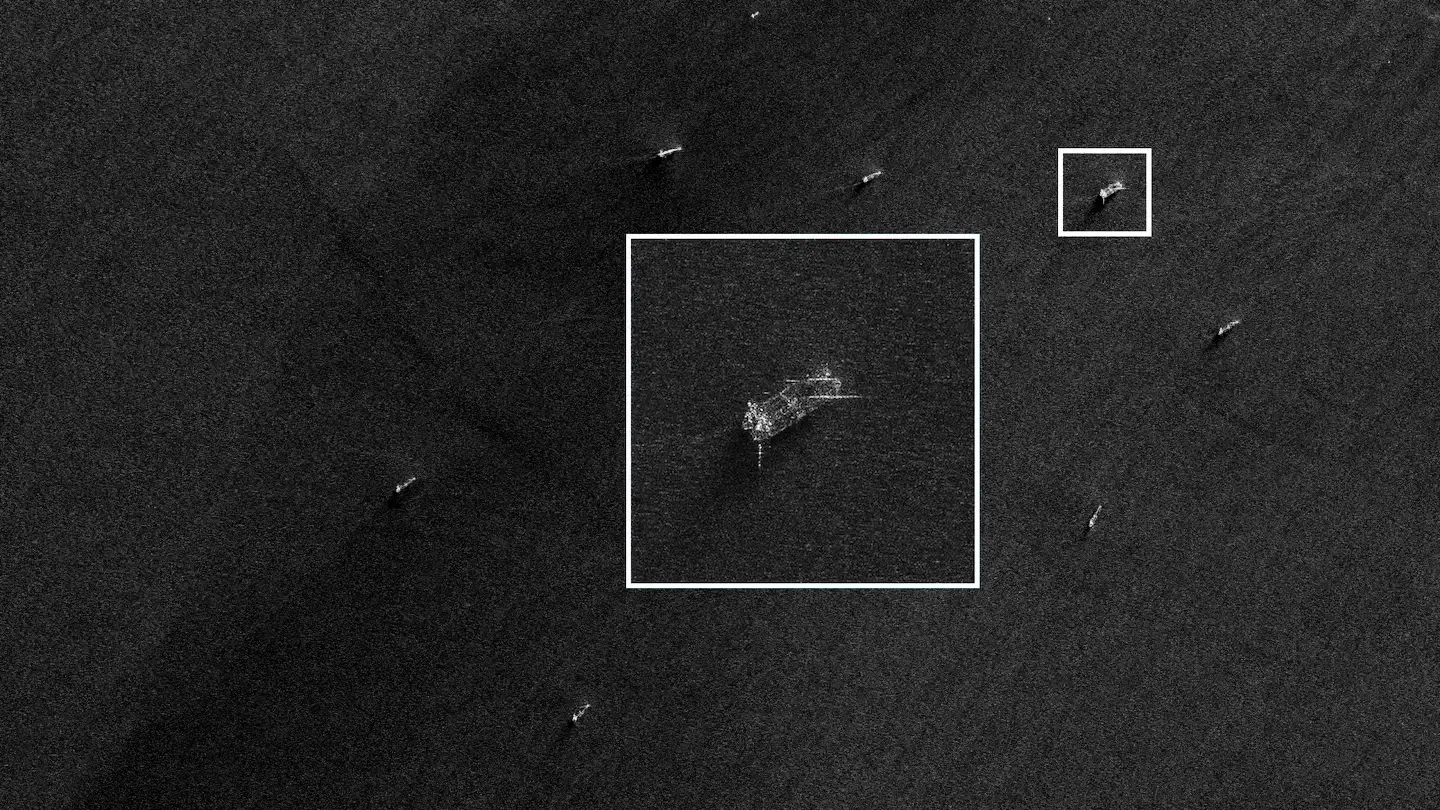
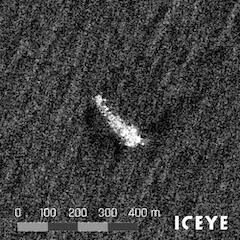
Tankers involved in illegal oil trading typically switch off their identification devices to avoid being tracked and to conceal the origin of the oil. It is common to transfer oil secretly from one tanker to another at open sea. Illegal activities of this kind are highly difficult to detect using conventional methods, but SAR satellite monitoring by ICEYE enables rapid and accurate detection. See a SAR image of two oil tankers in a ship-to-ship formation in the Persian Gulf.
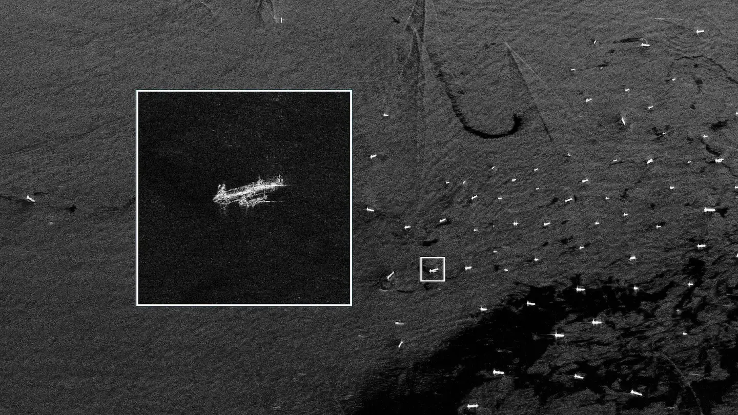
Smuggled goods are typically transferred from one vessel to another at open sea with identification devices either turned off or transmitting a false location and identity. When this is done beyond the range of coastal radars or at nighttime, authorities are not able to respond effectively. However, SAR satellite monitoring by ICEYE offers an effective way to detect and counteract illegal activities at sea. See a SAR image of bulk carriers in a ship-to-ship formation in the Black Sea.
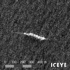
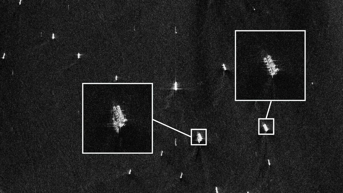
Human and arms trafficking often involves transferring cargo from a larger ship to a smaller one beyond national borders at sea. Activities like this are extremely difficult to detect using coastline radars and optical sensors. SAR satellite monitoring by ICEYE enables authorities to detect and counteract human and arms trafficking, rapidly and effectively. See a SAR image of a transfer of cargo between two vessels, taking place at night.
Illegal maritime smuggling and human trafficking are conducted at night using small vessels that are difficult to detect with coastal radars. It is also a common practice to conceal the origin of sanctioned or stolen goods by loading illegal cargo from one vessel to another on the open sea with identification devices turned off or transmitting false location and identity. When done beyond the range of coastal radars or at nighttime authorities are not able to provide effective response.
The world’s leading SAR satellite data from ICEYE helps you stay constantly aware of vessels operating in specific areas. You can detect unreported vessels or any suspicious activities, like ship-to-ship transfers, and take immediate action, for instance send in patrol boats or prepare personnel on the coast. You can also predict possible threats to your maritime border and plan a timely response.
Download our Application study to learn how to use ICEYE SAR data to counteract illegal human trafficking and smuggling in your maritime borders.
Know what is happening at your borders and beyond.
Watch strategic sites and detect changes.
Oversee forests and identify activities.