Contact us
Get in touch with our experts to find out the possibilities daily truth data holds for your organization.
Helsinki, FINLAND – September 12, 2019 – ICEYE, the leader in small synthetic-aperture radar (SAR) satellite technology, today announced its two SAR satellites launched in July 2019 have finalized their initial commissioning, and are available for customer data orders. The company now provides standardized commercial imaging access to three of its SAR satellite units, in addition to serving a number of customers with custom data products and solutions. ICEYE is set to launch two more SAR satellite units by the end of 2019 to further increase the commercial availability and coverage of the globe with the company’s constellation.
“The ICEYE SAR satellite constellation is soon becoming the largest of its kind in the world,” said Rafal Modrzewski, CEO and Co-founder of ICEYE. “In addition to serving customers with an increasing amount of capacity and access, we continue to develop and deploy new capabilities for our current SAR satellites already in orbit.”
The initial commissioning phase for these two ICEYE SAR satellites has been finalized, and standard SAR data access is available for commercial and government customers. ICEYE has recently published radar imaging with its newly developed Spotlight mode - imagery at very high resolutions.
ICEYE is simultaneously publicizing images that have been acquired with both new SAR satellite units, taken only minutes apart from each other, to demonstrate change detection capabilities the company is developing. ICEYE intends to grow its SAR satellite constellation to cover the globe with very frequent imaging, with an average of only hours between imaging opportunities for individual locations.
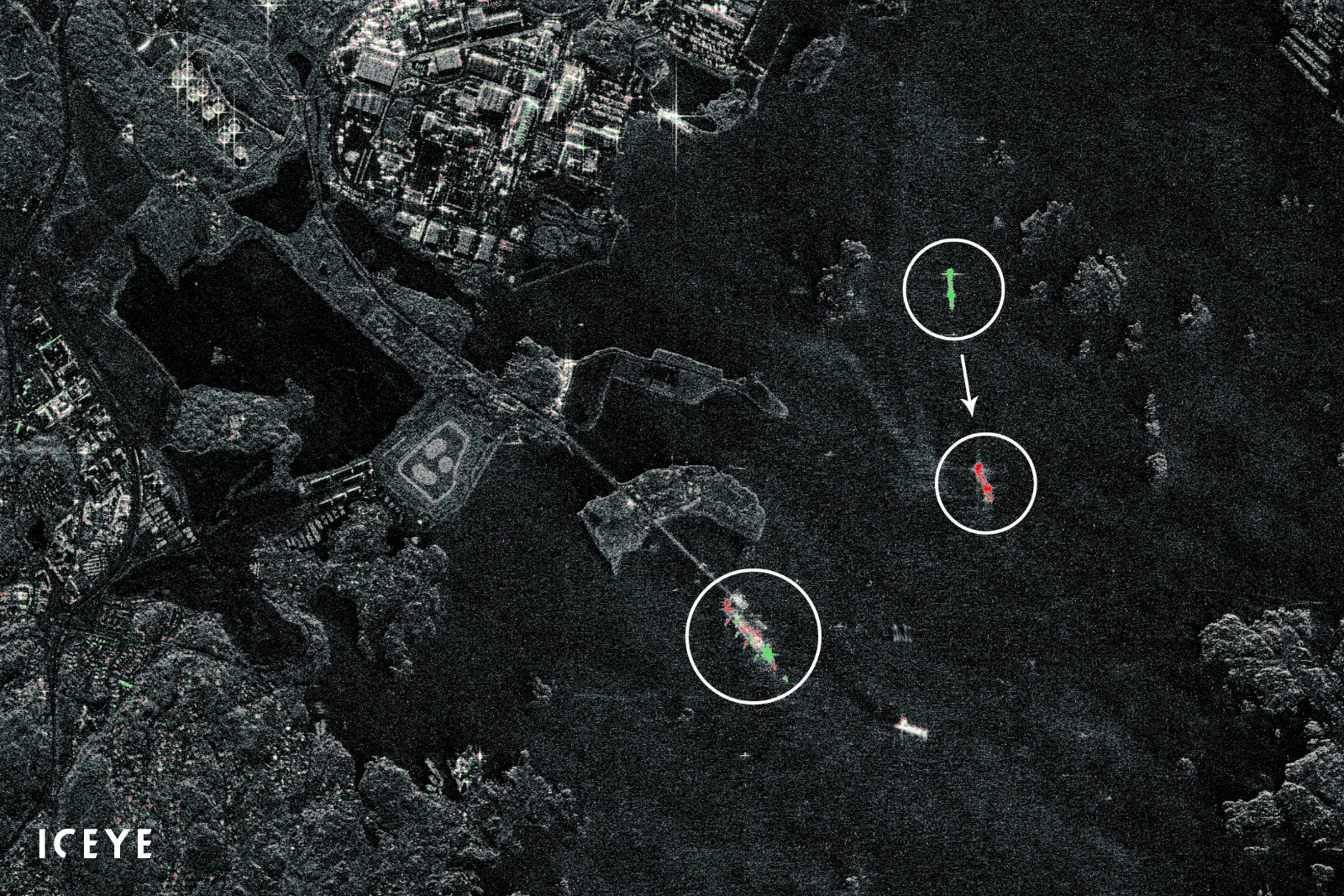
In this composite visualization, vessels in the port of Gothenburg, Sweden, are detected changing their position with just minutes between two combined SAR satellite images. Elements shown in green represent the position of elements only seen in the prior image, and elements in red represent elements only in the following image. One of the vessels is leaving the port, and another is slowly approaching the oil terminal visible in the scene.
“The capacity of these two SAR satellites helps us increase our revisit rates for individual locations, which further ensures our customers don’t have to wait for imaging,” said Pekka Laurila, Chief Strategy Officer and Co-founder of ICEYE. “With this dramatic increase in imaging capacity, we are able to also serve segments such as the insurance and energy industries with tailored information solutions that bring more direct value towards their needs.”
# # # # #
About ICEYE
ICEYE is building and operating its own commercial constellation of SAR satellites, with SAR data already available to customers. ICEYE empowers others to make better decisions in governmental and commercial industries by providing access to timely and reliable radar satellite imagery. The company is tackling the current crucial lack of actionable information with world-first aerospace capabilities and a New Space approach. ICEYE’s radar satellite imaging service, designed to deliver coverage every few hours, both day and night, helps clients resolve challenges in sectors such as maritime, disaster management, insurance, and finance. For more information, please visit: www.iceye.com.
Other assets available at https://www.iceye.com/press.
Download images by right-clicking and selecting "save link as":
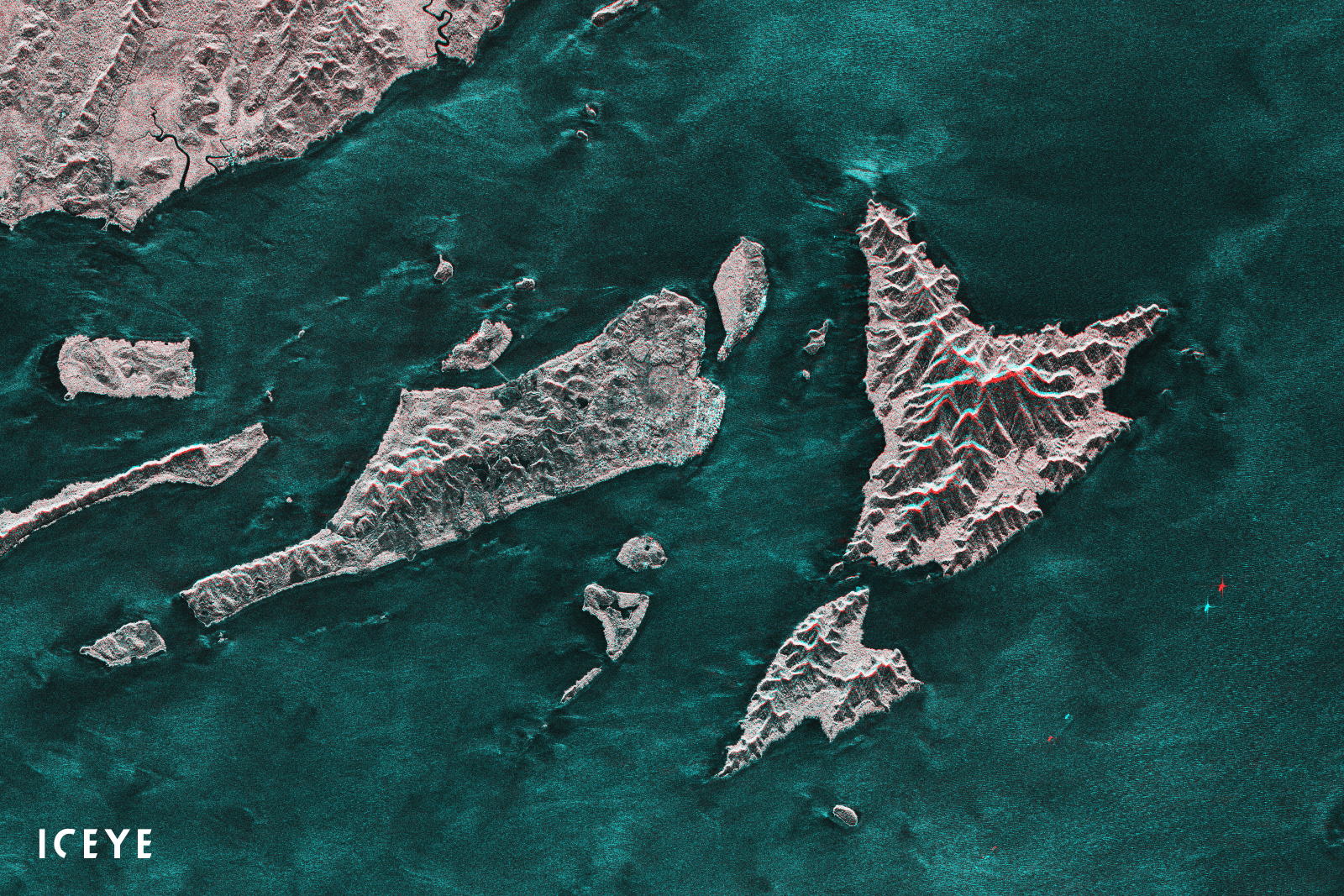
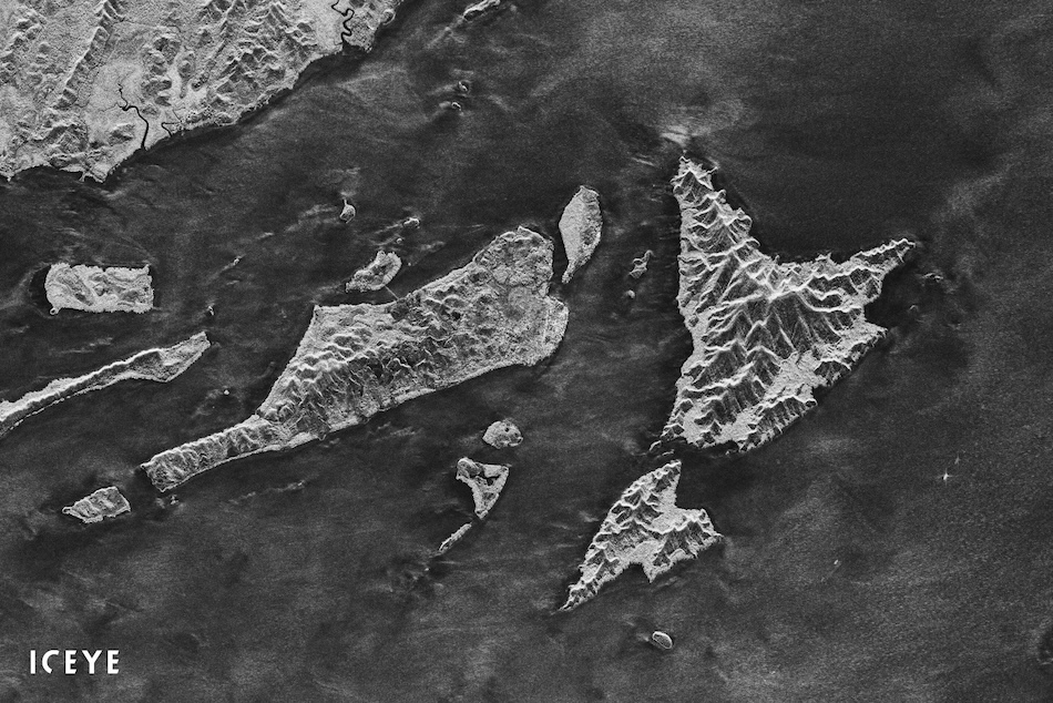
"A stereo visualization of two SAR images from Indonesia, taken only minutes apart from each other with ICEYE's two satellites launched in July 2019."
"In this composite visualization, vessels in the port of Gothenburg, Sweden, are detected changing their position with just minutes between two combined SAR satellite images."
![]()
ICEYE logo.