Contact us
Get in touch with our experts to find out the possibilities daily truth data holds for your organization.

Helsinki, FINLAND – June 13, 2023 – ICEYE, the global leader in persistent monitoring with radar imaging satellites and an expert in natural catastrophe solutions, has successfully expanded its constellation with four new synthetic aperture radar (“SAR”) satellites on June 12. The launch on SpaceX’s Transporter-8 smallsat rideshare mission via Exolaunch was conducted from Vandenberg Space Force Base in California, USA. Each spacecraft has successfully established communications and are undergoing routine early operations. The next generation ICEYE satellites launched today can image the Earth with a ground range resolution of 50 cm and are accompanied by the release of a new data product named Spot Fine. This new imaging mode is the first of a new class of data offerings enabled by ICEYE’s Generation 3 (“Gen3”) satellite technology.
The deployed satellites will provide additional capacity to ICEYE's growing constellation and unlock novel SAR collection techniques, including rapid monitoring of small changes on land and at sea thus extending ICEYE’s leadership in SAR remote sensing. Two of the launched satellites are manufactured, licensed, and operated by ICEYE US, the company’s U.S. subsidiary headquartered in Irvine, California.
“The ICEYE team continues to deliver results for our customers in direct need of reliable, frequent, and high-fidelity data about our world. We are privileged to help solve issues that arise from the lack of actionable information across multiple industries,” says Rafal Modrzewski, CEO and Co-founder of ICEYE. “With this launch and beyond, we continue to grow and develop our constellation capabilities to meet the still-emerging needs of our partners.”
ICEYE’s Gen3 satellite features improvements that will significantly enhance the value of ICEYE’s SAR data for various use cases. The Gen3 includes an advanced radar that enables major improvements in image quality, faster downlink speeds to better support agile imagery collections and better integration with ICEYE’s global network of ground stations.
Spot Fine mode represents a significant step forward for SAR imagery and analytic users alike. SAR satellites illuminate the ground with microwaves and create images from the energy that is reflected back to the satellite. SAR is superior to traditional electro-optical imaging for monitoring and search applications because it provides a powerful day/night all-weather imaging capability. With Spot Fine mode, ICEYE satellites can now detect smaller features on the ground, which provides analysts with higher confidence in conclusions drawn from SAR imagery. The benefit of Spot Fine applies both to customers consuming ICEYE imagery data and those acquiring ICEYE satellites.
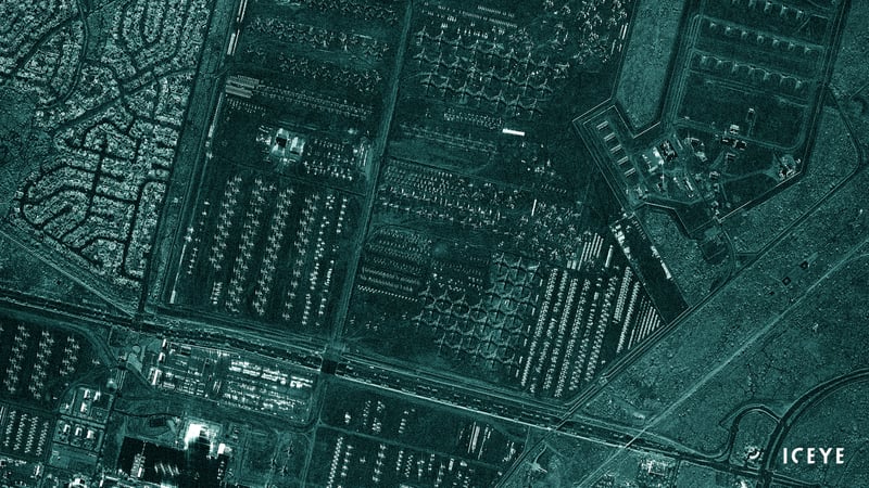
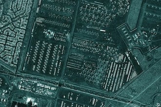
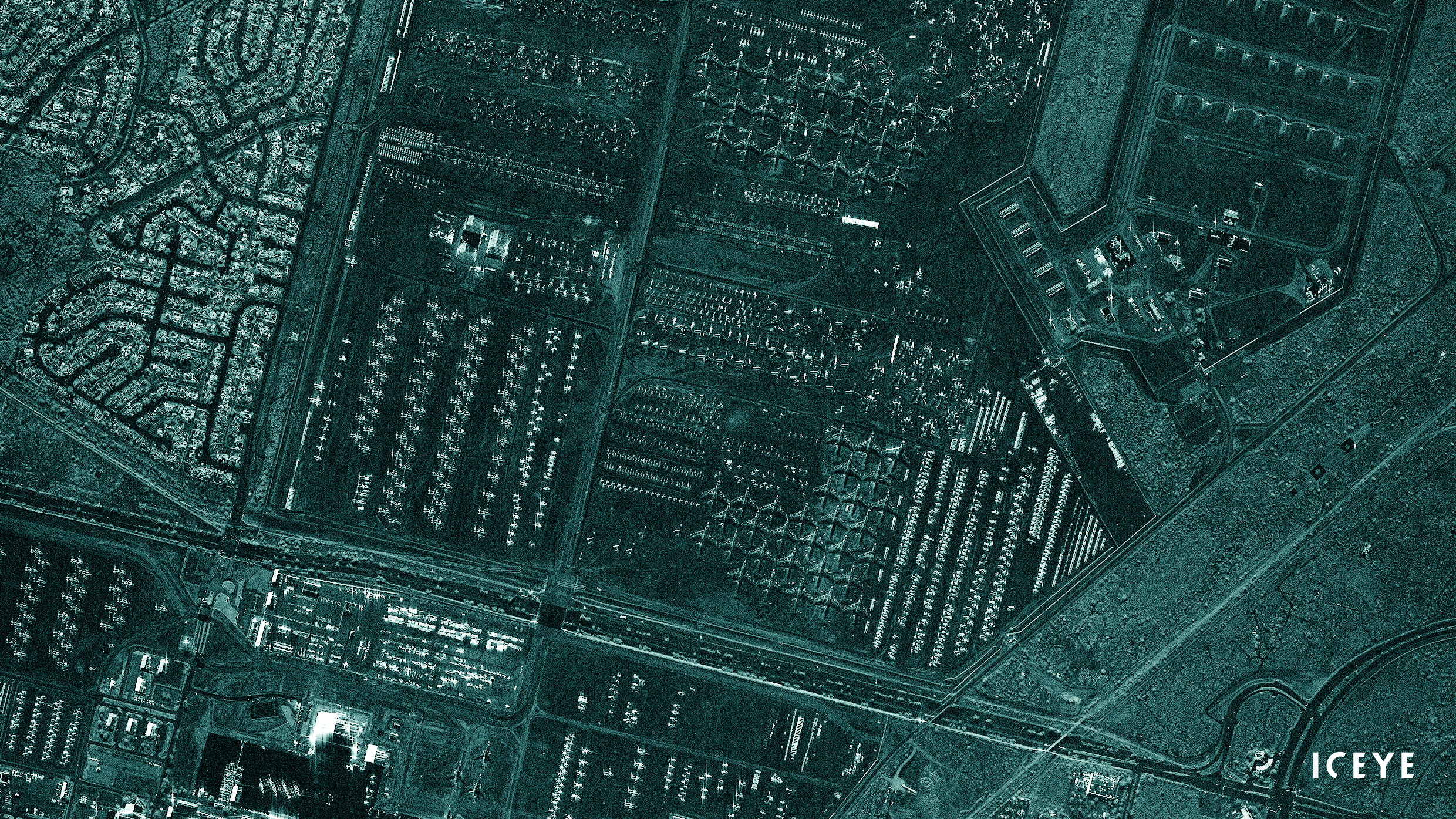
ICEYE Spot Fine 50 cm ground resolution image of Davis-Monthan Air Force Base Aircraft Boneyard in Tuscon, Arizona, US acquired during night time. The image showcases the ability of Spot Fine to not only see the shape of the individual aircraft, but also to zoom in to component level for enhanced classification.
John Cartwright, Head of Data Product at ICEYE says: “Spot Fine means what it says. Customers can understand their areas of interest with finer detail and therefore extract better, more reliable, more actionable information about what is happening on the ground.” “SAR imagery enables precise detections of objects and features on the ground,” he adds. “With Spot Fine, the shape, structure, and even changes in these objects and features can be more easily identified and characterized.”
Radar satellite imaging technology provides visibility to the surface of the Earth both night and day and even through cloud cover. ICEYE offers a vital source of insights for government and enterprise needs in sectors such as insurance, natural catastrophe response and recovery, maritime, national security, humanitarian relief, and climate change monitoring.
ICEYE has now deployed 27 satellites since 2018, including both commercially available and dedicated customer missions. ICEYE plans to launch four additional SAR satellites in 2023.
Other assets available at https://www.iceye.com/media-assets
ICEYE Spot Fine 50 cm ground resolution image of Davis-Monthan Air Force Base...
ICEYE Spot Fine 50 cm ground resolution image of Davis-Monthan Air Force Base Aircraft Boneyard in Tuscon, Arizona, US acquired during night time. The image showcases the ability of Spot Fine to not only see the shape of the individual aircraft, but also to zoom in to component level for enhanced classification.
.webp?width=400&height=269&name=image0%20(1).webp)
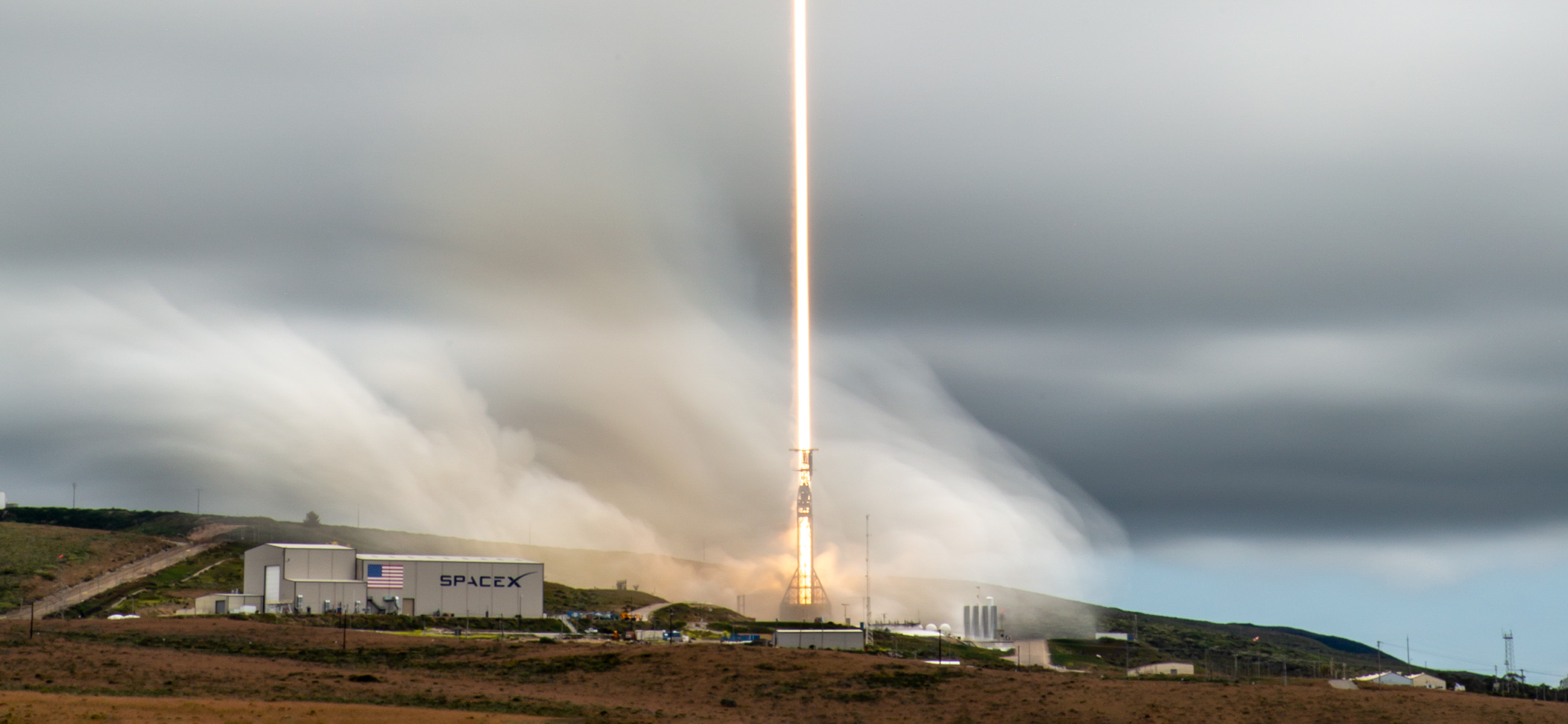
A photo from the Transporter-8 launch. Credit: SpaceX
A photo from the Transporter-8 launch. Credit: SpaceX
