Contact us
Get in touch with our experts to find out the possibilities daily truth data holds for your organization.
Helsinki, FINLAND – October 13, 2020 – Finnish New Space leader ICEYE today announced access to ICEYE's Public Archive, containing nearly 18,000 images from ICEYE satellites. The ICEYE Public Archive includes radar imagery in various imaging modes taken with ICEYE’s SAR satellite constellation between mid-2019 and now. The ICEYE Public Archive consists of preview images from around the world, which are released under CC BY-NC 4.0 license, allowing for non-commercial use.
“The ICEYE SAR satellite constellation is here for the global community of decision makers, data users, and more, to improve our shared world around us all,” said Rafal Modrzewski, CEO and Co-founder of ICEYE. “The ICEYE Public Archive opens up a unique view of the world, which we invite you to explore together with us.”
The ICEYE Public Archive is provided as a downloadable file through the ICEYE website, showing the locations and time of imaging for each thumbnail in the Archive. After downloading the file, users can open it with their Geographic Information System (GIS) program of choice, such as Google Earth Pro or QGIS, making exploring the world of radar satellite imaging accessible for all.

Animated visualization of the  which contains nearly 18,000 thumbnails of SAR satellite images taken with the ICEYE SAR satellite constellation over the last years.
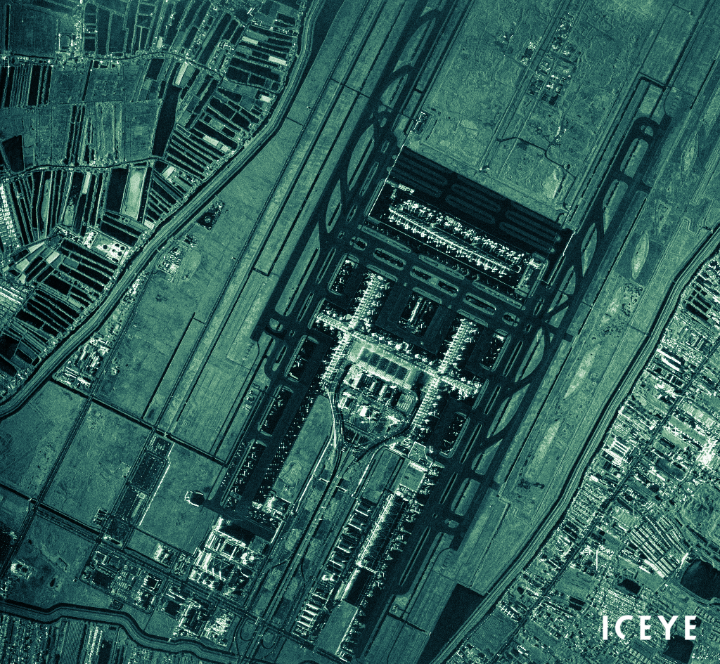
An example of a thumbnail from the . This radar image of Suvarnabhumi Airport, Bangkok, Thailand, was acquired on 9th of August 2020, in Spotlight High imaging mode, with an ICEYE SAR satellite.
“Every day, ICEYE provides unique access to data and information for our customers that hasn’t been available before,” said Steve Young, Vice President, Business Development and Sales, ICEYE. “Our customers and the global community of Earth observation data explorers now have access to some of the imagery that has been collected in the prior years by ICEYE's SAR satellite constellation. The ICEYE Public Archive provides additional inspiration for what can be achieved in the future.”
The ICEYE Public Archive is available to download today. The Public Archive does not contain the full catalog of ICEYE imagery, as customer exclusivity applies in many cases. The ICEYE SAR data associated with the preview images presented in the Public Archive can be ordered in the ICEYE standard image formats by following the order process described in the ICEYE Product Guide. ICEYE sales will assist new customers to set up an account for image orders.
# # # # #
About ICEYE
ICEYE is building and operating its own commercial constellation of radar imaging satellites, with SAR data available to global customers since 2018. With the company’s unique satellite constellation capabilities, ICEYE empowers others to make better decisions in governmental and commercial industries. The company is tackling a tremendous global need for timely and reliable information, with world-first aerospace capabilities and a New Space approach. ICEYE’s radar satellite imaging service, designed to deliver very frequent coverage, both day and night, helps clients resolve challenges in sectors such as maritime, disaster management, insurance, and finance. For more information, please visit: www.iceye.com
Other assets available at https://www.iceye.com/press.
Download images by right-clicking and selecting "save link as":
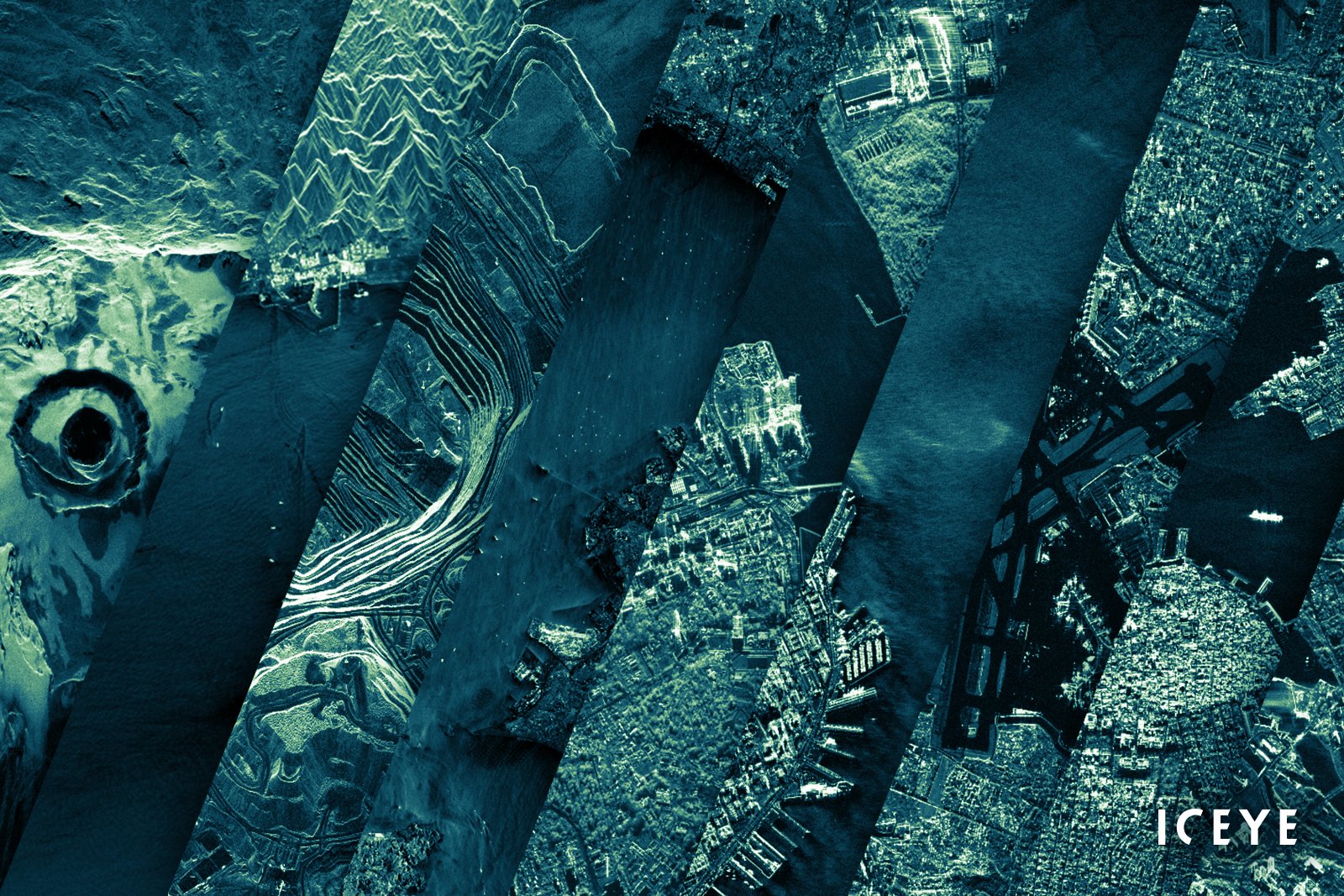
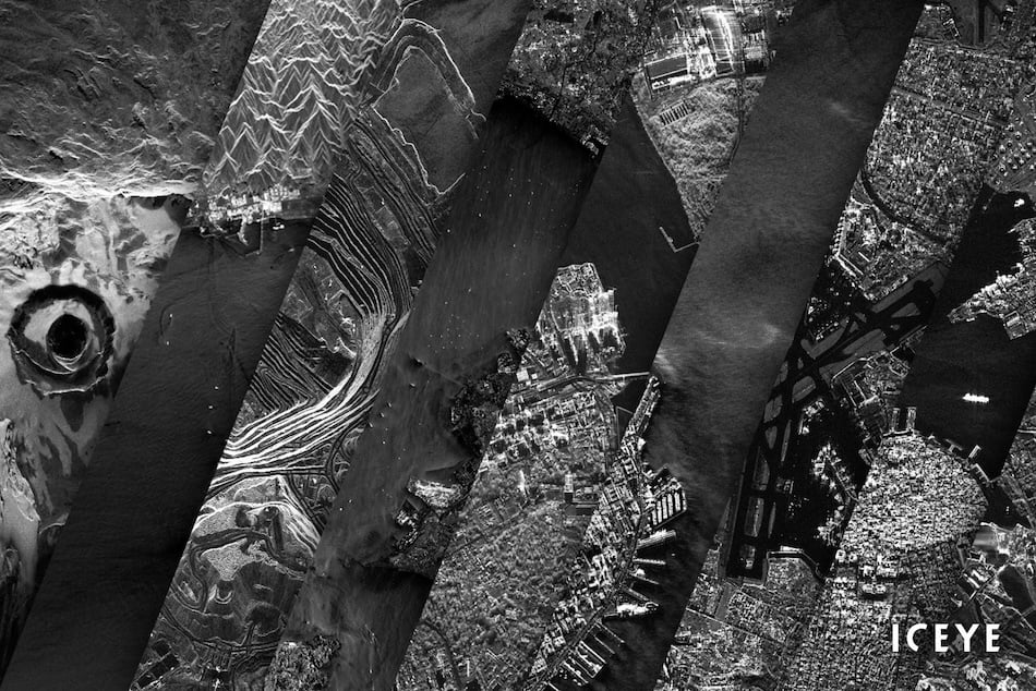
"Several preview images of ICEYE SAR satellite data from different locations and acquired in different imaging modes, representing the variety of imagery in the ICEYE Public Archive."
"An example of a thumbnail from the ICEYE Public Archive. This radar image of Suvarnabhumi Airport, Bangkok, Thailand, was acquired on 9th of August 2020, in Spotlight High imaging mode, with an ICEYE SAR satellite."
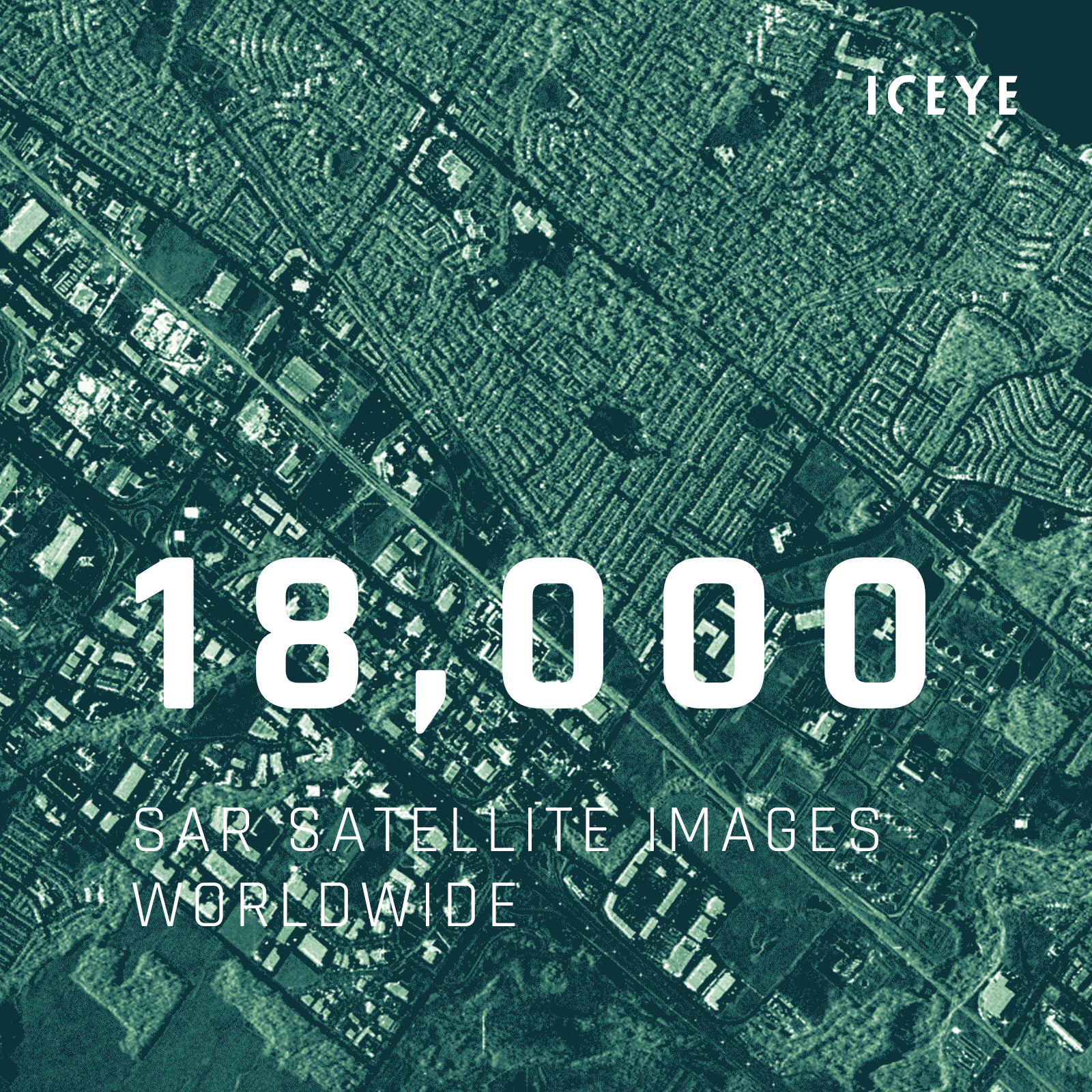
"Animated visualization of the ICEYE Public Archive which contains nearly 18,000 thumbnails of SAR satellite images taken with the ICEYE SAR satellite constellation over the last years."
![]()
ICEYE logo.