Contact us
Get in touch with our experts to find out the possibilities daily truth data holds for your organization.
Helsinki, FINLAND – May 10, 2021 – Finnish New Space leader ICEYE announced today the commercial availability of wide area imaging capabilities covering 10,000 km² data acquisitions with its SAR (synthetic-aperture radar) satellite constellation. ICEYE is the only New Space SAR satellite provider to achieve wide-area Scan mode imaging, with up to a 100-times larger area coverage from the closest alternatives in the marketplace. Thanks to the completely unique system design of ICEYE’s SAR satellites, ICEYE is now able to provide the world’s single most comprehensive persistent monitoring capabilities both for land and sea data use cases.
“It’s really exciting to see another world first from ICEYE. Our leading-edge persistent monitoring capabilities, now boosted with Scan mode, enable our commercial and government customers to quickly and effortlessly survey huge areas for purposes such as sea ice monitoring, ensuring maritime safety and national security use cases,” said Steve Young, Vice President, Business Development and Sales, ICEYE. “Our unique satellite constellation and technology approach makes ICEYE’s capability something alternative approaches simply aren’t able to match.”
“ICEYE’s ability to now generate wide coverage imaging brings an addition to the radar based service market, in particular for maritime users” said Marte Indregard, Chief Commercial Officer at KSAT, an ICEYE data customer and partner. “As the largest buyer of SAR data for maritime applications we know there is a strong demand for Scan mode images providing effective large area coverage, and we are eager to start delivering this to our customers world-wide.”
ICEYE’s new Scan imaging is particularly effective for acquiring wide coverage imagery for maritime use cases, where national security authorities and maritime safety officials require persistent visibility into large sea areas. The alternative methods of monitoring these areas, such as airplanes and sending out patrol vessels to sea, are costly and not always feasible due to inclement weather or night time. Radar satellite imaging works both day and night, and even through cloud cover. ICEYE is the only New Space SAR data provider with a current system design that supports comprehensive wide area imaging.
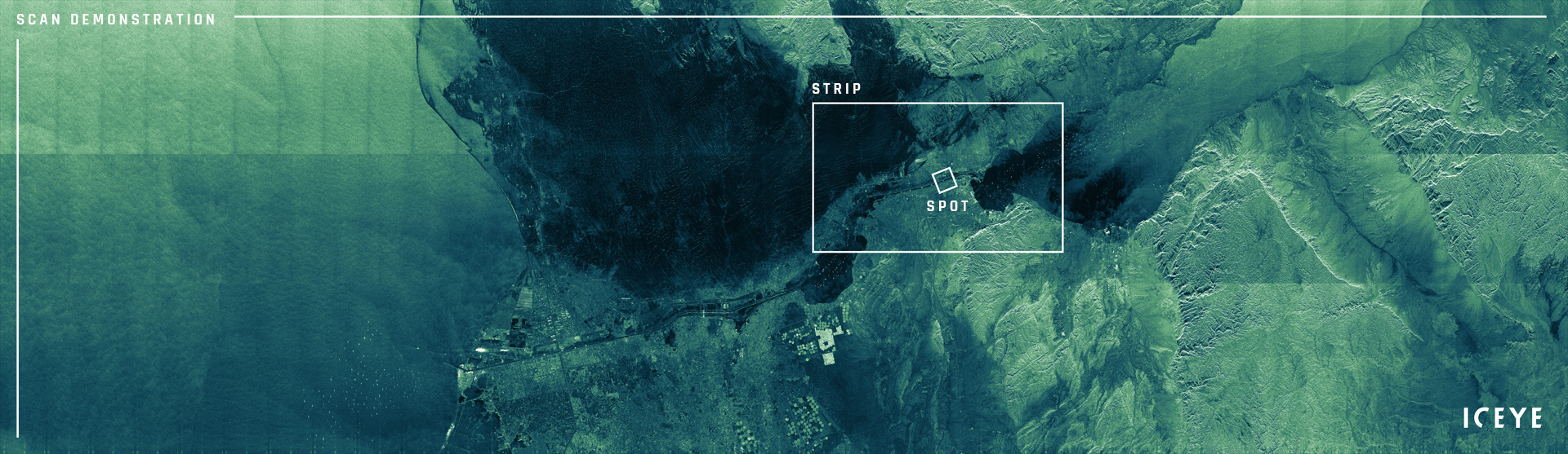
This image is an ICEYE demonstration of 400 km by 100 km Scan mode imaging, acquired around the time the vessel Ever Given was released from its recent predicament, with marine traffic still queuing for their turn to pass through the Suez Canal. This 40,000 km² image covers an area of over 1500 individual Spot images.
These images show the difference between Strip (medium area), and Spot (detail area) imaging in terms of their coverage. Each mode has its distinct benefits, and ICEYE’s unique system versatility allows all data users to acquire each type for varying information needs.
“We’ve done trials to Scan image areas as large as 100 km x 400 km (60 x 250 miles) with a single acquisition, covering areas at once that would take more than 1500 Spot images as a comparison,” said Pekka Laurila, CSO & Co-founder, ICEYE. “ICEYE continues to lead the way with several world first technology innovations for the benefit of our customers, as we have continually done since we launched the world’s first New Space SAR satellite over 3 years ago.”
ICEYE was the world’s first company to launch a SAR satellite under 100 kg in 2018, the first New Space provider to achieve under 1-meter SAR resolution imaging in 2019, the first to demonstrate interferometric capabilities in 2020, and even the first to produce SAR videos from individual satellite passes also in 2020. In total, ICEYE has raised $152M in financing, launched 10 SAR missions, and has plans to launch up to 10 more spacecraft still in 2021.
# # # # #
About ICEYE
ICEYE empowers commercial and government partners with unmatched persistent monitoring capabilities for any location on Earth. The company helps customers make informed, data-driven decisions to address time-critical challenges in various industries, to ensure infrastructure safety, and to protect the environment. ICEYE’s radar satellite imaging service, designed to deliver very frequent coverage, both day and night, helps clients resolve challenges in sectors such as maritime, disaster management, insurance, and finance. For more information, please visit: www.iceye.com
Other assets available at https://www.iceye.com/press.
Download images by right-clicking and selecting "save link as":
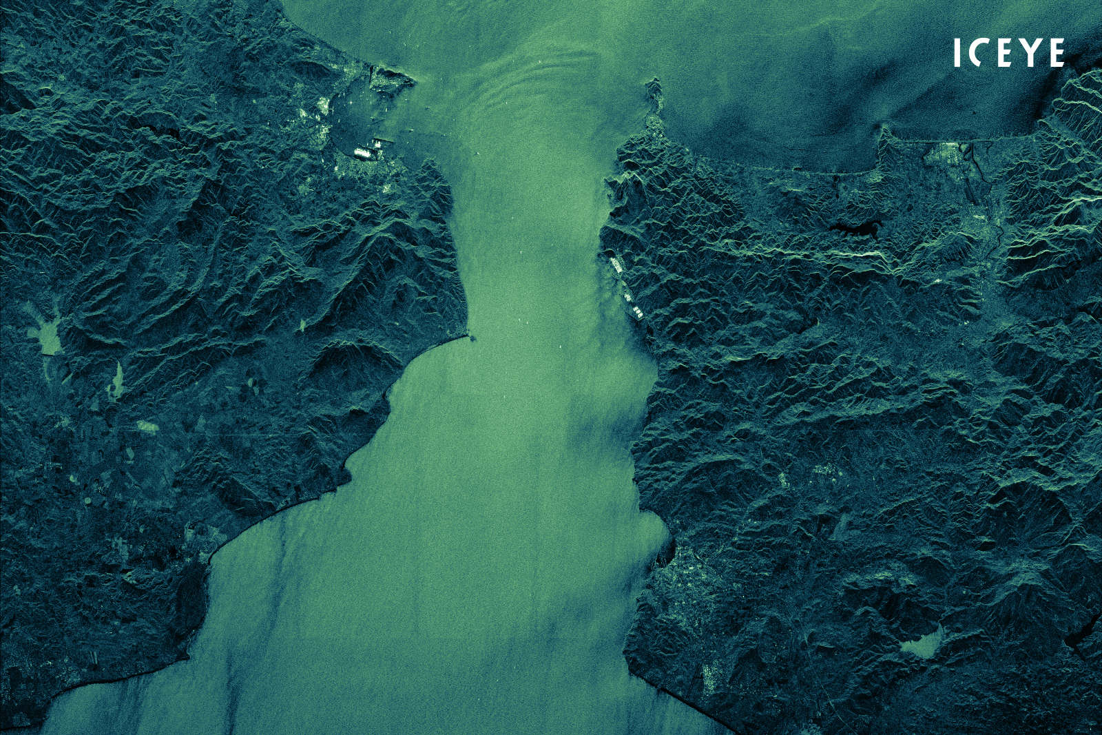
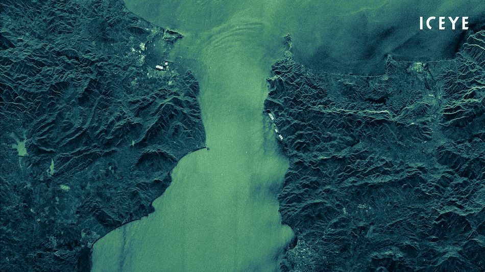
“A wide area ICEYE radar satellite image of the Strait of Gibraltar.”
“This image is an ICEYE demonstration of 400 km by 100 km Scan mode imaging, acquired around the time the vessel Ever Given was released from its recent predicament, with marine traffic still queuing for their turn to pass through the Suez Canal.”
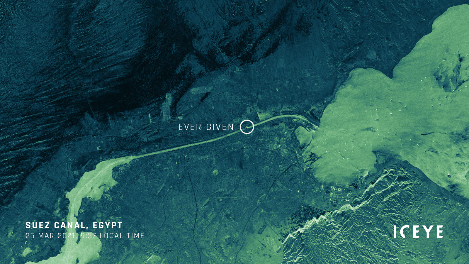
“A Strip ICEYE radar satellite image of the Suez Canal from March 26, 2021, when the vessel Ever Given was blocking the waterway.”
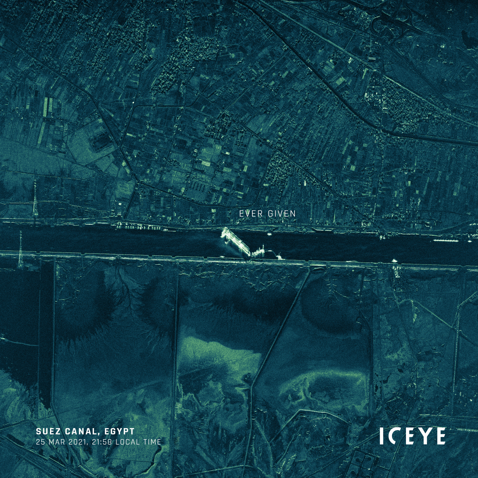
“A very high-resolution Spot image of the vessel Ever Given stuck in the Suez Canal, acquired with an ICEYE SAR satellite.”
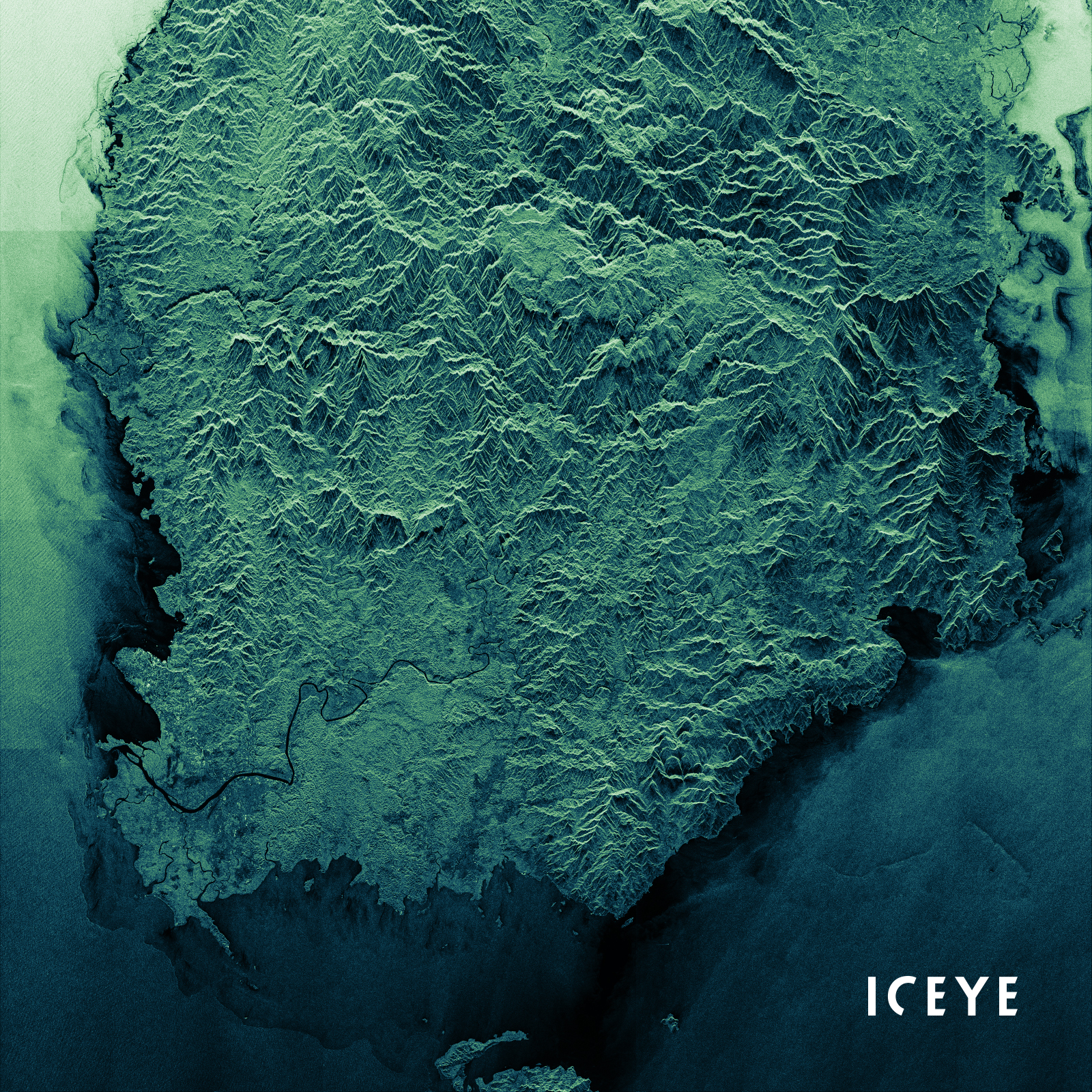
“A radar image of Viti Levu Island where Suva, the capital city of Fiji, is located. The image was taken with an ICEYE SAR satellite in the recently released Scan imaging mode, perfectly suited for wide land & sea area monitoring.”
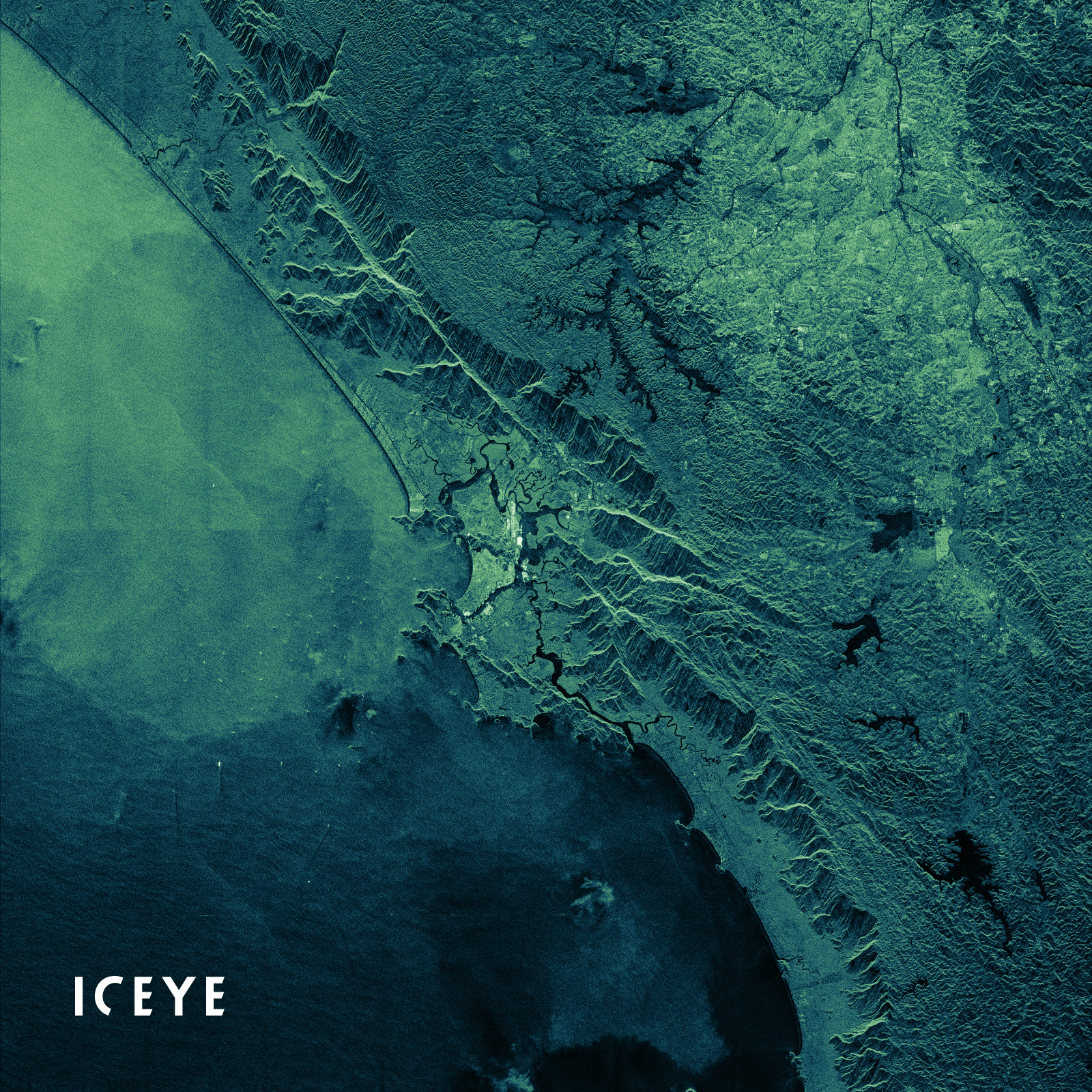
“ICEYE SAR satellite image acquired in Scan imaging mode. This image shows Santos, state of São Paulo, Brazil, and the Port of Santos which is the largest and key public port in Brazil.”
![]()
ICEYE logo.