Contact us
Get in touch with our experts to find out the possibilities daily truth data holds for your organization.
Persistent Monitoring
Natural catastrophe solutions
Newsroom

ICEYE headquarters in Otaniemi, Espoo (Finland).

ICEYE headquarters in Otaniemi, Espoo (Finland).

Staff inside ICEYE headquarters in Finland.
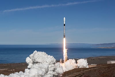
Launch of ICEYE-X2, delivered into orbit via Spaceflight’s SSO-A: SmallSat...
Launch of ICEYE-X2, delivered into orbit via Spaceflight’s SSO-A: SmallSat Express mission aboard a SpaceX Falcon 9 rocket on 3 December 2018, from Vandenberg Air Force Base, California.

ICEYE Co-founders, Pekka Laurila & Rafal Modrzewski, are showing the model of...
ICEYE Co-founders, Pekka Laurila & Rafal Modrzewski, are showing the model of an ICEYE SAR satellite to Mr. Moon Jae-in, the President of South Korea.

ICEYE SAR satellite hardware and cabling.
ICEYE SAR satellite hardware and cabling.

Rafal Modrzewski inspecting satellite hardware.
Rafal Modrzewski inspecting satellite hardware.

Captured during the Transporter-11 launch (Image courtesy of SpaceX)
Captured during the Transporter-11 launch (Image courtesy of SpaceX)
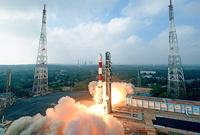
Launch of ICEYE-X1, ICEYE's first microsatellite mission with a SAR sensor as...
Launch of ICEYE-X1, ICEYE's first microsatellite mission with a SAR sensor as its payload and the world's first SAR satellite in this size, on 12 January 2018, on ISRO’s PSLV-C40 rocket from Satish Dhawan Space Center in India. Credit: Antrix
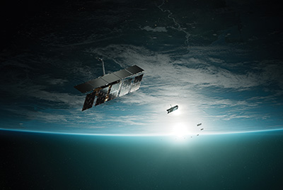
ICEYE SAR Satellite Constellation
ICEYE SAR Satellite Constellation
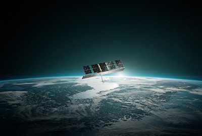
ICEYE SAR Satellite over Scandinavia
ICEYE SAR Satellite over Scandinavia
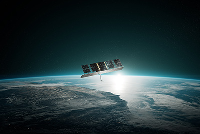
ICEYE SAR Satellite over the US
ICEYE SAR Satellite over the US
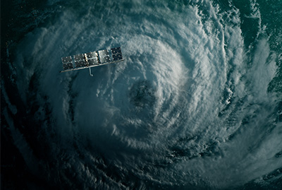
ICEYE SAR Satellite in orbit over a hurricane
ICEYE SAR Satellite in orbit over a hurricane
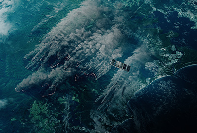
ICEYE SAR Satellite in orbit over a wildfire
ICEYE SAR Satellite in orbit over a wildfire
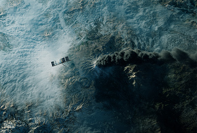
ICEYE SAR Satellite in orbit over a erupting volcano
ICEYE SAR Satellite in orbit over a erupting volcano

3D render of an ICEYE SAR satellite in a showroom.

Close-up 3D render of an ICEYE SAR satellite in a showroom.

ICEYE specialists inspecting an ICEYE SAR satellite in a clean room.
ICEYE specialists inspecting an ICEYE SAR satellite in a clean room.

ICEYE engineers working with an ICEYE SAR satellite in a clean room.
ICEYE engineers working with an ICEYE SAR satellite in a clean room.
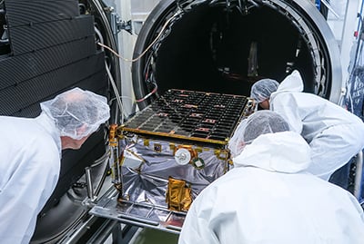
ICEYE engineers executing the backout of an ICEYE SAR satellite.
ICEYE engineers executing the backout of an ICEYE SAR satellite.

ICEYE specialists testing an ICEYE SAR satellite in an anechoic chamber.
ICEYE specialists testing an ICEYE SAR satellite in an anechoic chamber.

ICEYE professionals testing an ICEYE SAR satellite in an anechoic chamber.
ICEYE professionals testing an ICEYE SAR satellite in an anechoic chamber.
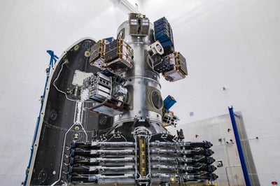
3 ICEYE SAR satellites on the SpaceX launch vehicle, ready to be launched via...
3 ICEYE SAR satellites on the SpaceX launch vehicle, ready to be launched via the Transporter-1 mission. Credit: SpaceX.
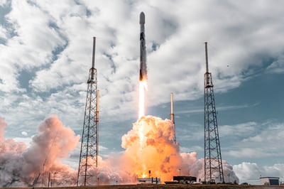
Falcon 9 Transporter-1 mission lift off from Space Launch Complex 40 (SLC-40)...
Falcon 9 Transporter-1 mission lift off from Space Launch Complex 40 (SLC-40) at Cape Canaveral Space Force Station in Florida on January 24th. Credit: SpaceX.

ICEYE Dwell Precise image of the Port of Rotterdam.
ICEYE Dwell Precise image of the Port of Rotterdam.

ICEYE Dwell Precise image of the Port of Rotterdam (clean).
ICEYE Dwell Precise image of the Port of Rotterdam (clean).

ICEYE Dwell Precise image of the Port of Rotterdam (zoom-in).
ICEYE Dwell Precise image of the Port of Rotterdam (zoom-in).

ICEYE Dwell Precise image of the Port of Rotterdam (zoom-in).
ICEYE Dwell Precise image of the Port of Rotterdam (zoom-in).

ICEYE Dwell Precise image of the SpaceX Starbase in Texas, US.
ICEYE Dwell Precise image of the SpaceX Starbase in Texas, US.

ICEYE Dwell Precise image of a naval base (clean).
ICEYE Dwell Precise image of a naval base (clean).

ICEYE Dwell Precise image of a naval base.
ICEYE Dwell Precise image of a naval base.

Scan mode image of the Panama Canal, Panama
Scan mode image of the Panama Canal, Panama

ICEYE Dwell Fine image of the Davis-Monthan Air Force "Boneyard" in Tucson,...
ICEYE Dwell Fine image of the Davis-Monthan Air Force "Boneyard" in Tucson, Arizona, US taken on March 1st, 2024.

ICEYE Dwell Fine image of the PS10 Solar Power Plant, the world's first...
ICEYE Dwell Fine image of the PS10 Solar Power Plant, the world's first commercial concentrating solar power tower operating near Seville, in Andalusia, Spain.
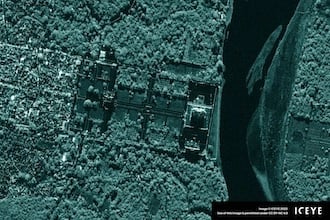
ICEYE SAR image of the famous Taj Mahal taken during nighttime in Dwell mode.
ICEYE SAR image of the famous Taj Mahal taken during nighttime in Dwell mode.
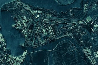
ICEYE Spot image of the Yas Island, Abu Dhabi, United Arab Emirates. The image...
ICEYE Spot image of the Yas Island, Abu Dhabi, United Arab Emirates. The image features the Yas Marina Circuit, where the Formula 1 Abu Dhabi Grand Prix takes place every year.
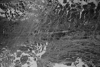
Gulf of Finland sea ice between Helsinki and Tallinn on 25 February 2018,...
Gulf of Finland sea ice between Helsinki and Tallinn on 25 February 2018, imaged with ICEYE-X1.
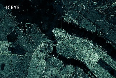
ICEYE radar satellite image of New York, NY, taken in March 2020.
ICEYE radar satellite image of New York, NY, taken in March 2020.
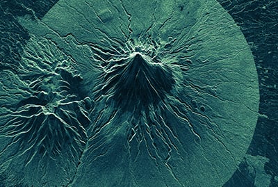
ICEYE radar satellite image from Mount Taranaki, Stratford, New Zealand, taken...
ICEYE radar satellite image from Mount Taranaki, Stratford, New Zealand, taken on 19 February 2019. Mount Taranaki is an active stratovolcano, or composite volcano, that can put tens of thousands of people at risk if it erupts. Mt. Taranaki is also a spiritually important landmark for Taranaki, holding great cultural significance to local people.
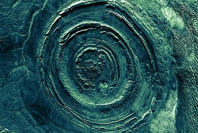
ICEYE radar satellite image of Ouadane, Mauritania, taken on 29 March 2019. The...
ICEYE radar satellite image of Ouadane, Mauritania, taken on 29 March 2019. The image shows the Richat structure, or the “Eye of Africa”, which is a giant, geological wonder in the Sahara Desert of Mauritania.
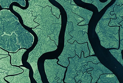
ICEYE SAR satellite image of the world’s largest river delta - the Ganges...
ICEYE SAR satellite image of the world’s largest river delta - the Ganges Delta, taken in March 2020.
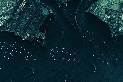
ICEYE radar satellite image from the Singapore trait, taken on 26 January 2019....
ICEYE radar satellite image from the Singapore trait, taken on 26 January 2019. The image shows various vessels around the International Airport of Changi, Singapore, and its surrounding areas.
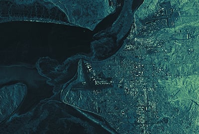
ICEYE radar satellite image from Alaska, Anchorage, taken on 26 December 2018....
ICEYE radar satellite image from Alaska, Anchorage, taken on 26 December 2018. The image shows Fire Island, the Ted Stevens Anchorage International Airport - the world's fourth busiest airport for cargo traffic - and the downtown of Anchorage. The river Knik, starting from the top right of the frame, is partly covered with ice.
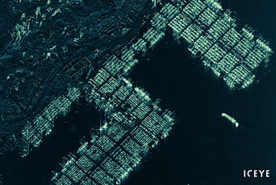
ICEYE radar satellite image from the Pasir Panjang container terminal of...
ICEYE radar satellite image from the Pasir Panjang container terminal of Singapore, taken on 20 December 2019. The image shows the container ports, several anchored cargo vessels, and a vessel maneuvering alongside the port.
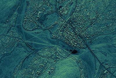
1-meter radar image of Rovaniemi, Finland, taken with an ICEYE SAR satellite on...
1-meter radar image of Rovaniemi, Finland, taken with an ICEYE SAR satellite on 19 February 2020.
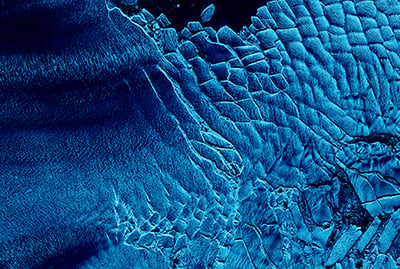
ICEYE radar satellite image from a part of the Thwaites Glacier, Antarctica,...
ICEYE radar satellite image from a part of the Thwaites Glacier, Antarctica, taken on 20 April 2019.
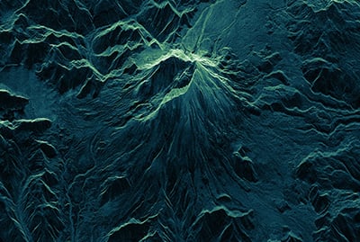
ICEYE SAR satellite image of Mount St. Helens, WA, from March 2020. Symbol of...
ICEYE SAR satellite image of Mount St. Helens, WA, from March 2020. Symbol of forest destruction and recovery: Mount St. Helens’ once barren surroundings are reemerging after the volcanic eruption in March 1980.
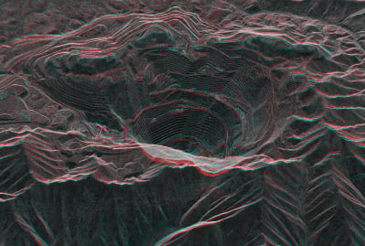
A stereo view of the Bingham Canyon Open Pit Copper Mine in Utah, combined from...
A stereo view of the Bingham Canyon Open Pit Copper Mine in Utah, combined from two ICEYE SAR satellite images.
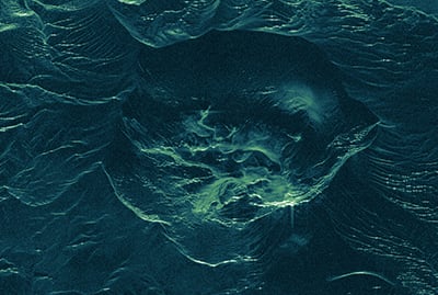
ICEYE SAR satellite image of Taal Volcano, the Philippines, after the volcano’s...
ICEYE SAR satellite image of Taal Volcano, the Philippines, after the volcano’s eruption. The image was taken on 16 January 2020, 6:37 AM UTC.
.jpg?width=400&height=269&name=ICEYE_media-NASA-HQ-Capitol-Hill-1920%20(1).jpg)
ICEYE Dwell mode image of Washington D.C showcasing Capitol Hill and NASA...
ICEYE Dwell mode image of Washington D.C showcasing Capitol Hill and NASA Mary W. Jackson Headquarters Building. The Dwell product is created from a 25-second collection providing high-fidelity SAR image with superior interpretability.
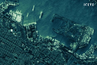
Radar image of the Port of Alexandria, the main port in Egypt, acquired with an...
Radar image of the Port of Alexandria, the main port in Egypt, acquired with an ICEYE SAR satellite during the night.
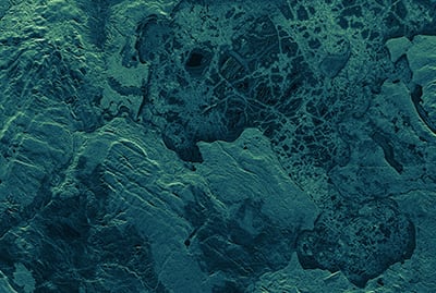
ICEYE radar satellite image of the Yellowstone Lake, Yellowstone National Park,...
ICEYE radar satellite image of the Yellowstone Lake, Yellowstone National Park, Wyoming, covered with ice, taken on 2 March 2020.
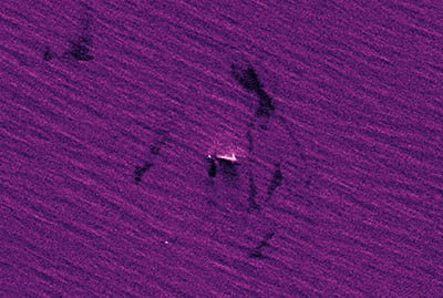
ICEYE radar satellite image taken on 14 June 2019 from the Gulf of Oman. The...
ICEYE radar satellite image taken on 14 June 2019 from the Gulf of Oman. The image shows oil slicks around the tanker Front Altair in the Gulf of Oman. ICEYE verified the Front Altair vessel identity with AIS data from Spire.
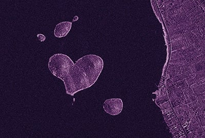
Radar image of Galesnjak, a heart-shaped island in Croatia, taken with an ICEYE...
Radar image of Galesnjak, a heart-shaped island in Croatia, taken with an ICEYE SAR satellite on 8 February 2020.
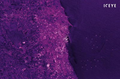
An ICEYE SAR satellite image of Casablanca, the largest city of Morocco,...
An ICEYE SAR satellite image of Casablanca, the largest city of Morocco, acquired in the Stripmap imaging mode.
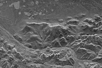
The first radar image obtained with the ICEYE-X1 SAR satellite on 15 January...
The first radar image obtained with the ICEYE-X1 SAR satellite on 15 January 2018, at 21:47 UTC. The image depicts Noatak National Preserve, Alaska.

Before & after animation, of storm Boris in Nysa, Poland
Before & after animation, of storm Boris in Nysa, Poland

Before & after animation, of storm Boris in Lewin Brzeski, Poland
Before & after animation, of storm Boris in Lewin Brzeski, Poland

Before & after animation of Hurricane Milton in Florida, US.
Before & after animation of Hurricane Milton in Florida, US.

Before & after animation of Hurricane Milton in Hillsborough Country, Florida,...
Before & after animation of Hurricane Milton in Hillsborough Country, Florida, US.

Before & after animation of flooding after storm DANA in Valencia, Spain.
Before & after animation of flooding after storm DANA in Valencia, Spain.

Hurricane Milton in Suwannee, Florida, US
Hurricane Milton in Suwannee, Florida, US

Visual of storm Boris in Lewin Brzeski, Poland.
Visual of storm Boris in Lewin Brzeski, Poland.

Visual of flooding after storm DANA in Valencia, Spain.
Visual of flooding after storm DANA in Valencia, Spain.

Rafal Modrzewski, Chief Executive Officer (CEO) & Co-founder of ICEYE.
Rafal Modrzewski, Chief Executive Officer (CEO) & Co-founder of ICEYE.

Pekka Laurila, Chief Strategy Officer (CSO) & Co-founder of ICEYE.
Pekka Laurila, Chief Strategy Officer (CSO) & Co-founder of ICEYE.
Eric Jensen, Chief Executive Officer (CEO) of ICEYE, Inc, the US subsidiary of...
Eric Jensen, Chief Executive Officer (CEO) of ICEYE, Inc, the US subsidiary of ICEYE.
The ICEYE synthetic-aperture radar (SAR) satellite constellation is already...
The ICEYE synthetic-aperture radar (SAR) satellite constellation is already today providing data to organizations around the world. The imaging and vessel detection data that is provided by this technology is a vital next leap in how nations can secure their maritime areas.

On March 9th, 2020, ICEYE is publishing the first in-orbit demonstration of...
On March 9th, 2020, ICEYE is publishing the first in-orbit demonstration of synthetic-aperture radar (SAR) videos, acquired with ICEYE SAR satellites. In these scenes, you can detect and analyse movement in a new way, giving insights into what is happening on the ground during a single SAR satellite pass over the location.
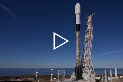
Video of the ICEYE-X2 launch aboard a SpaceX Falcon 9 rocket on 3 December...
Video of the ICEYE-X2 launch aboard a SpaceX Falcon 9 rocket on 3 December 2018, from Vandenberg Air Force Base, California. (Spaceflight’s SSO-A: SmallSat Express mission) Credit: SpaceX
All photos, images and videos on this page are subject to copyright and should be credited to ICEYE, unless otherwise indicated.
June 27, 2025
2 min read
Finland Ministry of Defense selects ICEYE for space-based intelligence and surveillance capabilities
Helsinki - June 27, 2025 - ICEYE, the European leader in new defense technology and the global leader in Synthetic Aperture Radar (SAR) ...
Read the post Finland Ministry of Defense selects ICEYE for space-based intelligence and surveillance capabilities →June 24, 2025
2 min read
ICEYE to provide SAR Satellite Data to NATO Allied Command Operations within Alliance Persistent Surveillance from Space Initiative
Helsinki and Brussels - June 24, 2025 - ICEYE, the global leader in Synthetic Aperture Radar (SAR) satellite operations for Earth ...
Read the post ICEYE to provide SAR Satellite Data to NATO Allied Command Operations within Alliance Persistent Surveillance from Space Initiative →June 24, 2025
2 min read
Six new satellites for ICEYE and its customers launched aboard the Transporter-14 rideshare mission
Helsinki - June 24, 2025 - ICEYE, the global leader in Synthetic Aperture Radar (SAR) satellite operations and primary provider of critical ...
Read the post Six new satellites for ICEYE and its customers launched aboard the Transporter-14 rideshare mission →For all press inquiries and other media requests, please get in touch.