Contact us
Get in touch with our experts to find out the possibilities daily truth data holds for your organization.
Persistent Monitoring
Natural catastrophe solutions
Press release

Helsinki and Brussels - June 24, 2025 - ICEYE, the global leader in Synthetic Aperture Radar (SAR) satellite operations for Earth Observation, announced today that it will be providing satellite data to NATO Allied Command Operations (ACO) as a key element of the Alliance Persistent Surveillance from Space (APSS) initiative.
The APSS initiative is a multi-year, multi-domain, multinational initiative that aims to increase space-based intelligence sharing across the Alliance, leading to a more comprehensive cross-domain intelligence picture necessary to inform political decision making and military operations. Managed by the NATO Communications and Information Agency (NCIA), the initiative will improve NATO’s overall intelligence through a more effective use of both government-owned and commercial space-based assets, technologies, and data, increasing the speed at which space-based data is collected, aggregated and delivered.
Through this collaboration, ACO will be able to access the ICEYE capabilities, which will enhance its capacity to deliver better and faster data-driven assessments to decision-makers. ICEYE SAR data is collected day and night and in all weather conditions. This enables for persistent monitoring of sea, land and hard-to-reach locations. The standard time from image acquisition to data delivery is 8 hours, with the capability to deliver imagery within less than 1 hour in certain instances.
This partnership established between ACO and ICEYE will broaden NATO’s access to valuable earth observation data through ICEYE’s cutting-edge technology. Earlier in March 2025, ICEYE announced that it will be providing satellite data to the Situation Center at NATO HQ (SITCEN).
“We are very pleased to strengthen our cooperation with NATO and to provide our SAR satellite data to NATO as part of the APSS initiative. Our proven satellites provide actionable intelligence for situational awareness and rapid decision-making for NATO and allied countries,” said Pekka Laurila, Chief Strategy Officer and Co-Founder of ICEYE.
ICEYE owns and operates the world’s largest SAR satellite constellation, delivering unlimited global access and the highest frequency revisits on the market. ICEYE SAR satellites provide 25 cm ground resolution, enabling accurate object detection and situational awareness in all weather and light conditions. To date, ICEYE has launched 54 SAR satellites into orbit for ICEYE’s and its customers’ use.
ICEYE delivers unparalleled persistent monitoring capabilities to detect and respond to changes in any location on Earth, faster and more accurately than ever before.
Owning the world's largest synthetic aperture radar (SAR) satellite constellation, ICEYE provides objective, near real-time insights, ensuring that customers have unmatched access to actionable data, day or night, even in challenging environmental conditions. As a trusted partner to governments and commercial industries, ICEYE delivers intelligence in sectors such as defense and intelligence, insurance, natural catastrophe response and recovery, security, maritime monitoring, and finance, enabling decision-making that contributes to community resilience and sustainable development.
ICEYE operates internationally with offices in Finland, Poland, Spain, the UK, Australia, Japan, UAE, Greece, and the US. We have more than 700 employees, inspired by the shared vision of improving life on Earth by becoming the global source of truth in Earth Observation.
Media contact
press@iceye.com
Other assets available at https://www.iceye.com/media-assets

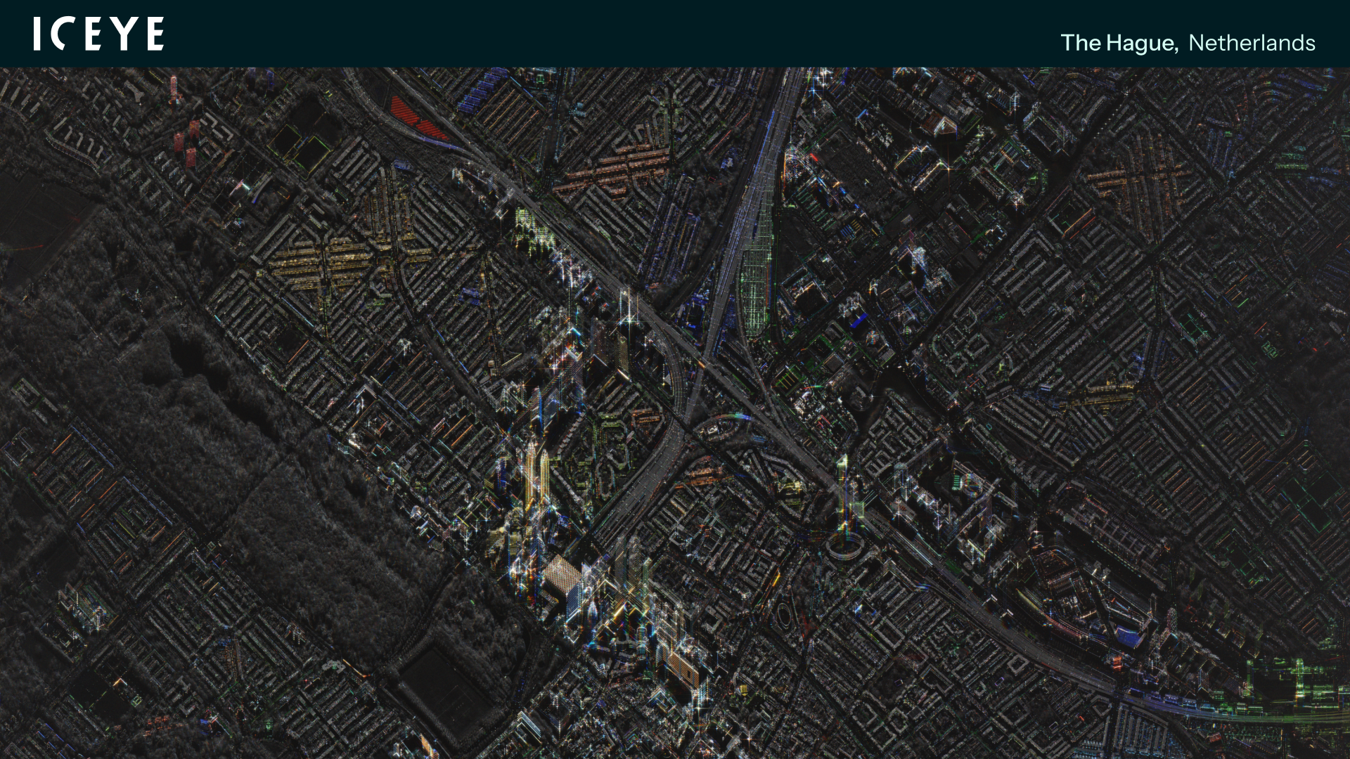
ICEYE SAR Dwell Fine image of The Hague, Netherlands.
ICEYE SAR Dwell Fine image of The Hague, Netherlands.
Get the latest news and updates from ICEYE directly to your email. Don't forget to follow us on @iceyefi & on LinkedIn. For press inquiries and further materials please refer to our Press section.
