Contact us
Get in touch with our experts to find out the possibilities daily truth data holds for your organization.

Use cases
Stay informed about what is happening at your borders and beyond to enhance your security on land and sea.
Eric Jensen, CEO / ICEYE US


You need to detect any unexpected actions near your borders and in the wider area, including the concentration of vehicles and equipment. How can you get reliable information about their quantity, classify them, and monitor their activities around the clock even in inaccessible areas?
ICEYE’s detailed, high-revisit, and comprehensive monitoring can cover vast areas along your borders daily or even sub-daily. One of our unique capabilities is to collect high-resolution images even at night, through clouds, rain, fog, and smoke.
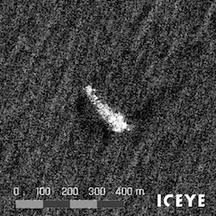
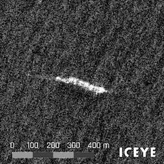
See example dark vessels
When the automatic identification system (AIS) and ICEYE SAR satellite data are combined, dark and collaborative vessels can be detected. The annotated vessels have been detected via SAR but were not visible to AIS receivers.
To counteract potential security threats, smuggling, illegal immigration, and unregistered fishing, you need timely insights about dark vessels entering your territory and Exclusive Economic Zone (EEZ).
With ICEYE’s SAR satellite constellation, you can persistently monitor coastal and open waters and identify vessels by matching them with external AIS signals. You can locate and track ships, identify their destinations based on their maneuvering patterns, and take immediate action if required.
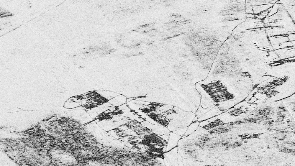
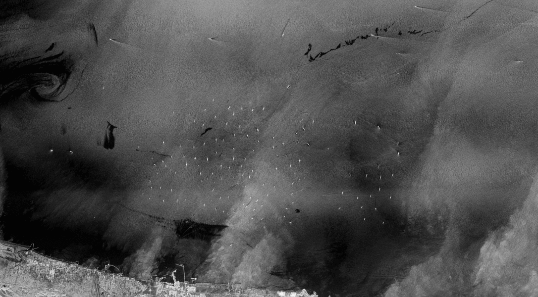
Example of coherence change caused by vehicle traffic through fields between the 21st and 22nd of January 2022. In Coherence Change Detection analysis two coherent SAR images are compared, enabling the detection of changes that are not visible to the human eye. The change between the images is shown as dark, what remains the same is shown as bright.
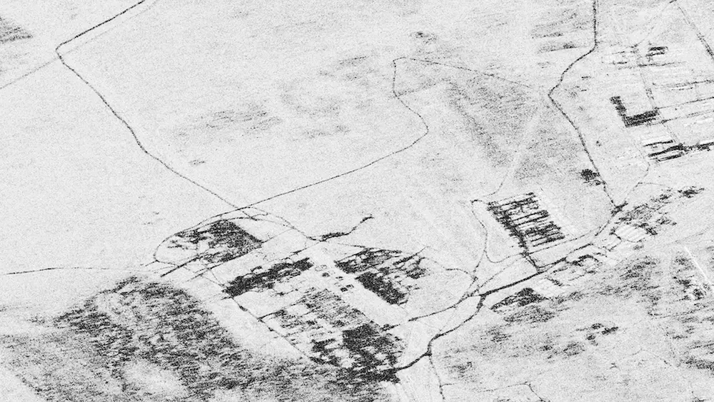
Example of coherence change caused by vehicle traffic through fields between the 21st and 22nd of January 2022. In Coherence Change Detection analysis two coherent SAR images are compared, enabling the detection of changes that are not visible to the human eye. The change between the images is shown as dark, what remains the same is shown as bright.
How do you know if something happened between satellite image acquisitions? How can you predict suspicious human-induced activities near your borders?
ICEYE’s Daily Coherent Ground Track Repeat imagery helps you identify the smallest changes happening between image acquisitions. You can see millimeter-level ground changes not visible to the human eye, caused by vehicle traffic or other activity on a gravel road, grass, or in a desert. Obtaining this level of information every 24 hours is possible only with ICEYE.
Download our SAR application study to learn how to use ICEYE SAR data to counteract illegal human trafficking and smuggling in your maritime borders.
Watch strategic sites and detect changes.
Monitor forests and identify activities.
Detect suspicious maritime activities.