Contact us
Get in touch with our experts to find out the possibilities daily truth data holds for your organization.

Use cases
Watch strategic sites and detect changes to stay on top of evolving risks and threats to your national security anywhere in the world.

Eric Jensen, CEO / ICEYE US
Many airports and other sites in inaccessible locations are very difficult to monitor. How do you detect any out-of-the-ordinary activities that could be a threat to national security?
ICEYE’s SAR satellites provide you with the world’s most reliable data for non-intrusive persistent monitoring and change detection, day and night, in any weather. Identify potential threats in one or many locations simultaneously. Detect stationed planes, helicopters, and other equipment. Determine if aircrafts or vehicles have been moved in the last 24 hours. Be aware of any non-routine activities.
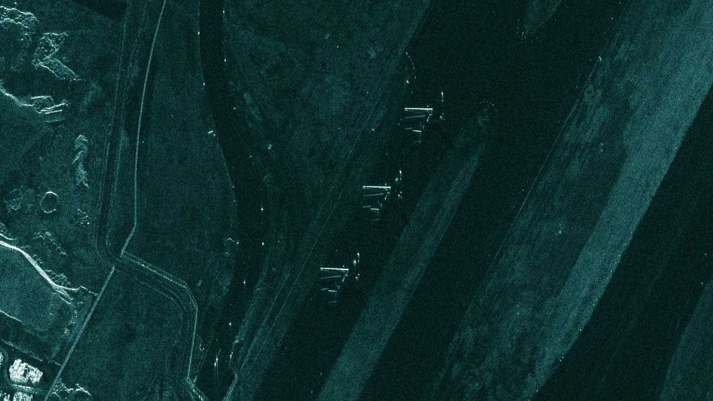
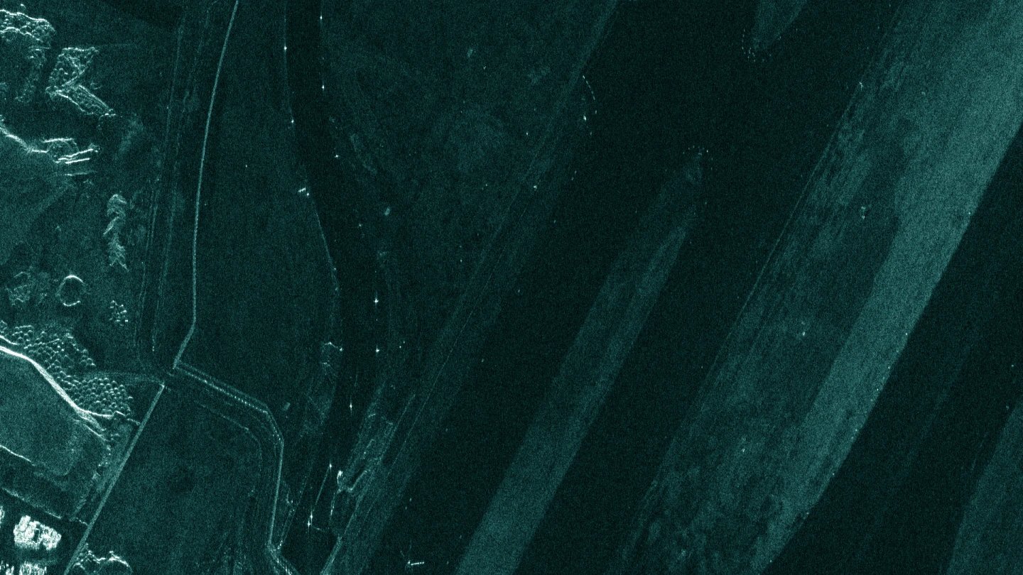
See a Coherence Change Detection analysis of ICEYE SAR data acquired over Mosul, Iraq on 4 consecutive days. Each analysis highlights changes that have occurred between two acquisitions acquired between two consecutive days. Changes are shown in the dark. What has remained the same is shown brightly. You can clearly spot the changes, including millimeter-level soil disturbance.
See a Coherence Change Detection analysis of ICEYE SAR data acquired over Mosul, Iraq on 4 consecutive days. Each analysis highlights changes that have occurred between two acquisitions acquired between two consecutive days. Changes are shown in the dark. What has remained the same is shown brightly. You can clearly spot the changes, including millimeter-level soil disturbance.
See a Coherence Change Detection analysis of ICEYE SAR data acquired over Mosul, Iraq on 4 consecutive days. Each analysis highlights changes that have occurred between two acquisitions acquired between two consecutive days. Changes are shown in the dark. What has remained the same is shown brightly. You can clearly spot the changes, including millimeter-level soil disturbance.
Reliable site monitoring is needed for high-security sites, such as dams, nuclear power plants, and open pit mines. How do you stay ahead of potential security threats?
With the largest SAR satellite constellation in the world, ICEYE helps you monitor any location of interest, any time of the day, regardless of clouds and darkness up to several times per day. Large area and high-resolution imagery help identify irregular happenings on your site of interest. This includes information about millimeter-level changes happening between two image acquisitions, such as vehicle tracks on loose ground.
Download our Application Study to learn how to use ICEYE SAR data to obtain actionable insights on the unusual concentration of aircrafts, vehicles, and equipment in any strategic site on the globe.
Know what is happening at your borders and beyond.
Oversee forests and identify activities.
Detect suspicious maritime activities.