Contact us
Get in touch with our experts to find out the possibilities daily truth data holds for your organization.

Helsinki, FINLAND – January 20, 2020 – ICEYE announced today the launch of its global Dark Vessel Detection solution for governmental maritime security customers. The unique solution combines synthetic-aperture radar (SAR) satellite data from ICEYE, and automatic identification system (AIS) data from vessels. Dark Vessel Detection is used as a source of actionable information for governments monitoring their Exclusive Economic Zones (EEZ), day and night, and even through cloud cover.
“Dark Vessel Detection offered by ICEYE is built for governments around the world for improving the maritime safety of their regions,” said Steve Young, Vice President, Business Development and Sales, ICEYE. “This unique solution enables authorities to take action based on reliable information. Data users can improve their enforcement activities against illegal transshipments of goods, help them in addressing illegal fishing, and assist in curbing drug and human trafficking.”
Vessels engaged in illegal activities can choose to turn off their AIS transponders to avoid detection from authorities. ICEYE’s Dark Vessel Detection service’s core is built on the company’s own radar imaging satellite constellation data, which provides a reliable source of information at all times of the day and in all weather conditions. ICEYE’s customers have access to both location information and radar satellite images of all detectable vessels - even when they do not have their AIS transponders turned on.
Interactive Demo: Dark Vessel Detection
See how detecting dark vessels enables authorities to react to emerging situations.
“Together with our partners, ICEYE has developed a unique dark vessel detection capability for solving far-reaching maritime safety issues,” said Pekka Laurila, Chief Strategy Officer and Co-founder, ICEYE. “Our roadmap to achieve near-real time delivery capabilities for dark vessel data, on a global basis, is very short. With the introduction of our current standardized data format, actionable information is available already today.”
Access example data, and learn more: Dark Vessel Detection solution for Maritime Security from ICEYE.
# # # # #
About ICEYE
ICEYE is building and operating its own commercial constellation of radar imaging satellites, with SAR data already available to customers. ICEYE empowers others to make better decisions in governmental and commercial industries by providing access to timely and reliable SAR satellite imagery. The company is tackling the current crucial lack of actionable information with world-first aerospace capabilities and a New Space approach. ICEYE’s radar satellite imaging service, designed to deliver coverage every few hours, both day and night, helps clients resolve challenges in sectors such as maritime, disaster management, insurance, and finance. For more information, please visit: www.iceye.com
Other assets available at https://www.iceye.com/press.
Download images by right-clicking and selecting "save link as":
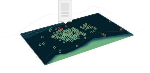
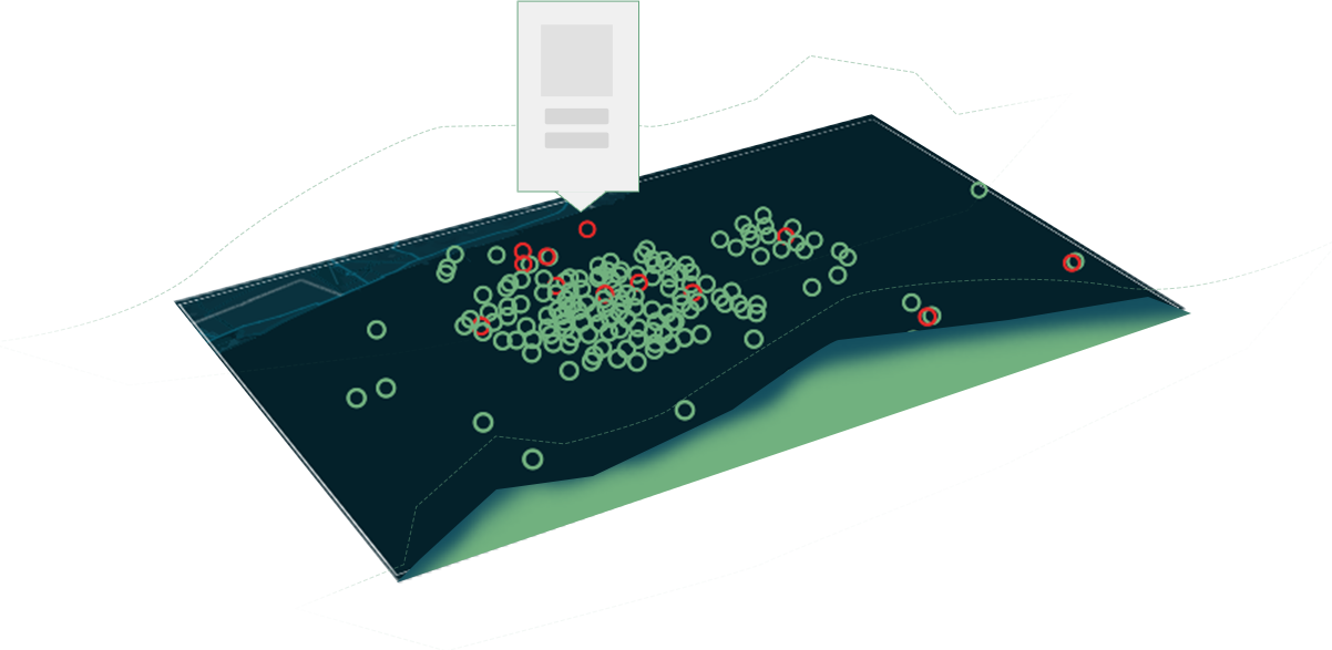
"Visualization of the ICEYE Dark Vessel Detection Solution, showing locations, and the AIS status of collaborative vessels with a green circle, and dark vessels with a red circle, on top of ICEYE SAR satellite data."
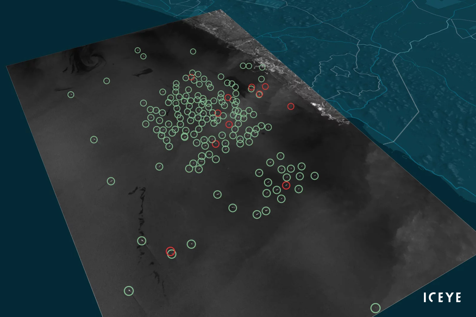
"Vessels detected and classified from SAR data, and visualized in 3D. The original radar satellite image of transshipment was taken with an ICEYE SAR satellite on 30 January 2019."
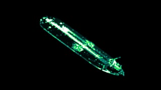
"Visualization of SAR signal reflection from an oil tanker."
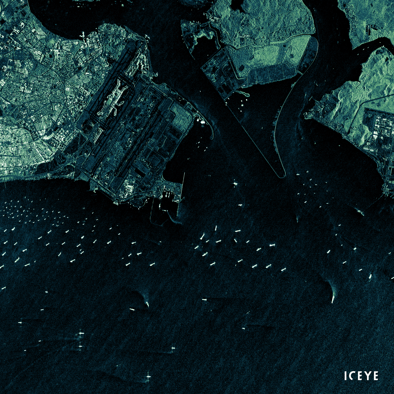
"ICEYE radar satellite image from the Pasir Panjang container terminal of Singapore, taken on 20 December 2019. Image shows the container ports, several anchored cargo vessels, and a vessel maneuvering alongside the port."
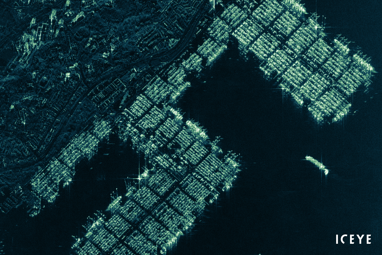
"ICEYE radar satellite image from Singapore on 26 January 2019. Image shows different vessels sailing in the Singapore Strait, near the International Airport of Changi and its surrounding areas."
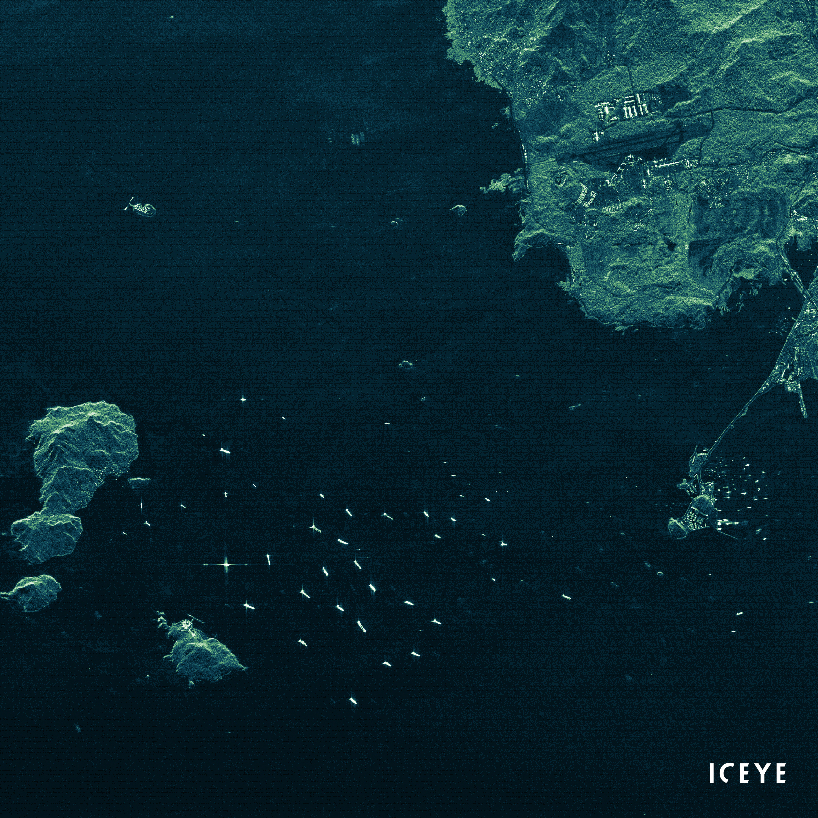
"ICEYE radar satellite image of Port of Panama City on 3 April 2019. Image shows several vessels sailing in the Gulf of Panama."
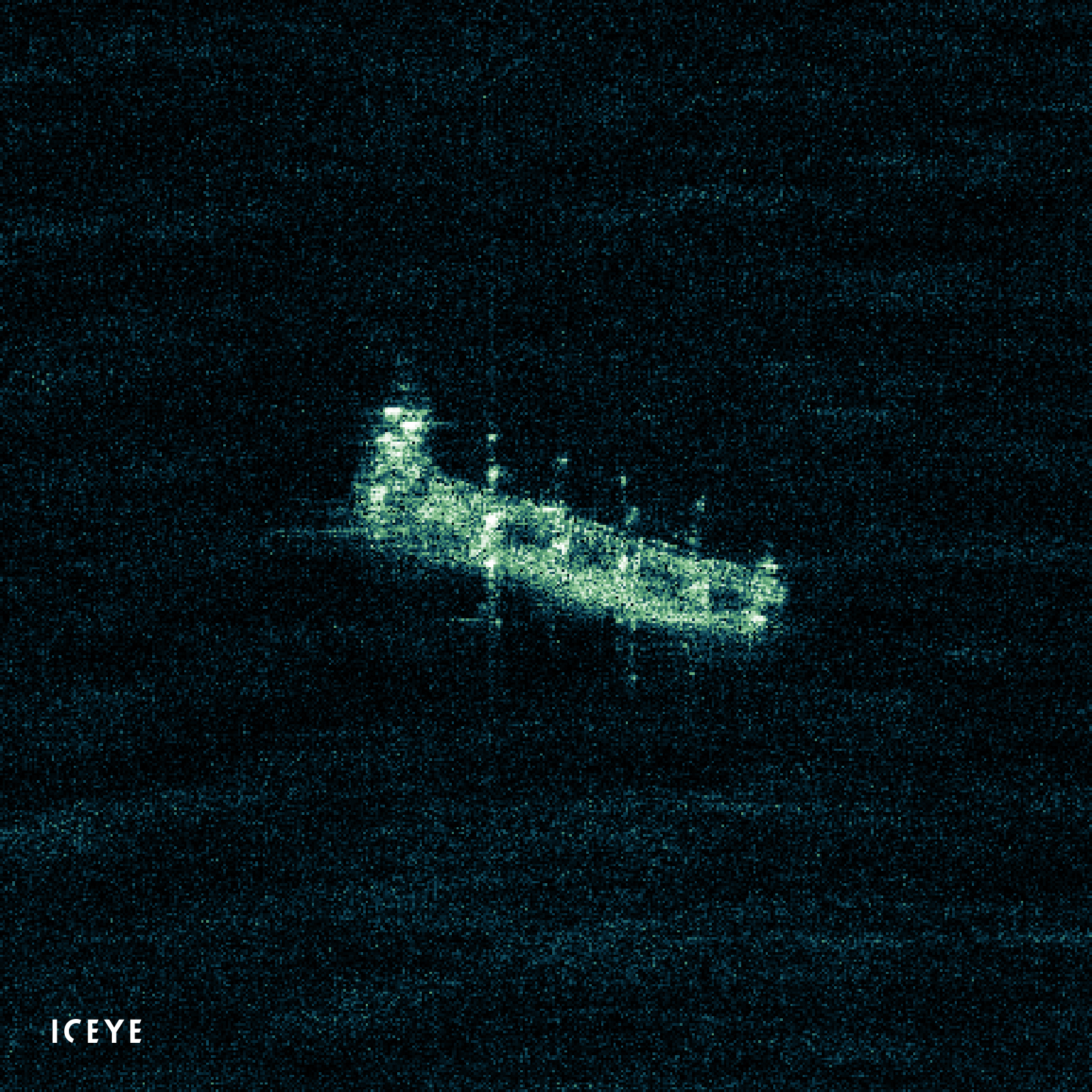
"ICEYE radar satellite image from Busan, South Korea, taken on 23 October 2019. Image shows clear structures of a vessel sailing near Dongsam-dong."
"A visualization of the ICEYE Dark Vessel Detection website demo."
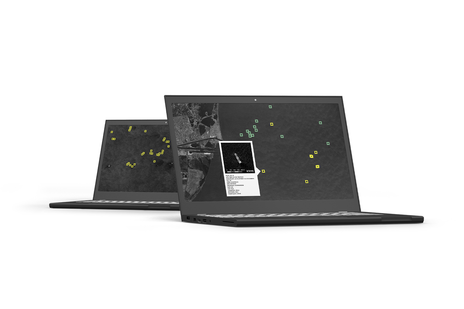
"A visualization showing the ICEYE Dark Vessel Detection Sample Dataset."
![]()
ICEYE logo.