darren-muff-1 Darren Muff mobile hero

Persistent monitoring – the technology
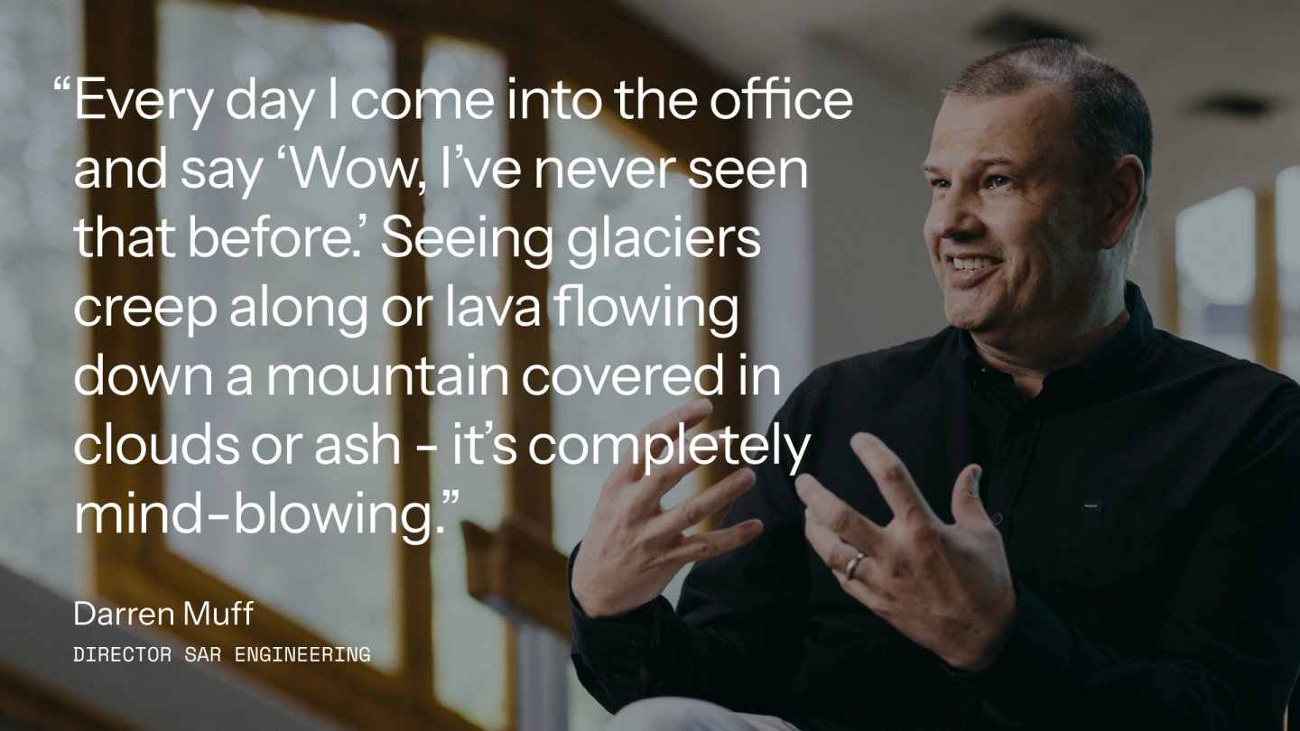
with Darren Muff

"This is a level of persistent information that the planet has never seen before."

Truly effective change detection requires persistent monitoring. ICEYE's large constellation of new space satellites unlocks new access to valuable data on any location on Earth – day and night, through the clouds, and multiple times per day.

darren-muff-1440

How ICEYE revolutionized the SAR satellite industry

Darren Muff, Director - SAR Engineering / ICEYE

A forensic level of persistent information

If you want to be able to track changes to any location on the globe in minutes, hours, or a few days. That’s exactly what ICEYE does.

A key requirement that’s been missing from Earth observation is being able to track changes very quickly and very often. Synthetic aperture radar (SAR) allows you to see in any weather, day or night. But if you want to be able to track changes to any location on the globe in minutes, hours, or a few days, you need a constellation of satellites that are small and affordable enough to enable persistent monitoring that can be quickly activated, flexibly maneuvered and that can deliver the right information at the right time. That’s exactly what ICEYE does.

To me, it’s like how detectives worked in the 20th century. With traditional police work, you go around and talk to people and look at things. Then amazing scientific inventions like fingerprinting and DNA analysis came along and allowed us to suddenly understand much more than meets the eye. Until now we’ve been looking at things on the ground and trying to understand what we’re seeing. With radar, we can exploit things that change over time or frequency. By using the computer to compare microphase changes within the image pixels, we can identify changes between observations and beyond human sight. It’s an almost forensic level of persistent information that’s unlike anything the world has ever seen before.

PA Darren Data Img bnw

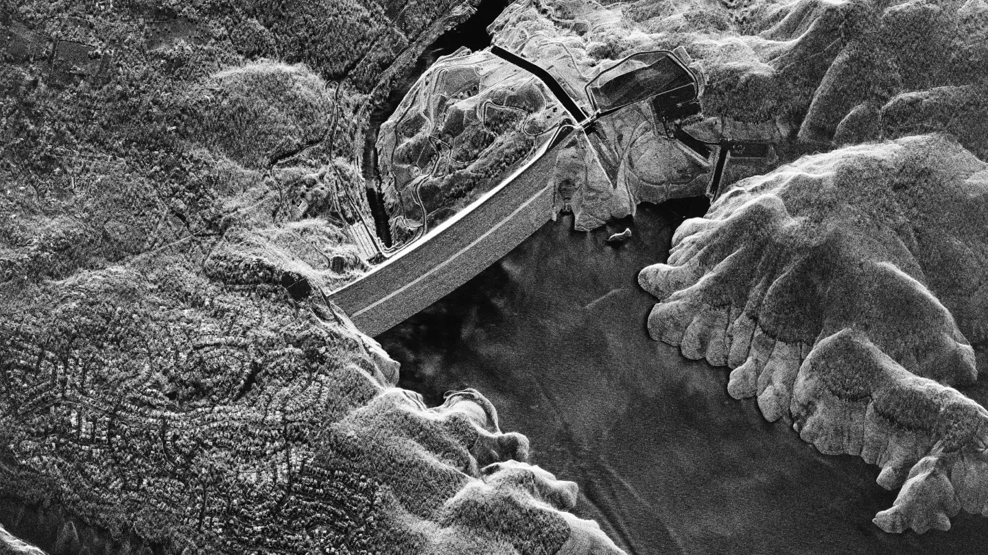
This is an ICEYE SAR image of the Oroville Dam, California, US. By monitoring a dam regularly, you can get information about slight subsistence and ground eruptions around the dam and potentially get an early indication if the dam is going to fail.

Daily images of the ground taken form the same location in space

SAR satellites are designed for change detection. Images taken from the same location with the same geometry are always identical unless something changes. The challenge until now has been collecting radar images of the same exact location that are close enough together in time to truly detect – and ultimately predict – changes happening on the Earth’s surface.

“Our satellites orbit the Earth 15 times every 24 hours. Each of those ground track repeats mirrors the previous image, allowing us to unlock science that's never been possible before.”

Darren Muff

Seniors SAR Product Manager, ICEYE

Made for change detection

If we’re able to image a location on the planet from a very precise imaging geometry within very short intervals, we can compare the image data and the raw phase information inside the information to unlock unprecedented levels of scientific information. And that’s what ICEYE is doing by delivering Daily Coherent Ground Track Repeat capability. The trick is enabling a satellite to image a location on Earth every day from the same imaging geometry.

There’s an amazing balance of physics where the amount of time it takes a satellite to go around the Earth is a function of its altitude. ICEYE’s ion engines gives us the phenomenal capability to adjust the altitude so that each satellite orbits the Earth exactly 15 times in 24 hours. So an ICEYE satellite can image the exact same point on the ground every day – rain or shine, day and night. And because our satellites are less than 100 kg, we’re able to have many of them doing Daily Coherent Ground Track Repeats of the same locations across the globe. This enables a level of scientific data exploitation that’s never been possible.

PA Darren Data Img SAR Honduras

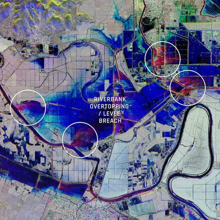
RGB Color Composite image of flooding in La Lima, Honduras. This three-image color composite shows the flood situation in the surrounding areas of La Lima, Honduras, on November 18th, 19th, and 20th. The three-image color composite illustrates the flood (blue) and probable levee or riverbank breach locations (red).

Quote_Darren

Welcome to a new age of SAR with Dwell, Spot, Strip and Scan modes

ICEYE's antenna design is truly unique. It's an electronically steered phased array that we can control with software. By controlling when the radiation is illuminated from the front of the antenna, we can make the beam point in different directions.

Strip Mode illuminates and collects long SAR image strips parallel to the flight direction, which enables long collections. With Spot Mode, we can continuously point the antenna at an individual location on the ground and massively increase the resolution of what we’re looking at. The cool bit is when we first use the mechanical agility of the antenna to focus on a point and then use our electronic beam steering ability to image in Scan Mode, where we can point at something on the ground and elevate the beam to cover an area as large as 100 km by 100 km, which is unprecedented for a small satellite.

Now we can also use an even wider area and Strip or Spot Mode to support multiple customers and requirements in a single satellite pass. We’re going from taking images through clouds and at night to a completely new way of doing electromagnetic sensing of the ground.

access_satellite

Dwell mode

Dwell mode helps extract unmatched critical information from a single image. See every detail in incredible clarity with enhanced image quality, superior information congestion, and reduced noise.

access_satellite

Spot mode

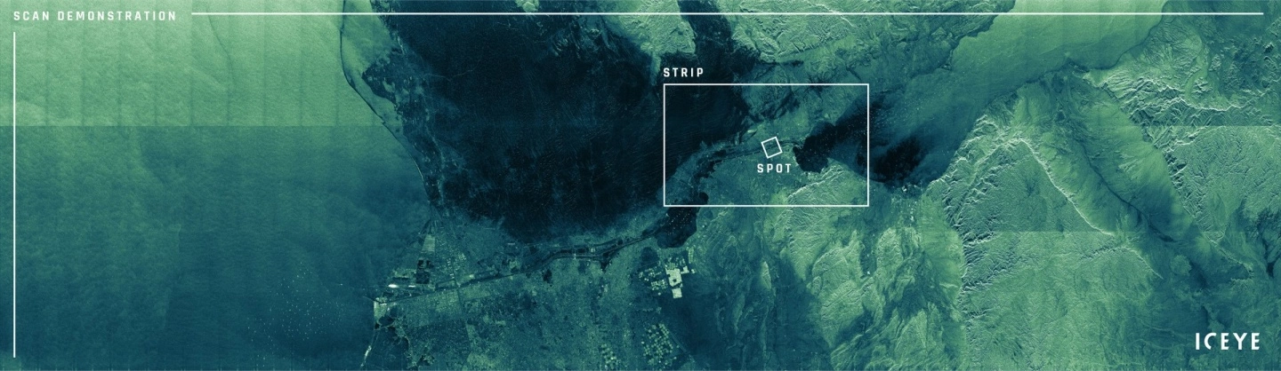
Spot mode enables very high resolution and the largest available scene size for detailed monitoring. Use Spot mode for object identification and highly detailed change detection.

delivery_satellite

Strip mode

Strip mode is perfect for detecting changes to vast sea and land areas. Use Strip mode to see and respond to natural disasters and illegal activities and to persistently monitor borders, coastal areas or any location of interest.

ground_track_satellite

Scan mode

The scan mode can cover an area up to 100 km by 100 km. Scan mode is particularly effective for acquiring wide coverage imagery for maritime use cases, where national security authorities and maritime safety officials need persistent visibility.

PA Darren Scan Demo

This image is an ICEYE demonstration of 400 km by 100 km Scan mode imaging, acquired around the time the vessel Ever Given was released from its recent predicament, with marine traffic still queuing for their turn to pass through the Suez Canal. This 40,000 km² image covers an area of over 1500 individual Spot images.

Meet Darren

Senior SAR product engineer, ICEYE

Darren Muff

Dr. Darren Muff is a well-known and widely respected physicist who’s spent the past 30 years working in the field of satellite Synthetic Aperture Radar (SAR). Since joining ICEYE in 2019, he’s been in charge of SAR processing algorithms and advanced signal processing techniques. The work he does enables ICEYE to explore novel SAR modes and image formation techniques, progressively moving ICEYE beyond today’s conventional Earth observation technologies. Before ICEYE, Darren has done pioneering work in a range of research, advisory, and tactical positions in defense and intelligence – both at home in the UK and the US.

PA-Darren-Scan-pic

Learn more about persistent monitoring

Shay Strong & Eric Jensen

The Applications

At ICEYE, we believe there is a unique opportunity to unlock the potential of SAR data by making it more accessible. ICEYE’s ability to persistently monitor the ground and provide quantifiable information with our radar technology means that it’s now open and available for governments, companies, organizations, and people to evaluate and leverage to better serve humanity.

Persistent-monitoring_Shay-Strong_twothirds

Rafal Modrzewski & Pekka Laurila

The Vision

Welcome to a completely new way to understand life on Earth. ICEYE's constellation of SAR satellites opens access to entirely new levels of data for the persistent monitoring of large and small locations around the globe – every few hours, day and night, and in any weather.

Persistent-monitoring_Rafal_twothirds