Fast and accurate flood extent for U.S. emergency management
Unmatched situational awareness, speed, and precision for emergency responders, utility and energy companies who need real-time visibility into floods.
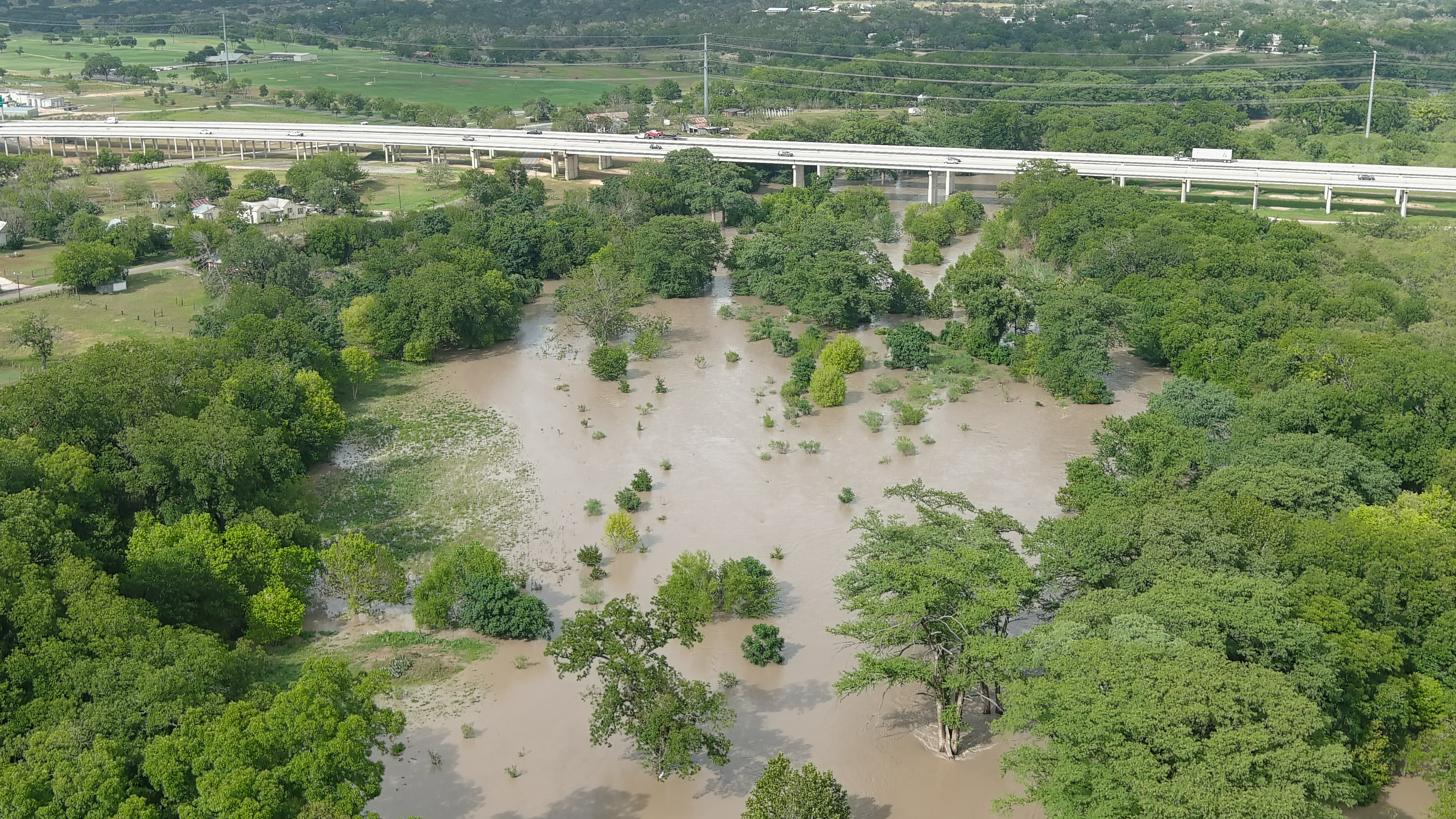
Observations from orbit. Decisions where they matter.
ICEYE generates near real-time flood intelligence by combining remote sensing satellite ground observations, third-party data sets, and machine learning. Unlike flood models that rely on static what-if scenarios, we use real observational data to deliver timely, accurate analyses worldwide. ICEYE’s SAR (Synthetic Aperture Radar) sensors are central to this capability, detecting flooding day and night in any weather condition.
Because our technology provides insight across the entire flood lifecycle, we help customers stay ahead of potential impacts. With detailed data layers and summary reports, we offer unmatched clarity and a concise view of the flood landscape to facilitate informed decision-making.
Rolling updates within 6 hours of the flood start
NEW PRODUCT
Introducing Flood Rapid Impact
ICEYE’s Flood Rapid Impact delivers fast, automated insights during flood events using SAR (Synthetic Aperture Radar) imagery, even through cloud coverage. The product generates accurate flood extent snapshots within hours to support early response efforts. Activated at the first signs of flooding, FRI continuously processes data and releases updated flood extent within hours, rather than days. Designed for timely decision-making, it emphasizes reliable detection and frequent updates throughout the event.
Flood Rapid Impact vs. Flood Insights
While Flood Rapid Impact (FRI) offers frequently updated views of flood extent as the event unfolds, which is ideal for tracking the progression in near real time, Flood Insights captures the peak impact, offering the most comprehensive picture of the event’s severity, down to the building level.
Flood Rapid Impact
Our newest product, Flood Rapid Impact offers fully automated, fast flood extent analysis uses AI-powered interpretation of ICEYE’s SAR satellite constellation data to deliver rapid, frequently updated, evidence-based estimates of flood extent.
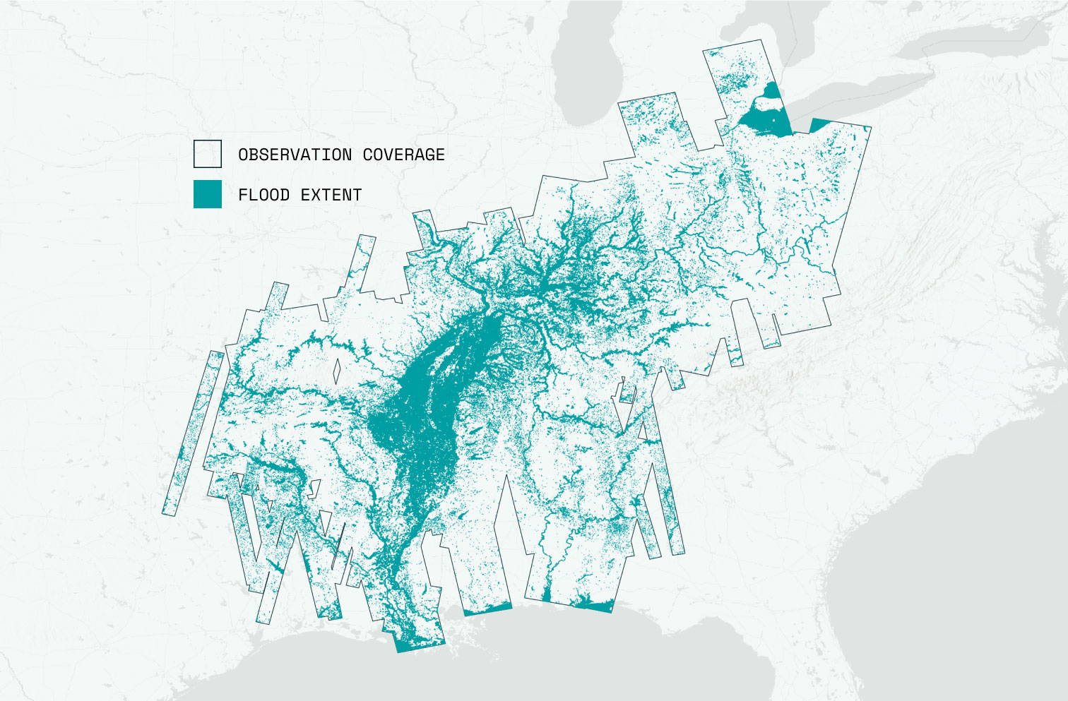
Flood Insights
Our flagship product, Flood Insights (FI), delivers the world’s first consistent, near-real-time flood data based on direct observational evidence, providing a precise quantification of maximum flood extent and depth during and after an event.
Book a demo
ICEYE Flood Solutions
ICEYE Flood Solutions provides fast, reliable access to critical flood data with Flood Rapid Impact and Flood Insights. These tools deliver near real-time, high-accuracy flood extent information to support quicker response, better planning, and smarter recovery. Fill out the form below to get a custom quote and see how ICEYE can support your mission when every second matters.
Availability of Flood Rapid Impact varies by state. Fill out the form below to confirm availability in your area and explore how ICEYE can support your mission.