Helsinki, FINLAND – May 6, 2020 – Finnish New Space leader ICEYE is the first in the world to demonstrate interferometric capabilities from synthetic-aperture radar (SAR) satellites under 100kg (220 pounds) in mass. With an actively maintained 18-day ground track revisit cycle, ICEYE is now able to produce a further capability that was previously only available from larger, conventional SAR satellites. Interferometry is made available to ICEYE customers later in 2020.
SAR interferometry is used to detect millimeter-scale surface movements in vertical direction between two or more SAR images. These height differences are analysed using maps called interferograms, which are the basis for creating Digital Elevation Models (DEM). Interferograms are also used for monitoring oil exploration activities, ongoing underground constructions, ensuring the safety of mining activities, and analysing ground deformations after earthquakes, among other uses.
“Interferometry can only be performed with data from SAR satellites that are maintained in a very precise orbit.”, said Pekka Laurila, CSO & Co-founder, ICEYE. “The now-demonstrated 18-day repeat orbit highlights the maneuverability of ICEYE’s satellite constellation, which allows us to produce new high-precision data types for our customers.”
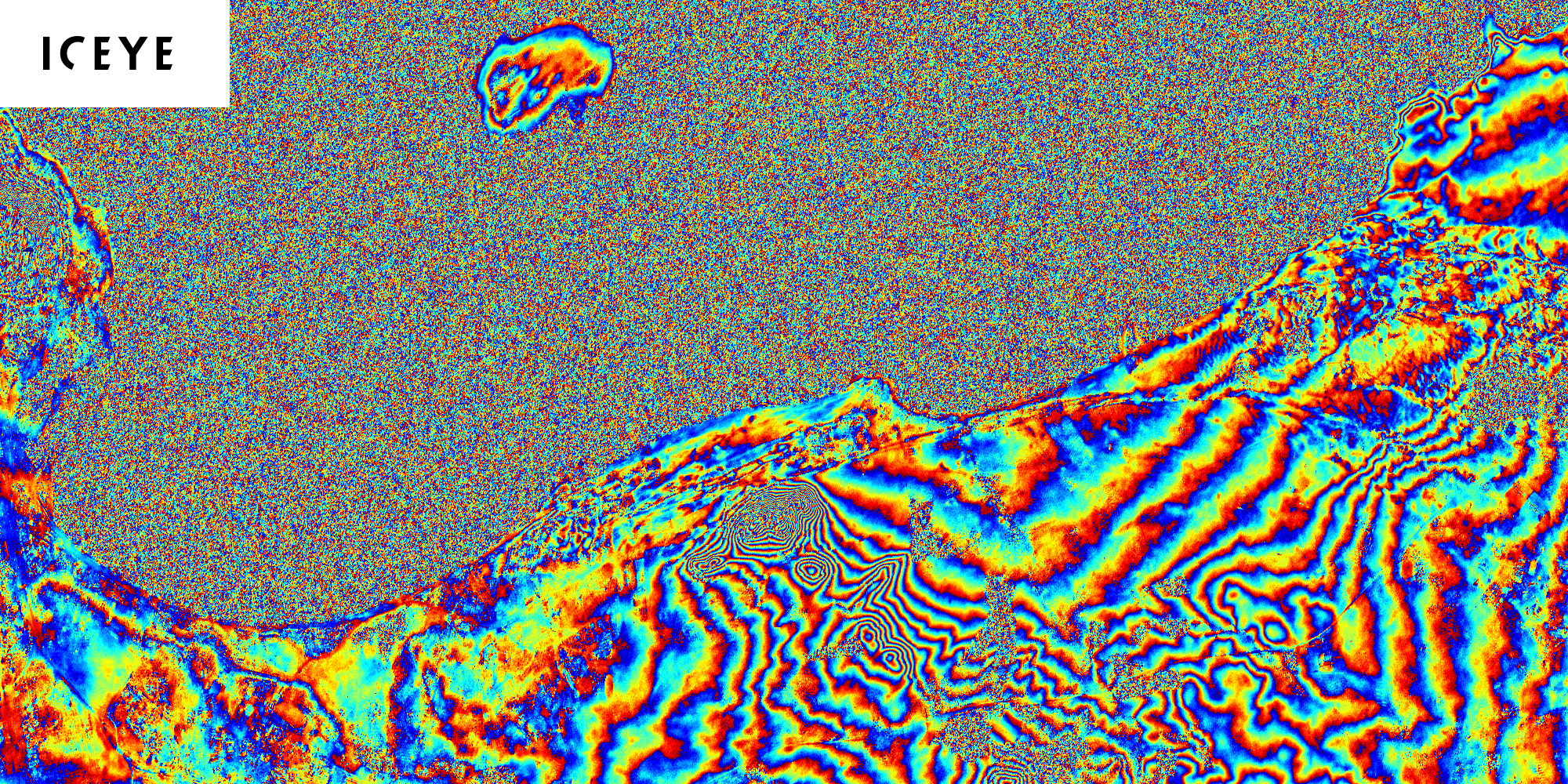
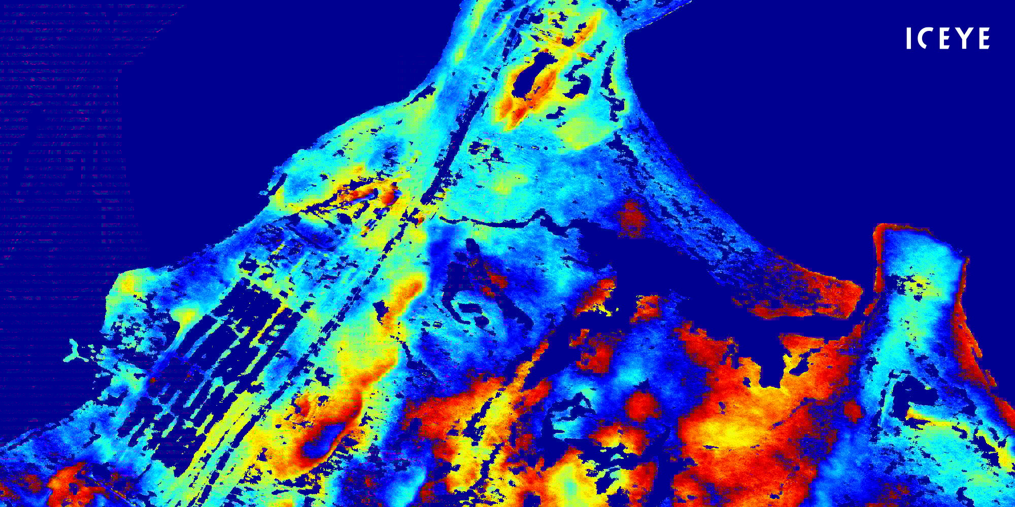
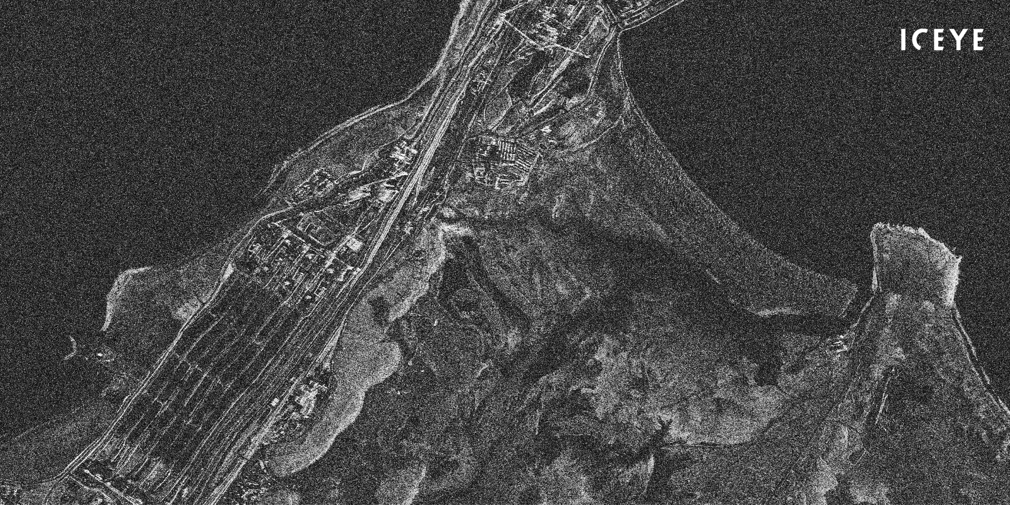
An interferogram shows height information by considering differences between two SAR images.
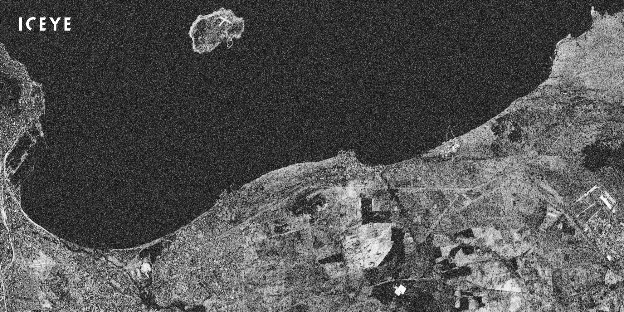
The coherence between two SAR images shows what has changed (shown as black) - and what has stayed the same (white) - between the time that has passed from one image to the next.
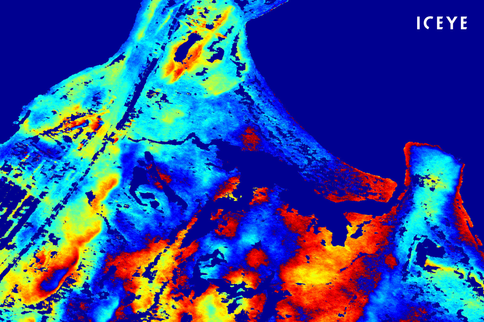
Coherence, a correlation between two SAR images, is a valuable source for detailed change detection analysis, land cover classification, analysing infrastructure, flood monitoring, and more.
ICEYE is in a unique position in the world, as its small SAR satellites are maneuvered with electric propulsion, which enables the exact maintained satellite orbits that are necessary for interferometry. The integrated propulsion solutions and technical support provided by ICEYE’s key partner ENPULSION - with additional collaboration from the European Space Agency - have been instrumental for ICEYE in achieving the desired outcomes in this capability demonstration.
“Generating interferometric information from the world’s smallest SAR satellites is revolutionary.”, said Steve Young, Vice President, Business Development and Sales, ICEYE. “This will enable our customers to perform change detection measured in millimeters, and to utilize SAR satellite based 3D data from their locations of interest.”
ICEYE’s interferometric data will be provided to customers later in 2020. Interferometry will be made available in high detail from Spotlight images, and for wider areas from Stripmap data. Once commercially available, ICEYE's standard product formats for interferometry will be accessible with standard Geographic Information System (GIS) tools.
# # # # #
About ICEYE
ICEYE is building and operating its own commercial constellation of radar imaging satellites, with SAR data already available to customers. ICEYE empowers others to make better decisions in governmental and commercial industries by providing access to timely and reliable SAR satellite imagery. The company is tackling the current crucial lack of actionable information with world-first aerospace capabilities and a New Space approach. ICEYE’s radar satellite imaging service, designed to deliver coverage every few hours, both day and night, helps clients resolve challenges in sectors such as maritime, disaster management, insurance, and finance. For more information, please visit: www.iceye.com
Other assets available at https://www.iceye.com/press.
Download images by right-clicking and selecting "save link as":
"Interferogram of Point Samson, Australia, created from 2 Spotlight images, taken with an ICEYE SAR satellite 18 days apart from each other."
"Example of ICEYE Interferometry: interferogram of Point Samson, Australia, created from 2 Spotlight images, taken with an ICEYE SAR satellite 18 days apart from each other."
"Example of ICEYE Interferometry: coherence of Point Samson, Australia, created from 2 Spotlight images, taken with an ICEYE SAR satellite 18 days apart from each other."
"Example of ICEYE Interferometry: interferogram of Cape Town, South Africa, created from 2 Stripmap images, taken with an ICEYE SAR satellite 18 days apart from each other."
"Example of ICEYE Interferometry: coherence of Cape Town, South Africa, created from 2 Stripmap images, taken with an ICEYE SAR satellite 18 days apart from each other."
ICEYE logo.